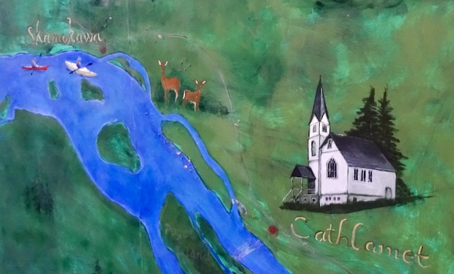
Russian Island on the Columbia

A Practice Landing

March 16, 2024:

Recently I saw that a group of kayakers had spent a day paddling from Westport Oregon down the Columbia River taking out just east of Astoria. It’s a quiet trip through protected lands that are marked green on the Forest Service map below. Their excellently written trip report with the Mountaineers is here.

Here is a link to this USDA Forest Service Map

I commented on their Facebook post how much I appreciated their pictures and map and it inspired me to study their route. Where they had paddled through Russian Island, I could see the group of eight floating homes they had seen tucked into a channel.

Last summer I was told by a fellow paddler that a lot of property rights in this area are grandfathered in. I confirmed that by looking at the 2010 USFWS Conservation Plan for this area available here. They list thirty-two floating recreational cabins (FRCs), commonly termed “duck hunting shacks”, within the L&C National Wildlife Refuge. Some were built in the early 1900’s, others as recent as the 1980’s. As per a proposed 2003 ordinance, any built before 2000 may legally remain if they meet requirements (waste disposal, appropriate use, modification or construction etc.), but no new ones can be built.

Today I would go see those floating homes, because they would be different from the typical beauty and wildlife I would normally see.

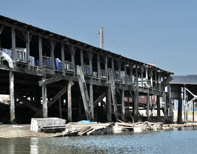
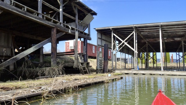
Svensen has several floating homes that are always interesting, and I have paddled out from Aldrich Point further upstream to check out other floating homes on Horseshoe and Woody Islands as well as written about here and here.

I have no history of Russian Island to share, as my favorite research site seems to have vanished. I searched my books that mention this area but came up with little. I am poorly qualified to be any sort of expert here. This area has a rich history and is still being used and maintained by so many.

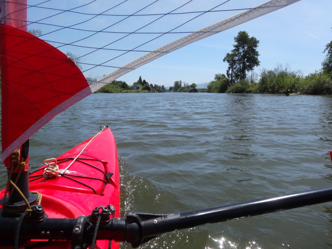
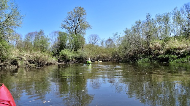
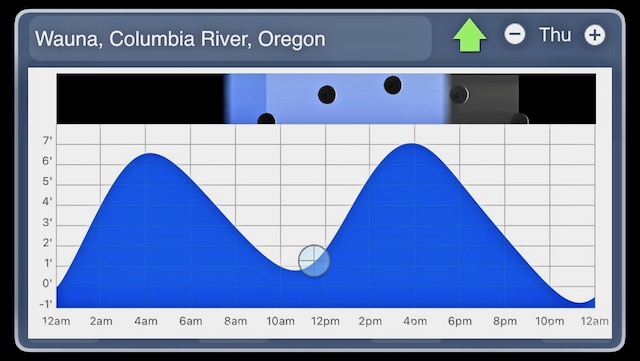
After packing up and double checking, I found that the high tide that I thought I had today was instead for a previous day. Today would be safe and have more potential adventures then revisiting a nearby lake. It would just be shallow. The weather was predicted to be clear with 8-15 mph SSE winds. The kayak would be set up Polynesian style which is fun, stable and fits in with a book I am currently reading that partly covers the Polynesian’s remarkable seafaring prowess (the first chapters of Guns, Germs, and Steel by Jared Diamond).

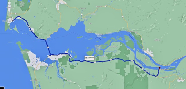
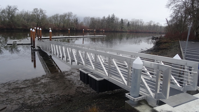
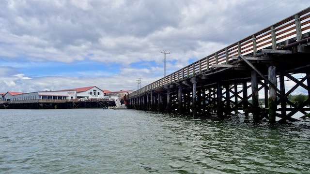
The John Day boat ramp isn’t the closest to Russian Island, but it has the best ramp in the area for my heavy kayak.

Make sure you bring a credit card that works. A truck parked near the payment station was hoping for leniency with a note explaining how it “Won’t read card I’m getting a new one”.

I assembled off to the side on the grass. Little boats blocking the ramps longer than necessary irritate those with trailered boats. They paid their additional license fees and may express their anxiety to get a move on.

I spotted three different water birds before reaching the Columbia. First, an American Coot checked me out.

Off to the left was a Great Blue Heron and a Bufflehead was further ahead as I approached the abandoned railroad swing bridge.

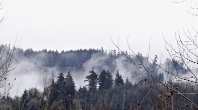
Following the South Channel upriver, I noticed the trees above the railroad line are still awaiting spring.

I checked my old automotive Garmin as I carry redundant GPS & camera gear. It suggested I should turn right with my car and continue on US 30 onto Svensen Island, then turn left to Russian Island.

The weather was beautiful today.

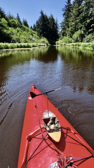
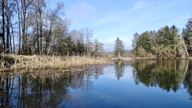
Just shy of the Twilight Eagle Sanctuary I landed and took the time to explore this stream coming out from under the trestle. The tide had just turned and was rising from today’s low of +0.5′.

Sometimes these streams go inland quite a way. The channels further east in the sanctuary are fun to paddle in too, but not today. A post about a previous trip into the sanctuary can be found here.

From atop the trestle, I found a small sheltered lake to explore later on a higher tide.

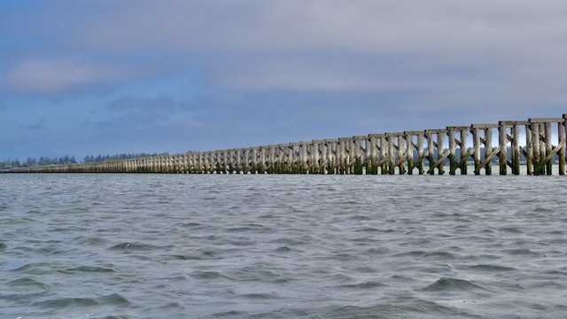
The intact railroad continues eastward and could be used for rail bicycles with a bit of clearing. The railroads have the best and most level right-of-ways. In the early 1980’s while I worked at a bicycle shop in Coeur d’Alene Idaho, a local inventor named Dick Smart patented and developed a street bicycle that could also be ridden on railroad tracks. I helped assemble and figure out what parts were required for his early models. Once I was invited for a ride east of town. I’ll never forget the thrill of hesitantly pedaling over a banked trestle high over a river supported by only two bicycle tires, a small guide in the front, an adjustable outrigger, and no way to put my foot down. He latter sold several to London for their use to inspect tracks. An illustrated article about it is here.

A picture from Dick Smart’s book: Biking on Rusty Ribbons of Steel shows our first batch. I’m wearing the hat at the end as we were recreating a similar picture of railroad bikes from the 1890’s.

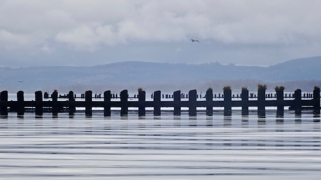
Here is Settler Point just outside the Svensen Slough. The stream had been about a half hour diversion as the tide rose. It’s out to Russian Island now. The tide had risen to +0.9.

The pin is from my camera later. I am about a quarter mile away from the island and just bumped the bottom. I watched ahead for vegetation following my Garmin’s marine map.

Here is a corner the NOAA chart I keep on the wall at home.

Between me and the island was flotilla of Trumpeter swans. I pulled out a biggish old inexpensive camera with its long 30×2 lens.

The Sony DSC HX200V took pretty good photos today, but the movies it took from this distance were crazy up and down and unusable. I have a newer camera to try out next time which I’d be more sad if it got dunked.

Pushing the boat with my feet, I entered the shallow channel. The tide had risen to +1.8′.

There was more blocking vegetation ahead, so I worked my back northwest looking for a place to land.

I waited while a Western Sandpiper grabbed a few more bites. Here’s a quarter minute to share.

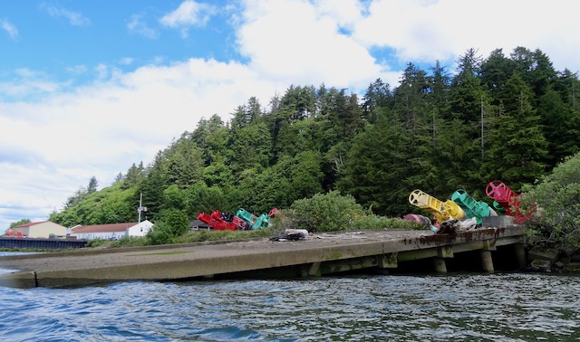
Looking northeast across the island it looked flat and walkable. Shrubs haven’t filled the island nor are there many ravines. I scanned for the floating houses.

There was a pitched roof with a nearby wind turbine almost a mile away . The pin marks the camera’s GPS location, the arrow marks where I was not going today.

Time’s up. Three hours until sunset.

Time to sail west into the sunset. Many unexplored routes will have to wait until later. With the additional depth I didn’t need to retrace my route due south back to Settler’s Point. Four and a half miles ahead is a view of Tongue Point with several uninhabited islands between.

Louis Island.

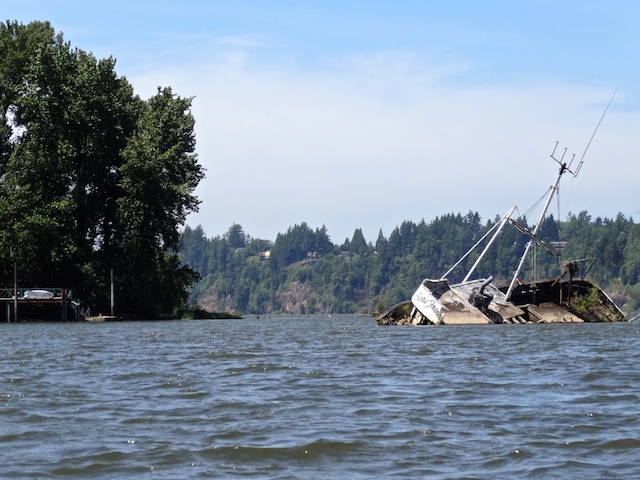
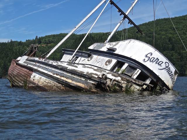
Here is Grassy Island. When the birds are standing nearby, it’s time to bear off. Google earth shows a possibly wrecked little boat on this island’s northwest tip. Maybe I’ll look for it another day.

The tide had risen to 3.8′ and keeping within the channels was easier.

I went south under Lois Island and approached the entrance to the John Day where I recently read that the bridge tender used to live in a house at one end.

A mile and a half away I could see that Tongue Point now has a ferry boat or a small cruise ship at their docks. An excuse to return for for a short paddle.

Next it was through the railroad gate into the John Day and home by the twilight. A very enjoyable trip and I am better prepared for next time.

14.5 miles traveled in 5 hours and 24 minutes with a maximum speed of 6.0 mph with a moving average of 2.7 mph. 

An Adventure Island in NW Oregon: Parts 1 & 2

Adventures on the lower Columbia River & a lake

I’ve edited down a few posts about sailing and pedaling a 2014 Hobie Adventure Island. These are segments taken from longer posts to emphasize this unusual kayak’s versatility for sailing open waters or squeezing through low narrow channels as a skinny trimaran.

Sometimes I see posts on the Hobie Adventure & Tandem Island Owners Facebook page asking for buying advice. Coming from a heavier sailing dinghy, I think this boat is brilliant. I store it in a single car garage and fit in onto my van without a trailer. It keeps me safe as it’s less likely to tip than either the old dinghy or a kayak. I can return upwind to my launch and it doesn’t leave me super-slow if there is no wind.

I am fortunate to live at the mouth of the Columbia River. These four trips were neither tropical nor on the ocean. They were on the Columbia River’s tributaries, on one of its islands, and on a lake in NW Oregon, USA.

Logging on the Clatskanie

March 8, 2019 and it was cold. The amas were inside the van and I just needed to lash the mast onto the rack. I now use the Thule Lock strap to help prevent mast theft but the rest had been packed the night before.

After an hour drive I was ready to launch.

If any wind made it worthwhile, the mast would be set up after pedaling under the nearby bridge. It’s only eleven pounds, lighter than an outboard motor.

My planned route downriver to the bridge was blocked by a log. I could take the time to portage around it but instead I paddled upriver to ‘the shallows’ and back. That took 1 1/4 hour.

After I returned I confronted the log across the river. First I tried the fast approach over the top. Didn’t work. Then I pulled the boat on shore and pushed it around past the log and that worked.

It was then that someone from Kuiper’s Auctions at the other of the log offered to pull the log out if I would set his choke cable. The log had been blocking the river for almost a month. I pedaled over and found the shore drops straight down, deeper than my 7.5 foot paddle. It would require a low stable boat and someone fool enough to nose in and put their forehead on the log giving the log a hug while feeding the cable underneath. Meanwhile, I would need to grasp the receding boat with my feet.  If the choke cable sank, it was gone, so I tied an end it to my bow. All done pretty safely with witnesses. I’m on the front deck, my watch is on the mast.

At first, the forklift could only drag it ‘into’ and not ‘up’ the bank. Then they put a barrel under the chain and got enough vertical lift.

Here is a 20 second video of the lift out. My mast is finally installed so I could hold it while filming.

Here is the log on the shore, the river was now clear, and downstream I went.

The whole day’s adventures are in a post here.

————————————————————————————————

Up the Creek at Cullaby Lake

June 6, 2023 and our work schedule had offered an opportunity as in: “Why don’t you go boating next Tuesday?” I wasn’t one to complain that the wind was forecast to be 17 gusting to 30 mph and that the tide would be a very low -1.1’ at noon. That would make many waterways impassably muddy but, not a lake, not Cullaby Lake.

After a not-so-windy sail to the lake’s southern end I entered Cullaby Creek. I was using my formal wind vane today with the Wind and the Willows crew from Tetley Tea.

The creek closed in but continued for another mile.

Here is a 42 second video as I folded the boat small to follow this deep creek.

Back out in the lake I set up the sailing gear and tacked north to the park. It was an 8.0 mile trip topping out at 8.3 mph averaging 2.6 mph according to the iPhone app MapMy Tracks. The complete trip is posted here.

————————————————————————————————

A Brisk Sail off Puget Island

Cathlamet WA is on the northern shore of the lower Columbia River. On June 2, 2019 I launched from there to Puget Island on the Columbia River to explore the Birnie Slough.

I sailed east on the slough. I de-masted to clear the bridge leading to a ferry across to Oregon.

DSC05224.JPG

The breeze was from the northwest, almost directly behind me. Without a boom, I used a notched paddle to grab some wind.

Columbia River Kayaking in nearby Skamokawa used to give lessons and sold a sail kit for sea kayaks. They closed at the end of 2023. Their old site advised: “Sailing a sea kayak ranges from simply helpful to downright exhilarating. In Australia, kayak sails are viewed as safety features. They provide auxiliary power and increased visibility.”

DSC05192.JPG

The real estate prices are not as high as I thought they’d be. Maybe I’d live in a house with kayaks on the dock

DSC05181.JPG

Rounding the upstream of the island and entering the Columbia River, I saw a wreck I had seen earlier on a YouTube video. In this 6.5 minute 2014 video by Frank Blangeard, the kayaker circumvents the island in short edits set to music. Twelve miles in 3 hours. I talked to a local who opined that it would take a long day with the correct wind and tide to pull off such a trip. I did 12.5 miles today but relying on the sail added a lot of sideways distance. The wreck was still here, it’s even  visible on a Google Satellite Map search at 46.153212, -123.326516.

DSC05270.JPG
DSC05281.JPG

Here the wind picked up as it was predicted to do. Without the slough’s protection and a few white caps showing, I was looking forward to an exciting ride back to the marina.

DSC05288.JPG

A 42 second video including a powered tack at around 7 mph…

Not sure but I looked later and I think the gusts were only about 16 mph. The camera had the wind canceling feature enabled. All this splashing and noise doesn’t warn of the same consequence and possibility of capsizing as many other boats but it was a thrill nevertheless. For paddling and exploring, I felt there was more to see on Little Island so I delayed crossing until I was nearly at the bridge. Also, I would not want boat trouble near the cliffs upstream of the Puget Island bridge.

DSC01064.JPG

There was still a good wind until I entered the sheltered channel near the marina.

DSC01068.JPG

12.5 miles averaging 3.5 mph when moving and a top speed of 7.7 mph.

————————————————————————————————

Mixing with the Kayaks near Astoria

The fort where Lewis & Clark wintered near the Pacific organized a kayak gathering. We would meet in Astoria August 19, 2017 and paddle across Youngs River Bay and then up the Lewis and Clark River to Fort Clatsop.

The park department supplied several kayaks, others like mine, were brought from home by permission. I arrived early. My kayak started floating off while I got a picture.

I unfurled only a little bit of sail and matched their speed with my pedal drive. The mast cleared the bridge when we soon entered the Lewis and Clark River.

Later we entered a narrow slough to approach the fort and watch a presentation. I folded up my boat and tried to blend in. I wore a touristy fur cap with a tail for the occasion.

When it was over the others drove off taking advantage of a shuttle back to Astoria to fetch their vehicles. I continued up the river another three miles to a low bridge. I didn’t want to de-mast as it was getting late and the sky was darkening. I zig-zagged back through the pilings left from the logging days.

A rainy wind storm came up as I tacked past the fort. A couple blew upstream past me in their inflatable kayak giving me concern.

It was a lonely, splashy, and fun trip back across the bay to Astoria.

————————————————————————————————

An Adventure Island in NW Oregon: Part 2

Adventures on the lower Columbia River

This post and ‘Part 1’ above is written for the Facebook group: Hobie Adventure & Tandem Island Owners and others when they ask about my boat. They’re combined and made into an extra long post (sorry) to work on the index page of all the boating posts here. The owner’s FB group is heavy on tech advice, items for sale, and sharing the joy of sailing warm open southern waters. Here are seven short posts featuring my 2014 Hobie Adventure Island in the cold grey waters around the Columbia River in Oregon, USA.

Youngs River

The Youngs River flows past Astoria from the south. It’s about ten miles long before it ends upstream, as far as boating is concerned, at Youngs River Falls.

On December 16, 2023 I launched the Hobie Adventure Island, sans sailing kit, from the Klaskanine ramp. It flows into the upper Youngs River where I planned to pedal and paddle upstream through the shallows, and finally drag or walk to the base of the falls.

Here is the muddy launch on a windless day. Still I’m glad I brought the Hobie as there were beautiful pictures to take and distance to cover. It would function better my short sit-on-top .

After four miles the current overtook the incoming tide. I pulled in the foot drive, raised the rudder, and paddled. That didn’t last long. I got out and towed. Soon I beached and walked but the shore was steep and narrow ahead.

The falls were only a third of a mile up the channel but I turned around here instead. On the way back there were more beautiful reflections to photograph. The view was distracting me as I gave the pedal drive kick-up feature another test.

As the sun fell and highlighted the shore, I filmed this one minute video to share with someone using a pedal exerciser a lot this winter. I thought it might inspire them to add a mirage drive model to their kayak collection. Two complete posts for the upper Youngs River are written up here.

8.9 miles traveled in 3 hours 24 minutes (moving time) with a maximum speed of 4.5 mph averaging 2.6 mph.

————————————————————————————————

Blind Slough

On August 22, 2022 I launched the Hobie fully kitted out with outriggers to sail and explore the side channels of Blind Slough near Brownsmead Oregon. I had read that I could visit the recently preserved ancient stand of Sitka spruce in a swamp setting that has mostly disappeared in our area due to dike building.

I unloaded from the roof using my ‘BIG$$’ two-by-four that tucks under the roof rack and assembled the boat while an incoming commercial fisherman loaded up.

I paddled past flood damaged houses by an abandoned railroad bridge and checked out the mucky end of Grizzly Slough.

After checking out an eagle nest down a small quiet channel, I came out into the blustery wind. I cautiously let out part of the sail and continued tacking towards the Columbia River.

A log almost blocked the entrance to another channel west of Little Grizzly Slough. This turned out to be within the stand of ancient Sitka spruce.

Here’s the two minute trip within, bumps and all.

On a previous trip I sailed out of Blind Slough and onto the Columbia River to Marsh Island. I got lost sailing back that time and went up the wrong slough. Fortunately I caught my mistake before dark. Here’s looking back at Oregon from Marsh Island. Both these trips are more fully written about here.

I pedaled and held out the sail to catch the tailwind back to the launch.

The phone app “Map My Tracks” on the right below show a top speed of 13.6 mph but I don’t believe it. The back up Garmin was reset partway through the trip (31 miles!?). It indicated a top speed of a more attainable 7.0 mph averaging 2.8 mph for 13.6 miles averaging 2.9 mph.

————————————————————————————————

Clatskanie River

Have you ever arrived at your launch and forgotten your outriggers? This happened to me August 16, 2021. After an hour drive I arrived at Jones Beach Oregon on the shores of the Columbia River. It would be a brisk wind from the north that I planned to use to sail east and enter the Clatskanie River to explore an anomaly I had spotted using Google’s satellite view.

I pulled into the parking lot and unlashed my sail walking it down to the beach to figure out where to launch. I would be sailing to the island behind the mast, turn starboard, and blow upriver. It was only when I returned to the van that I saw that the outrigger kit was still at home. I decided it would be safer to launch on the river instead.

The town of Clatskanie is better protected from the wind. I lashed the mast to the boat as I was not comfortable leaving it atop the van for the afternoon. Off I went for a pedal. A fishing float ahead marks a hazard. The mast is lashed onto the left, the paddle on the right.

I pulled into a small channel and installed the mast. I discovered its 11 lbs. was was too tall and tippy for me even without unfurling any sail. I took it down and refastened it.

The side channel to the building of mystery was at a low tide and pretty weedy.

I paddled up and checked out the structure. It is still a mystery to me years later. There is a higher hill a quarter mile away that would be simpler to place a water tank. There is no military presence but there is a lumber mill nearby. I wrote about what I found out in the second post here.

It was pretty good speed today and a good adventure. 12 miles averaging 2.9 mph while moving, and a maximum speed of 5.7 mph.

————————————————————————————————

Other Oregon Highlights

Svensen

On May 28, 2018 my Adventure Island was slid down the riverbank assembled. At the end of sailing through the sloughs upstream and de-masting for this adjacent bridge, I carried the pieces back up the bank with help from a dog walker. The trip is written about here.

————————————————————————————————

Astoria

On June 10, 2021 launched at the upstream end of Astoria at Pier 39. I wanted to explore a nearby calm lagoon and then maybe head out onto the Columbia River

Out on the river it was a windy day with a shoreline composed of large riprap that would prevent an easy landing. The tailwind and incoming current increased as I neared Tongue Point so I turned back. With the sail reefed and full pedal power I slowly made my way back to the shelter west of the point as written about here.

Here’s forty seconds as I tuck in behind pilings heading back west to Astoria.

————————————————————————————————

Trestle Bay

I’m finishing these posts at the mouth of the Columbia River. There are over a hundred trestles off Fort Stevens built from 1885 to 1895 when the south jetty was extended to improve the safety of the Columbia Bar. Trestle Bay formed as a result.

The right angle beach trail access is not big kayak friendly.

The full account of the July 6, 2021 trip is here.

To finish up, here are almost two minutes of kayak mode pedaling around the trestles.

Now to look and see what the Australian, New Zealanders and others south are doing in their Hobie Island kayaks while I wait up north for spring .

Upper Youngs River…Reflections

December 16, 2023

Today I would head back to Youngs River to see if I could paddle to the base of the Youngs River Falls near Astoria. On a previous trip I managed to get lost, which isn’t easy to do on a small river. I turned off onto Moosmoos Creek instead. You can read about that adventure here. Below is a picture of Youngs River Falls from the walking trail. Today I hope to photograph it from the water downstream.

The the tide would be high and the weather windless in the low fifties, good for December. This time I would watch for the Moosmoos exit and keep straight to the falls.

Mist lay beyond Tongue Point as I stopped to rechecked my kayak’s straps before crossing the Columbia River.

The Klaskanine River

I heard shooting across the field when I arrived. A local’s target practice? As I unloaded, a small motor boat arrived. The friendly crew of ‘Fowl Intentions’ packed their rifles into their truck. No carcasses today. I asked about the mud stains up to their waists and learned that they didn’t have a dog. I hadn’t yet linked the ideas that a fallen bird sometimes involves a walk through waist deep whatever.

After I launched I heard no more gunfire. The direct line to confirm waterfowl hunting dates within Oregon’s ODFW is (503) 947-6301. That number is also in my Launch Guide book in reference to the nearby Fort Stevens and their Trestle Bay hunting area.

After this trip I looked on Google maps. It said that this launch was closed. “If you add photos…. Google may also use them to update other information about this place.” I sent them the following picture and told them it looked open 24/7. The next day, I looked online and saw that the launch was now open. First time I’ve done that.

Off and away today on the Klaskanine.

GoogleMaps also showed that the Wildlife Center of North Coast is located just off to the right. It is a center that you can call when you have an injured wild animal that needs care. They offer tours, have volunteer opportunities, and always appreciate donations. Their phone number is 503-338-0331 and site is here. I didn’t make time to visit this time but hope to in the future. There is also more river to explore upstream from the launch. Here is a map showing the length of the Klaskanine. The launch is by the bridge at the upper right.

There were farms…

…and reflections.

I rounded a piling marking the confluence with the Youngs River. Ripples confirmed an upstream flow.

Cotoneaster berries for the critters grew along the bank.

Today the owner of this crane happened to be walking along the hill. I told him how I admired how it could load or unload boats. “I rigged it so we can swing out and dive into the river!” “Sounds like fun!” Of course… they have a regular dock just 300 feet downstream.

Today I paddled right past the exit to Moosmoos Creek and its dead end swamp. Here’s the camera’s GPS marking the similar bends on the Youngs River.

I admired a natural art installation of a figure plunging a shaft into the ground placed in front a reflecting pool.

The river continued double imaging ahead.

This bridge is the most upstream point achieved last time. I had considered sliding a boat down its banks to complete the trip another day, but it would be very hard to drag the boat back up.

Soon the river began to ripple. The 9’4″ tide was just turning so I must have been leaving the tide’s influence. The cautious local waterfowl continued upriver.

A gravel bar appeared.

I climbed the bank next to a fenced off field. There were more rapids ahead without an easy walk or paddle.

Here is a 46 second video of a decision:

There was no waterfall to be seen across the field but I could see the Youngs River road a quarter mile away. The falls would be another third of a mile upriver.

Maybe I could drive up to the falls again and look at this from the other side. I pushed off and enjoyed a quick ride down the current. Later, passing a couple enjoying a river walk I asked about paddling up to the falls. “Once you’ve reached the bridge, that’s about it.”

There were grass tufts stuck in the trees four feet over my head from recent flooding. Easier to photograph were more reflected trees.

This reminds me of the phrase “If you lived here, you’d be home by now.” Somebody’s kayaks are ready for fishing and fun.

The low sun put a glow on the trees as I rounded the point back into the Klaskanine River.

A sign that is saving wildfowl. It produces a satisfying noise when shot. I found out that it indicates no fishing upstream from this point as I browsed the regulations here.

Saw a bald eagle. My little 30x camera brought a closer view than the 8×42 monocular. Paddling closer to the subject would have improved this picture but it flew off.

More reflections.

Back to the ramp as the temperature fell to the low forties. The car became covered with dew as mist rose in the fields.

I drove down Youngs River into Astoria where the Pacific was just beyond the hills.

8.9 miles traveled in 3 hours 24 minutes (moving time) with a maximum speed of 4.5 mph averaging 2.6 mph.

Westport & Kerry Island

April 29, 2023

My first paddle with a ‘club’

A kayak group I’m a member of posted an invitation to join them on a paddle relatively close to Ilwaco. A rare thing as most of any group trips I find seem to be convenient to Portland and the interstate but not to the real southwest Washington that is west of Longview. The hosts were willing to drive almost an hour and a half whereas I was only an hour away.

We would meet at the almost new kayak dock system at Westport Oregon. The host’s map projected a trip to the to the end of the Westport Slough arriving at a culvert which flows into the Clatskanie river system. It was nine miles away, and then nine miles back with the tide rising to 5.1′ and falling to 2.2′. I had paddled around that culvert recently in this post. An 18 mile trip in 5 hours is not too fast for the authors of many kayak books I have read but too fast for me. I have placed near last at races in Ocean Shores and Elk River. I’m may not be fast but being behind gets better photographs and I ‘stop and smell the roses’ more than being in front. Fortunately today’s trip leader also felt a full eighteen miles in one day might be too ambitious.

I wrote them that we should look closer at Kerry Island which is about a mile east of the new boat launch. I had read a comment noting that it was special for its habitat. The Columbia Land Trust purchased it in 2013 and are restoring it from a diked cattle pasture to an intertidal wetland. Here’s a link to it at  https://www.columbialandtrust.org/kerry-on/ and a follow up 3 years after they breeched the dikes here at  https://www.columbialandtrust.org/return-to-kerry-island/.

It’s been fifteen months in landscaping time since I was last at this launch. The grasses are filling in. Similar grates, grasses and bio filters are also being planned for my local Port of Ilwaco’s parking lots.

It was a quiet morning. A heron flew upstream, and the ferry nearby left for Puget Island. Today I wouldn’t be the last one ready. Later today’s hosts told me that when posting a departure time, stragglers can hold everyone up an hour or more. Today was a get up at 6 am type day. I was the only guest and I found out many others don’t get up that early on their day off.

Dave had helped lift my boat off its wheels. Their lighter and simpler boats were quickly lowered over the dock built for ‘big boats’.

I’m apparently keeping up or, they’re politely slowing down. That’s a good start.

I was even able to photograph my distractions and catch up again. I circled around this tree appreciating whether it had been tied on to graft or had it just got lucky finding a home.

Soon we arrived at Kerry Island in the center of the slough. Most boaters bear right to the Kerry West Marina. We bore left up the 3/4 mile dead end.

The Columbia Land Trust’s restoration looks like a success from this side. Cat tails topped the long grasses. Dave identified wood ducks, black birds, starlings and red wing black birds. He also pointed out a large something splashing in the water ahead. We went further.

The splash occurred near to me next to the grassy bank. I stopped with camera in hand to wait it out. Odds are it was an nutria, an otter or some other furry mammal, maybe a fish, and not an alligator such as in the nearby Blind Slough which I learned about here. My critter being shy, it stayed quiet until I left it to catch up. It was turning out to be a good day. I followed as they chose a channel to explore.

The tide was at 5.0 feet. It was Sharmel who figured out how to get into the island and who didn’t follow my misdirection finding the way back out.

Back at the slough, we looked further up where a road crossed onto the island from near the barn. We could pretty much see everything and felt it was time to explore elsewhere. I would drive to that road later today.

This is a satellite view and my camera’s GPS mark. We had had to back out of Kerry Island by the same route we had entered. The trees atop the dike blocked our efforts exit anywhere else.

According to the Columbia Land Trust’s site, “More than 90 percent of the area that historically served as intertidal wetland has been converted for farmland, homes, or other uses. These areas (used to) provided vital nursery and shelter habitat for migrating salmon and steelhead from throughout the Columbia River Basin.” Here is a view showing the lack of wetlands to shelter fish along the Columbia River and the current dike systems that outline the fields in this area.

For a slide show of the Kerry Island dike being breached and reunited in 2016 with the tidal floodplain for the first time in more than a century, enjoy this link. It was time to return to the main slough until…

…a ship wreck ghosted under us.

There was a very recognizable hatch and a deck plank pattern as photographed with our rugged little waterproof gardening camera, an old Sony TX20.

This looks like the back of its cabin where the stairs still go down below deck.

We arrived at the always interesting Kerry Marina with the nearly impenetrable Kerry Island to the left. See the large black boat first in line?

I passed by here on August 2019 It was selling for $123,000 and is now still waiting for you at $123,000 45 months later.

Here is a better look for you shoppers from 2019 when I was more interested. As far as acquiring white boat in the foreground, ‘that ship has sailed’. It will be a real life changer for whoever restores the black one.

A mile and a half later, we approached the Magruder Bridge near the abandoned Seoul Food restaurant on highway 30.

In 2021 I stopped on the bridge and photographed this idyllic channel I wanted to paddle someday.

In 2022 I paddled up to the bridge and found the solitary blue cabin.

In February 2022 I was surprised by someone’s tragedy from the recent heavy rains and flooding.

Today we found the cabins gone leaving only sunken docks and a moored double masted ship.

Dave kept us safe today. He pointed out a danger on shore, had us slow down to create no wake, and noticed that the Magruder bridge had welds that appeared to be cracking. Today I didn’t park on the bridge for a newer photograph.

After paddling under the ‘safe enough’ bridge we stopped at a side slough we could see on the map.

I climbed the dike to see this slough that was not visible from the shore.

There was an old tractor under a blackberry it had once bullied around. Further was a view of two and a half miles of a diked in waterway.

On the way back we checked out another side channel located just east of the marina. It went towards the highway, turning east and following a railroad bed. Looking at my Garmin’s map it may be a circular route, but not today as the tide had fallen to +2.8′. The group slowed to a stop, stretched our arms and legs. More to explore another day and at a higher tide.

Passing the marina again, Dave spotted a nest on the dock.

I followed behind and photographed a fine goose home while nearby the mom watched from the shore at the uninvited tourists.

Soon we were back at the Westport dock. Dave pulled up alongside and lifted his boat out. He explained he is used to dockside launching. I used the trailer ramp. Sharmel went over to give the kayak launch a try.

Here is a 16 second video of my launch last year. It is secure. I could step onto the straps or extend a platform from the side to sit above the boat. I can step into the boat with no rocking. Probably the best ADA launch in the region.

Here are some views of it from last year when I paddled up the Columbia and portaged back to the Westport Slough.

Here is Sharmel about to dock. She stepped off her stable boat onto the metal straps and onto the dock. They both lifted out the boat. For a person arriving alone, the bench can be slid from the stairs. Then the boat is lifted while standing on the straps, pulled up from the side or slid out out flat at the end.

I was contacted about installing a kayak dock on the Ocean Shores’ waterways from an advocate with some connections/leverage. I returned a post two months ago, shown here, of four kayak docks on the coast including Westport’s.

After loading I drove off to check out the Kerry Island access road the Columbia Land Trust people use. Volunteering for a day of ivy clean up along Oregon’s Skipanon River, I had learned that these workers sometimes don’t see their work from the water but park and walk in.

I drove across the maybe rickety bridge we had paddled under earlier, even as another truck drove across from the other direction. As evident on the map, this is the route the community living on the Columbia River across the slough from Westport regularly use.

The road followed the slough’s bank until it was blocked by a gate at Carver Ranch. This is not a route for tourists to access the shores of the Columbia. The road to Kerry Island is watched by friendly barking dogs and curious residents. I had been warned…

Passing muster, I snapped a picture. We can rest assured that Kerry Island is safely behind its locked gate and is only accessible by boat. As I have been told before, land reserves discourage visitors as they regrow, maybe even discouraging kayakers who photograph nests that are not on the reserve.

A successful and productive day. We might have paddled past Kerry Island and missed its significance without a little pre-research. I noticed that the lead paddler sees the more wildlife, similar to when I joined a large group walk with the Audubon Society. New sloughs and narrow waterways were discovered, we made plans for future trips and had enjoyed each others’ company and, I had kept up.

Maybe looking at the culvert from the west will just have to wait. I just figured out the new and more complicated way to share a video. Here is the culvert to Clatskanie from its east side.

12.6 miles traveled in 4 hours and 40 minutes (from another Garmin GPS) with a maximum speed of 5.4 mph with a moving average of 2.9 mph.

Clatskanie River’s Culvert to the Westport Slough

March 18, 2023

I’ve been wanting to further check this area for a long time. On a map it appears there is a route parallel to the Columbia River from Westport to the mouth of the Clatskanie River, almost. I’ve read feed back from other people who are curious too. There are two gaps labeled on this map.

On the left end is the entrance to Westport Slough where there is an excellent ADA kayak launch at Westport, Oregon. The blue marks the Columbia River, the red marks the Westport Slough and part of the Clatskanie River system inland up to the Quincy Mayger Road bridge. I documented a portage through the gap on the left. The bank entering the slough was steep but I was fortunate that it was a slide down and not a pull up through the brush with my heavy boat. I wrote it up here.

If doable, the second gap to the east offered the possibility of sheltered waters paralleling over seven miles of the Columbia. I found an entry regarding this gap in the excellent 2004 book by Keith G. Hay: The Lewis & Clark Columbia River Water Trail available here.

Regarding passage, Mr. Hay offered a paddle through the gap if the tide was low with the possibility of a portage if a person didn’t want the thrill of a culvert:

Today I planned to launch here and observe at what tides the culvert works. When I arrived, the tide was rising at +6.7′ feet and about to turn. I planned to paddle east around Anunde Island, then north around Point Adams onto a sheltered bit of the Columbia. 3.5 miles into trip I would portage back onto Westport Slough and down the steep bank where I would rejoin the main path of Westport Slough four miles into trip. The loop would total about seven miles. When I returned, the tide would have fallen to a bit over +2 feet to show another extreme of the culvert.

Off I drove to find out.

This must be the place. This sign credits the many who made this culvert possible and encourages research to find out more. A quick search revealed from NOAA Fisheries that they “Removed dirt plug between river and slough, replaced with arch culvert to allow fish access to 8 trubitaries (sic) and water flushing of Westport Slough. Should reduce sediment load in slough.”

Looking west, here is the slough from Westport. My original plan was to loop back here in four hours after heading in the other direction. In the nineteen years since the book was written the banks have grown thick with Himalayan Blackberry.

There was one short path in the area and it went east to the Clatskanie River. It offered no view of the culvert but pulling aside some blackberries elsewhere I was able to photograph it. There was a small current westward as the tide was turning at +6.9 feet (as measured in nearby Wauna).

Being March, the blackberries are bound to further fill in the launch path during the summer.

Off I went to get a water’s view of the culvert. The divider was a deal breaker to me.

A local stopped to chat. He lives nearby on the northeast shore and paddles with his grandkids. He recommended that I return before the tide dropped to three feet. He can see the culvert from his dock but has not been tempted to paddle through because the Westport Slough is shallow at this end. I gave him a copy of the Launch Guide book I publish as he was unfamiliar with some of my favorite trips nearby. We both agreed that nearby Jones Beach on the Columbia River can be rough and exposed. Then he told me to watch for a waterway a farmer dug in the 1930s. It would take me through the fields and rejoin the Clatskanie River upstream. After he verified I knew what time to be back to avoid becoming stuck in the mud, I paddled off to find this uncharted route.

This looks like a narrow entrance to something worth exploring.

I had found the passage. It is more shallow than the Clatskanie but plenty wide.

Later research gave it a name: The Kinnunen Gut. That called for a directory which explained that “a ‘gut’ is a relatively small coastal waterway connecting larger bodies of water or waterways.” It is shown as a dead end on my large NOAA chart #18523 and on GoogleMaps where it is labeled the Kinnunen Cut. Calling it a gut will raise an eyebrow.

It was not a dead end as I later paddled into the Clatskanie River on a falling +5.8 foot tide.

It was a mile and a quarter paddle downstream to the Columbia River overlapping a trip I have previously written about here. On that trip, I was trying to figure out a large mysterious concrete structure that looks so out of place on a satellite view. The local land owner I had met didn’t know about it, and it still remains a mystery.

On their return trip the Lewis and Clark Expedition camped further down down the Columbia River near Aldrich Point on March 24, 1806. On March 25, they camped here at Point Adams. What is also here is this interesting fishing industry relic.

Gear is still stored on the precarious looking upper story of this building above the many old docks.

I spotted an otter or a nutria ahead and paddled to where I though it might emerge.

The critter didn’t appear as maybe it was fishing.

Owners of the vehicles parked nearby were out fishing too.

And there were those who have always fished here.

A bulky camera that had been slowing me down all day got some use.

I circled around to admire this boatbuilder’s style, particularly the compound curves on the bow.

Soon I headed back up the Clatskanie and into the loop with the culvert.

Here is the culvert again at a falling +3.3 foot tide. Water was flowing towards me vigorously turning my bow away, not that I wanted to enter anyway. The entrance path is to the right, now with a soft mud beach.

Here’s a minute plus of video demonstrating the decision not to paddle through.

The book was right. From the blackberry launch it is only a mile to the Columbia, which is closer than the 2.75 mile paddle from the Beaver Boat Ramp in Clatskanie.

A Red-winged Blackbird entertained me as I loaded for home.

Did I find an island? According to the Inventory of the Julia Buttler Hansen Refuge, Appendix F, under Islands: …the “Kinnunen Cut is not being considered because it is a human-made cut, which was previously part of the Oregon Mainland.” Apparently digging a trench does not create a new island. Here is a map from Anyplace America that provides the best satellite view of today’s trip. The tracking information from my phone’s MapMy Tracks app.

I recently read an excellent book of kayaking (and towing his kayak with his bicycle) across the the United States titled The Misadventures of a Cross-America Kayaker released late in 2022. He described headwinds, fog, rough water and silent freighters sneaking up from behind as he paddled upriver on the Oregon side of Puget Island and around the nearby Wallace Island. He could have entered the Westport Slough and exited near the upstream end of Wallace as he was also using Mr. Hay’s book as a guide. I wrote to him regarding his thoughts of the Westport Slough and he replied…

“…In retrospect I wish I had taken it. I suspect I did not for the same reason you cited; uncertainty about the culvert (and running aground in the slough at low water). The Columbia River Water Trail Guide was a little light on the details and didn’t provide a photo. Oh, well, there is always next time.”

I have more trips planned in the area too.

As I left, I stopped at the first bend to take a parting picture westward of the Westport Slough. The +2.6 tide would leave a paddler feeling poorly in this gut.

Here are the numbers that don’t quite agree with each other from MapMy Walk and Garmin.

Let’s keep: 6 miles traveled in 2 hours 20 minutes (according to the Garmin that measured stopped time) with a maximum speed of 5.3 mph averaging 2.4 mph.

Elochoman River

20 January 2023

Not just a drive over or paddle by river

With a high tide it would be a good day to explore a river to its shallows. Just east of Cathlamet, midway between Ilwaco and Vancouver, Washington, is the Elochoman River. It tempts whenever I cross it. It’s protected, looks interesting and has eluded me before when I attempted it. Here is Google’s 2018 east bound view.

I headed for Cathlamet’s City Dock, which would be a new experience from the popular Elochoman Marina. The tide would be flowing out today at about 1.3’/hr. from 7.3′ down to 2.0′.

This view shows where the river flows into the Elochoman Slough.

Cathlamet has a view platform with benches overlooking the Columbia River in the old part of town. It’s worthy of a lunch break and a walkabout. Soon a restaurant will be opening here.

The dock is a rough cast metal that gives the feet confidence.

Here is a view adjacent to a new diner about to open behind the dock. Workers were in today, the dining tables are there, the ceiling fans are on. We shall soon amuse the paying guests with not so graceful sea lion moves as we roll in and out of our boats. This is not a launching beach and there are no facilities nearby.

I am grateful for the free dock but beware that the hoops surrounding the pilings are still sharp and might score your hull. I wrote the city a note and left some of my boat plastic on one. No worries, my hull is built like a toy you might find at a day care center.

Based in Portland, the cargo barge Columbia Baltimore was docked today.

I had never noticed the ladder arrangement on the side of a barge.

Around its bow, the 1895 Pioneer Church overlooked me as I tucked in to shore.

The church is highlighted (along with kayaks and the protected Columbia White-Tailed Deer) on a large mural in town on Main and Butler Street.

Paddling by the marina I looked at the warm yurts. They currently rent for $65 per night. There was a time I camped here and enjoyed a boating messabout for a weekend.

Then it was a pedal further downstream on the Elochoman Slough past houses with boats ready and an island of sad boats.

I gave a wide berth to a wooden submarine bearing back towards Cathlamet.

Back in the day, logs were floated or maybe lifted out here. Now the yard has few logs.

I chose the north side of a triangular roundabout style island and looked for the Elochoman entrance. It was blocked last time I was here September 2019. Here is the GPS track of that day and the blocking tree. Still, I had had a good trip as I sailed over to Puget Island instead.

Today we would enter, and the Garmin agreed.

Here is the wide entrance once past the roundabout. Like a Tardis, it’s bigger once inside.

Fun Fact. From 1916 until 1960, the official spelling was Elokoman. Before that, a half dozen other spellings reflected the difficulty of translating the original name. source: Columbia River Images

Fall colours still in January

The sign offered drivers information on other activities on the west riverbank.

Highway 4 as it appeared around the bend.

From the river is the proper way to capture a river’s name.

A wide river stretched ahead.

Along the shore is a boat being restored. I learned at a Cathlamet Messabout that the vertical post is called a bollard. It is used for towing logs, boats, or what have you.

The bollard is located at the tug’s natural pivot point. Here the tow boat is turning port. (source: The Marsh Fleet)

A metal railing themed to the Highway 4 bridge.

I arrived at a second bridge where Foster Road crosses.

There is almost always another bend to explore but this would be the last. It was a short day and I didn’t want to return in the dark.

After I went around that next bend the Garmin indicated the river was now demoted to just a white line. The tide had fallen to 5.3′.

Last view looking upstream. before heading back.

After I got home I discovered that I should have gone around the next bend. Google Maps indicated a bright structure spanning the river just a quarter mile ahead. Is it a weir where a portage is necessary? Land access is by a private driveway with no tracks indicating a bridge. Here is the illustrationI I made for a Facebook inquiry.

I learned that it is a government fish weir for research. This is the end of the line for us touristy public boaters coming upstream.

The Columbia Land Trust has posted an informative article here of the Elochoman’s biological history and the work they’re doing restoring habitat on 148 acres they have acquired upstream from this bridge. Included is a video of snorkeling with the juvenile fish among the swirling autumn leaves taken late 2017.

It was a quick paddle back to the bridge. With the help of the outgoing tide, I tried a brief sprint and achieved 6.9 or 9.6 mph depending on which of my instruments has a symptom of dyslexia.

Checked out a small northbound cul-de-sac back at the Elochoman Slough. The sun was getting low over the Hunting Islands.

Hancock Forest Management’s site once again near the log loader.

The entrance to the Elochoman Slough Marina. Still a half mile to go.

The Georgia Pacific plant creating steam across the Columbia River in Oregon.

It was a proper calm day as I skirted the edge of the Columbia River channel around the barge.

A 25+ mph wind and a heavy rain storm were predicted for tomorrow. A lone kayaker paddled out onto the Columbia River’s main channel from here that day into the storm and couldn’t recover from a capsize but was OK after requiring a Coast Guard rescue.

The sunset turned a tug orange as I returned to the dock and the upcoming restaurant behind it.

Almost sunset on a quiet dock and a steeper ramp.

The MapMy Tracks app shown on the left clocked my top speed at 9.6 but I don’t believe that and am going with the Garmin’s 6.9 mph shown on the right. I really did reset before I started and stopped tracking at the dock.

FINAL: 9.1 miles traveled in 3 hours 53 minutes (total) with a maximum speed of 6.9 mph averaging 3.0 mph (when moving).

Jones Beach from Westport; Paddling With the Tide

3 February 2022

Today would be a trip of discovery. First, I’ve never launched off Jones Beach. I had never even considered it a place to launch from. Last fall, it was added it to my updates site supporting my book of local launch sites because it belongs. Second, I wanted to see if a portage onto the Westport Slough was possible. And finally, Westport had just put in a brand new ADA kayak dock that had opened three days ago.

All of this would begin after a one hour drive from the Port of Ilwaco.

Below is a map of the Columbia River between Westport and Clatskanie, Oregon. Westport is on the left, marked by the dotted line of the ferry route. Jones Beach is on the Columbia across from the eastern tip of the island. Clatskanie is in the lower left corner. The Westport Slough exits left after snaking across the map.

Today I’m not launching from Jones Beach to visit Westport because the tide would be against me all day. The TideGraph app shows an incoming tide until it turns at 4PM.

Today’s trip started 11:30 (the cross hairs) and ended at 6:15.

After pulling into Westport County Park, I was stalled taking it all in. Off the picture to the left is a new double ramp and dock for everyone, but this set up was built exclusively for canoes and kayaks.

I liked the long straight ramp that allowed me to cart my long heavy boat. The rails are deliberately flat on top if you wish to slide your boat down sideways as their crew demonstrates. The Westport County Park site has more details.

The cradles hold the boat absolutely stable as you step in. I have the ADA seat deployed.

The shoreline ahead is still rough from old lumber.

I saw a photo on their site from 1929 with a 112 foot keel that had just been milled.

The view out of Westport Slough as I paddled towards the Columbia River:

The ferry from Cathlamet by Puget Island was just arriving. Here is their schedule if you want to enjoy a $6 ferry trip. In the background is the Wauna paper mill. It produces pulp, paper, chips and steamy clouds. We’re not headed downstream, but I once paddled up to one of their barges in this blog entry.

Here is another image of the mill’s cloud-making as seen from Cathlamet.

DSC05259.jpeg

Heading up the Columbia I had to swing out to clear a series of weirs that help control the current and erosion.

They extend out to around 500 feet. No cheating allowed by following the shore instead.

Here is a 35 second video watching the swirling off the end of a weir during an incoming tide flowing at 1.9′ per hour. Interestingly, the tide is overpowered by the river’s current as I drift downstream instead of upstream.

A gull visiting a channel marker when the Ospreys weren’t home, one of several two story Osprey nests I saw:

A local Bald Eagle (upper left) preferred a more vase-like design.

I didn’t see another small boat out all day.

Soon the quiet turned into a faint rumble. I later found out that the bulk carrier ‘W Original’ was due in Vancouver at 11:30 according to marinetraffic.com.

Next time I’ll pull in further or stay in deep water and paddle through the wake as recommended on Skamokawa’s Columbia River Kayaking’s Resource’s page. The wake washed over the boat and added to the wet of the rain.

Here is Jones Beach. The first three pictures are from August 2021 when I drove in and then drove out because it was too windy. Instead I went to the more sheltered Beaver Boat Ramp that day to reach the giant mysterious artifact I was seeking that trip. The bottom two images are from today, showing the beach and the tire tracks of those who chose to drive off the asphalt parking lot. It’s 200 feet from the asphalt to the beach to launch.

Half a mile from from the paved lot at the southern end of Jones Beach is a water access for those who have no fear of getting stuck in soft sand.

A better day to launch from here to paddle downstream to Westport would start with an outgoing tide. Today there was one visitor here watching the river. Sometimes I feel more comfortable leaving the van parked where it is more busy. Here and now, the tide is cresting at 7.1 feet with all the incoming flow gone. Now it would be outgoing at up to 1.4′ per hour.

Back into into the Columbia I paddled upstream, not to Clatskanie or to look at the islands but to find if a portage exists. It looked worrisome as the shoreline was fenced until an informal launch appeared.

There are tracks of a vehicle backing down to the water.

Like a catfish flopping between lakes in Florida, I headed for the road.

There I encountered a sign and a poor frog that had both suffered from traffic.

The Westport Slough. No other boats and positively no cargo ships.

It was this deep near the shore as I sat and slid into the water and made a wake.

A twenty minute portage wasn’t slow, but I had 2 hours until sunset to paddle 6 (really 7) miles down the slough to Westport. At 3 mph it should only take a couple of hours, right?

Soon a seal popped up its head not more than five feet away. It stared at me, snorted and submerged as I scrambled for a my camera. Every few minutes I could hear a splash and a snort behind me. Could be worse, could be giant tentacles.

The morning fog was returning down the hills. It reminded me of art we have purchased from Betty Lu Krause, one of our favorite local artists.

Prints of ‘Foggy Morning’ are available from her site; long sleeve T-shirts are here.

title: Foggy Morning

Soon I saw the Watach Drive bridge that marked the turn around for a previous summer paddle from Westport three years ago. The distinctive but abandoned Myong’s Seoul Food restaurant’s red roof just west of Clatskanie can be seen on the left.

Soon I would see the idyllic floating cabins I had photographed last year.

Instead I was surprised by someone’s tragedy from the recent heavy rains and flooding.

The second building was gone altogether.

As the sun was getting lower the cars on the highway turned on their lights and the ambient noise of traffic increased. I won’t share my video of traffic noise on a smooth woodland slough. Instead, here is a one minute video from a few miles back of birds. We have been watching the BBC show Winterwatch where expert photographers capture daily wildlife with excellent microphones, tripods, and long lens cameras. My microphone was wet and packed away, my paddling may seem loud, but here is today’s effort.

The Kerry West Marina is always worth a look.

Finally, over an hour after sunset, Westport appeared.

It was time to text home, change into fresh dry shoes, and load up using the park’s new lamps. Four vehicles pulled in before I left. A couple got out to admire the view and new park. I like to think one of them might have been an officer checking on my van.

From the phone’s Map My Walk app, is today’s route in black.

If I hadn’t stopped for sightseeing for 1.4 hours, and had the route been 12 miles like I first estimated, I should have made it back to dock before dark. It was a wonderful trip after finishing up some big winter projects during the past five months.

14.3 miles traveled in 5 hours and 3 minutes with a maximum speed of 5.4 mph averaging 2.8 mph.

The John Day River, Big Docks & Ships

30 August 2021

Earlier this summer, I paddled from eastern Astoria to the west side of Tongue Point, as blogged about here. It was more interesting than expected when I discovered the buoy repair station. The current and weather seemed to get more extreme the closer I got to the point where the Columbia River narrows. Among other things, the point includes the Tongue Point Job Corps Seamanship Academy. Today I wanted to look at the docks on the point’s east side. Anyone anytime can not just drive in there and do a walkabout, but I figured nobody would care if I approached by water and looked.

From the Port of Ilwaco (the boating center of the lower Columbia), the John Day River Boat Ramp is upstream and southeast.

Although a quick restroom stop is free, the John Day Park will charge to park, use the ramp and/or this picnic spot.

I had a fiver but a ticket is only issued if you have a working credit card.

Coho salmon season was in progress but today was a quieter weekday. There would be less chance of a covid carrier close encounter in the parking lot. I set up the kayak’s sail and outriggers as it was forecast to blow 10-15 mph. I hoped to use the NW wind to my advantage like the native Chinook and the early fishermen.

As one of the sports fishing boats was loading, a fisherman looked at my kayak and asked: “Where’s your keel?” I showed him the dagger board. “But where is the keel?” “I lean a little bit and use these floats.” “Oh.” We both knew the likelihood of getting stuck in the tidal mud and vegetation. Deep keels can be limiting.

Mixing with the the fishing boats.

Kayaks didn’t create this oil slick that seeped through my scuppers.

The first interesting sight was an abandoned swing bridge. It is part of the same line the Astoria Trolley uses. One time the trains went to Portland. More about its history is here.

This is not part of the trolley system:

Entering the Columbia River, I could hear and see the speck of another power boat approaching. The Tongue Point docks are a mile and a half away.

Between the eastern long dock and Mott Island, this cormorant struck up a pose.

The power boats were avoiding Mott Island, keeping to the deeper channel near the docks. I didn’t, because I’m little.

It is a regulated island. Looking it up later, “all watercraft should stay at least 500 feet away.” The Rules and Regs’ are here. I took only pictures, left only ripples, and didn’t shoot the sign.

By the end of summer, vegetation has spread through many of the local lakes. I thought the Columbia would flow too fast to allow it to settle, but here it was extending about 600 feet off Mott Island. It wanted to cling on for a ride. Being a plant can sometimes be dull.

A fishing boat was checking out the bulk carrier Marianna from Monrovia, anchored off Tongue Point and soon continuing to Portland, according to FleetMon.

The Tongue Point docks are over a quarter mile long. They were completed in 1924 as a submarine and destroyer base. During WW2, it was an air station for coastal patrols, and they also pre-commissioned escort aircraft carriers built in Portland-Vancouver. After the war, it was used to mothball our reserve fleet. More about it is here.

I looked at this broken piling and thought, “I didn’t do it.” It looks like they use timber for bumpers while the steel beams support the dock.

I’ve seen the Ironwood before when I paddled upstream from Astoria. Built in 1943, it is now the primary training vessel at the Job Corps seamanship program.

Today a few trainees were painting its yellow mooring pylons.

Nearby, someone else was working next to the yellow pylons alongside the Iuka. It’s a large harbor tug which is also part of the Job Corps program.

Here is a 30 second water level video of one of the long docks concluding with a view of the USS High Point. If you’re ever paddling this way stop and take a closer look at our Navy’s first operational hydrofoil. It was launched at Tacoma in 1962 to keep up with the newer, faster Soviet submarines, decommissioned in 1975, and can cruise at 50 knots. It is being restored by a private owner.

There is a dock midway between Tongue Point and the John Day. An aerial view is here.

The Salvage Chief built in 1949 was moored here today. Among its many operations, it served as the primary support vessel during the Exxon Valdez spill in Alaska. Its history is well described here.

Then it was back to the mouth of the John Day where this blogpost stops. A trip up the Columbia to Svensen would also be a good choice for a paddle trip. I was fortunate to do both today.

The tide was rising at 0.7 feet per hour and there was over five more hours of sunlight. With a fine tailwind and current there would be time to explore the Twilight Eagle Sanctuary and more.

But that story will be in the next post.

6.4 miles traveled in 1 hour and 41 minutes with a maximum speed of 7.2 mph averaging 3.8 mph. Your milage may vary as I doglegged it twice and didn’t return to the launch.

Trestle Bay has hundreds of…

6 July 2021

Trestle Bay is part of the south jetty at the mouth of the Columbia River. I first heard about it when Fort Stevens offered kayak tours on it a few years ago in our newspaper. I didn’t take the opportunity to attend. When I recently asked at the park headquarters, I learned that they have had to cancel the tours for 2020 and 2021 due to covid restrictions. Here is the link to their programs.

The maps below show the similarities of Westport WA on the left and Trestle Bay on the right. I have visited Westport and have no desire to toss my little boat in so close to the wind and swells of the Pacific Ocean. I thought Trestle Bay might be similar.

This sign at Fort Stevens’ parking lot D indicates the jetty and trestle route that helps calm the bay. It also shows the nearby waterfowl hunting area. By the way, the hunters are allowed out Sept 11-19, 2021, Oct 16-31 and Nov 4 to Jan 30, 2022. The direct line to confirm dates within the ODFW is (503) 947-6301.

note to camo kayakers: “Shoot towards the bay, not towards the park.”

I couldn’t find much recorded about the park’s kayak tours but I found this gem. Bex Cat-herder “makes little home movies of her travels in her tiny camper and posts them to Youtube for all to enjoy!” She participated in the park’s guided tour in 2017 with their half dozen ten foot Pungo kayaks. I am grateful she recorded this video to share.

This is the view across the north end waterfowl hunting area towards the parking lot and where we’ll launch.

Today the tide would start at +4.6′ and drop to +3.3′. Bex’s video seems to show a higher tide but I had little problem finding clear channels to paddle.

It’s a twenty minute round trip drive back from Trestle Bay and off the main route to find the headquarters to get a car pass. They won’t issue you one anyway, nor will they ticket your car and charge you a fine. Those other cars you see in parking lot D that have them are camping and will need those passes to return to their camp site. The cars you see without a car pass are out exploring, kayaking or maybe shooting birds. When I called Park Information from the parking lot at (800) 551-6949 I was informed that parking fees for the campers was $5 per day.

Recording information like that is how my paddle trip book project began. A friend asked and I began listing these tidbits that save time getting launched.

There must be a reason to angle the trail head like this.

This is a the Wildlife Viewing Bunker. It won’t protect against bears but does have photos and IDs of many of the birds that visit the area.

From the parking lot it is 300 feet to the bunker and another 150 feet of soft sand to the water.

Looking back on a wide sandy beach under watch from the concrete bunker:

Seven miles away are the hills of Astoria. Closer are birds walking in the water looking for food. That is a mariner’s clue to thee water’s depth. I set a course starboard along the shore, shipped the rudder and foot drive and then deployed the paddle to avoid running aground.

The bird in profile has the curved beak of a whimbrel.

I followed a course starboard following a deeper shore route. It led to the spot where the jetty meets the shore.

The line of stones protecting the bay extends 1.5 miles. I was now leaving Jetty Sands and entered Jetty Lagoon.

A parallel line of pilings help contain the rocks. There is a second line of four pilings and then there are trestles as far as my eyes could see. These are relics from the late 1800s when the trains would carry the jetty stones.

Jetty construction was continuing today by truck.

Hundreds of trestles. From shore to shore, ten feet apart. That makes about eight hundred trestles to visit minus a few that have broken apart.

Extending the Columbia River out to the sea has made the bar crossing safer.

The water being shallow under the trestles, I stayed near the rock wall. The stone to the right in this picture if properly pried or jumped on could end someone’s mischievous ways forever.

This hawk took its lunch elsewhere.

Cormorants taking advantage of a chunk of rail left behind.

It was a breezy day. The tailwind of about 10-15 mph would allow me see nearly all the trestles, not leaving any unappreciated. I made a trial run upwind to be sure it wouldn’t be a long walk back and went for it.

Here is a video of some of the special rocks and trestles that spoke to me:

There are gaps in the jetty where the wind and waves blow through from the Columbia and nearby ocean. I preferred the jetty’s protection rather than paddling across the lagoon to follow the grassy shore.

The white buildings on the right of the picture above needed a look-see as I approached the southeast shore. The camera’s GPS soon Indicated me here:

The telephoto revealed more evidence of the fort’s history. On June 21, 1942 a Japanese submarine followed a fishing boat through a minefield and fired on the fort at night. The fort turned off the lights and didn’t fire back. The attacker unable to sight a target and the fort only lost the backdrop to their baseball field.

There were few white caps as I paddled back up. It took about an hour each way.

This colonnade longer than the Great Colonnade at Apamea in Syria which is only 1.2 miles long. Speaking of famous world sites, Astoria has done a fine tribute to the Lord Nelson Column at London’s Trafalgar Square nearby at the Youngs River.

Back to the beach, a few people and its other visitors.

4.2 miles traveled in 1 hour and 45 minutes with a maximum speed of 4.8 mph averaging 2.4 mph.

note: stopped time was
5 minutes not 5 hours

Pier 39 in Astoria

10 June 2021

Today I would be launching near the mouth of the Columbia River. The predicted SW wind would be around 13 mph and the incoming tide would peak at 3 PM. I’ve read that two hours before and after the highest tide is the best when going up tidal rivers.

Pier 39 is at the eastern edge of Astoria.

The pier has changed since my last visit. The preferred dock that I advise in my launch sites book, a low foot and a half off the water, is now closed off protecting a sailing ship project.

Alas, the poor Hawaiian Chieftain, I knew her well. She used to tour with the Lady Washington but now sits here for sale at $150,000. I was privileged in 2017 to sail on her off Ilwaco as blogged about here. There were fewer than three parking spots on the pier this breezy Thursday, a second reason to not recommend planning a launch here.

Third would be that the second dock on the pier is a lofty three feet off the water. That would be too high for my boat today. A small patch of Iris pseudocarus (a noxious weed in Washington state) were just finished blooming on a dock under the ramp.

Pier 39 has Astoria Scuba and Adventure Sports that currently will let you use a boat twelve hours for $25. Delivery is available. The nearby John Day, Youngs and Lewis Clark Rivers are always interesting. More interesting today, and within sight, is the entrance to a lagoon. It can be easily paddled to it if the winds and tide are favorable. Call the shop first at (503) 325-2502.

There is also the Rogue Ale Public House and the Coffee Girl Coffee Shop on the pier with indoor and deck seating to watch the busy boat traffic, plus there is a cannery museum.

I chose to pay $10 and launch at the nearby East Basin on 37th instead. They have ample parking, plenty of foot traffic from Astoria’s Riverwalk trail, and for even better security today, a Port truck arrived and watched me. I had my necessary Oregon Waterways permit but he/she stayed in their truck.

The sea lions have NOT taken over all the docks. They were not lurking underwater (that I saw) waiting to grab my sandwich. I think the port has restricted them since I moved here sixteen years ago. Working fishing boats moor upstream of the closed long dock and the sea lions noisily attract visitors on the downstream side. Here is a quick view with thanks to Google for their maps.

I pedaled off starboard back to Pier 39.

Any little boat without a mast could choose to stay near the shore and go under the roadway as the vehicles rumble overhead. Then it would be only 0.4 miles to the lagoon’s entrance. I had the mast up so I went around the buildings by the dining decks.

As I emerged on the shore side I saw two pre-teen boys pointing at me from the parking lot. “There goes that pedal boat again!” A local’s obligation to entertain visitors’ children had been fulfilled.

The structure has collapsed on the upstream end. I saw a goose and cormorants above with baby ducks below.

It’s a short 615 feet from the Hawaiian Chieftain or a longer 2,000 feet from the basin ramp to the trestle and the lagoon’s entrance.

I unstepped the mast and entered the almost mile-long lagoon. Here the water is more calm with additional relics of Astoria’s past.

There are several fields of pilings left from earlier buildings.

A boat house with its launch track.

The Union Fishermen’s Cooperative built in 1903 looks to be in good repair. If they still use delivery boats, they must be short to go under the trestle and then become tall (or maybe use a crane?) to unload at that dock.

Click here to see a great overhead photo of the area by Ninja Drone Guy.

A heron decided it was too crowded and moved further west, closer to the upstream exit where I was headed, too.

The breeze and current being favorable, I decided to check out the colorful objects on the beach ahead. The tide was +5.1′ and still rising with the sun setting in 9 hours.

A short trestle on the way didn’t look worth exploring but would have made a better place to stop than the one I later chose. Except for the lagoon, there are only a few pilings and sharp rip-rap on this shore to wedge your bow into. Waste treatment ponds behind this trestle await the adventurous.

Near the point there is a beach, maybe private, that is a popular perch for carrion and birds of prey. I saw this turkey vulture, several hawks and a bald eagle. The water was so rough at this point most of the pictures were fuzzzy tossers.

The colorful goal on Tongue Point turned out to be buoys being serviced by the Coast Guard Aids to Navigation Team. Their ship with additional buoys was anchored nearby.

Just a little further, maybe just around the point I hoped see the old line of docks but the GPS and my eyes disagreed. The wind felt about 16-20 mph or more. I had read a local’s posts about kayaking here and sure enough, Tongue Point seemed to accelerate the current and wind. The sail was reefed small to help tack back and forth and return to the quieter bird cove.

Out in the main channel a white pelican and the bulk carrier Sailing Sky faced the wind and tide.

The 1943 Tongue Point training vessel Ironwood that served at Midway in WW2 was also heading downstream.

It took only a half hour from the lagoon up to the point, but over an hour to tack back against the wind. Here’s 37 seconds of it all going pretty fun and good at about 6 mph.

Outside Pier 39 I chose to stay outside the sea wall to avoid taking down the mast again. Not much to see and a 2,300 foot commitment with no shore. The tide was just turning and I felt I had an adequate safety margin.

It was around the end of the seawall and then, there they were, all lined up on one dock. A chorus of barking.

Maybe sea lions don’t like car lot flags tickling their noses. This nearby dock with a couple of boats was sea lion free.

The center dock wasn’t so much.

Visitors walk back and forth on the shore just to see the noise. Here is a front row seat, but still backed off a bit as they can bully a little boat.

Then it was under the closed low pier from the sea lions to the fishing fleet’s moorage.

Here was the graceful Molly Ann and her mysterious drilled barrels.

The Cassandra Anne’s crew were loading supplies. I later saw this crew member when he came to shore in his tender / shuttle craft. He liked that my kayak had pontoons to to help avoid rolling over. I showed him the mast and sail that he hadn’t seen but admitted I still had not taken rolling lessons. (I’m not too proud to use training wheels).

A small wooden boat named the Hunky Dory based at Camano Island docked as I was loading. The father and son were being met after motoring down from Lewiston (465 miles). I briefly found out that the son had kept a journal, encouraged him to write it up and gave them a contact card. If he does I’ll put the link here. The Hunky Dory was built locally in Cathlamet, WA, ended up in Virginia but has returned to a local home again. A trip most worthy of sharing.

A scribbly track of the route I took from the free MapMy Tracks app.

9.5 miles traveled in 3 hours and 26 minutes with a maximum speed of 6.9 mph averaging 2.7 mph.