2 April 2021
I am guilty of choosing a paddle because I liked the name of the river, and why not? Also it was lazy close, the first paddle of spring, and I had never been. It used to be called the Walluski but was officially changed in 1975. There is no particular character or story regarding the name that I could find. For a memory aid, there is a 1962 song by the Orlons called the Wah-Watusi that can be watched here featuring the charming KCTU dancers.

To get to the Walloskee River you have two choices. Launch from near its shallows or launch from Astoria’s Public Fish Dock.
Launching from near its shallows heading down and back would work great in a short ten foot kayak. The tide should be rising when launching because if it is dropping, the water may just be puddles when you return to the upstream end. Appraise the water levels or you might be stuck waiting.
I chose the second launch option because it worked with today’s tide. I have a sixteen foot boat available that helps me feel safe in the middle of the Youngs River. The Astoria Public Fish Dock was until recently called the Astoria Yacht Club.


The tide would start at about zero and rise to about seven feet during the trip. On the drive over, I could see the tide was pretty low and hoped the launch ramp would go out far enough.


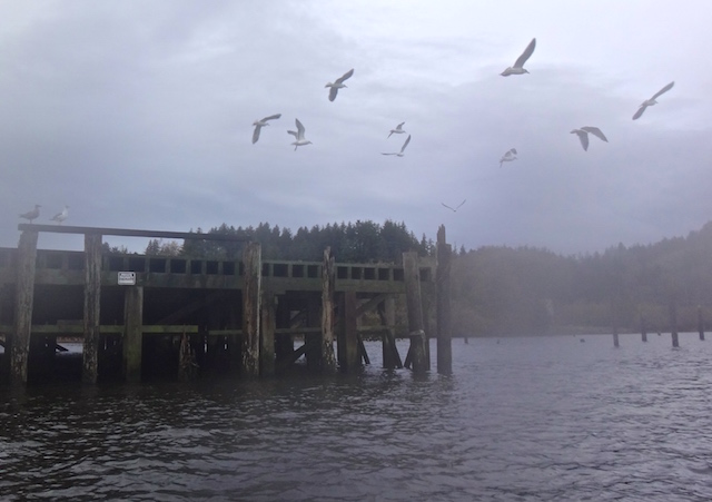
A sign at the dock’s entrance implied permission to check it out.


Using the locally authored ‘Common Birds of the Long Beach Peninsula‘ I’m pretty sure these are a pair of Lesser Scaups.

Across the river I heard a noise like helicopter rotors as hundreds of geese decided to get airborne.


The little GPS chart indicated ‘Dolphins and Piles off to the left (port)’ where I saw only pilings and lashed towers of pilings. I later learned through Wikipedia that a dolphin can also mean “a man-made marine structure that extends above the water level and is not connected to shore.” There were mooring dolphins, protective dolphins (such as seen at ferry docks), maybe berthing dolphins, but swimming dolphins were nowhere to be seen.

Here is the entrance to the Wallooskee, 2.87 miles up the Youngs River. I pedaled hard for a better picture.


After a scattering of houses, there is the Versa Pack building. They are a local manufacture of the large quonset storage tubes that you might see in grain fields.

The important thing to see at this building is a cat. On November 6, 2016 this kitty was watching me as I paddled by. As a friendly dog can mark an important site on a walk, I always look at this building for the cat. It wasn’t outside this time as the sliding picture demonstrates.


Here is the bridge where I turned around on that 2016 trip. That day I was more focused on how far up the Youngs River I could go that day, and blustery rain storms curbed my enthusiasm for the Wallooskee.

Soon there was a cute rodent to greet me. Probably a nutria and I give thanks to the reader who helped expand my knowledge of swimming rodents beyond beavers and rats.

There were pilings spaced widely to tie up log rafts and spaced closer to protect the shoreline.


Then I saw something quietly moving across the water. This nutria (I think) was quietly headed for the shore.
I saw the back of this sign and wondered if it had information about the river.

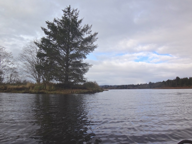
There was little wind as I entered the dark woods.


Here is a familar bridge. Nearby is a place to park and launch a small boat that is 7.42 miles from the Public Fishing Dock back in Astoria.


Soon after there was a stump looking like a turtle guarding the river and a natural archway to pass under.


A third of a mile after the launch a portage size stump blocked the river. I recently read of paddlers who would no more turn around from a blocking log than the early French trappers, the Lewis & Clark party, or any of the locals who have lived here for thousands of years.


Turning around, I landed to look again at the upstream shallows launch that I had previously researched for my book covering local launch sites.


Downstream I saw an otter ahead so I switched the camera to its slow burst and kept quiet. A movie might have captured the several fish I think the otter caught and the surprised look it gave me at the end.


I quietly went under the grated Wallooskee River bridge. The wind wasn’t as bad as it sounds.


15.1 miles traveled in 4 hours and 56 minutes with a maximum speed of 5.2 mph (or 5.6!) averaging 3.1 mph. Stopped time of about an hour partly spent paddling back and groping the cold water for a lost camera from my shirt pocket. Fortunately it was trapped above my dry suit’s waistband.