There are two posts here, stacked one above the other. This is meant to keep together all the posts regarding Autio’s Ramp (Brownsmead) together for easier reference later. This system made more sense to me for later reference than a scattered chronological order of all trips all places.
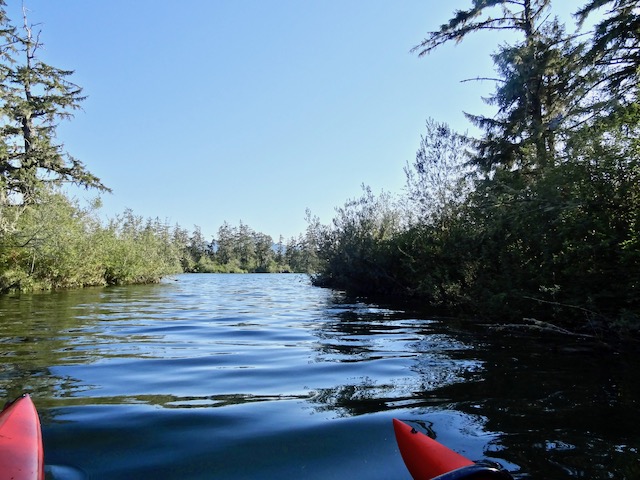
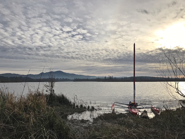
August 27, 2022, I launched the Hobie kayak with sail kit from Autio’s Ramp to look for the sloughs leading off from Blind Slough into the Sitka spruce swamp.
January 26, 2019, I launched the Hobie kayak with sail kit (Adventure Island) heading to near the inland end of the slough and then to he Columbia River end landing on Marsh Island with a side trip to Knappa.

I was following a Facebook discussion regarding a stand of ancient Sitka spruce on Oregon’s Blind Slough. A member of the group posted quotes and a map from the book Canoe and Kayak Routes of Northwest Oregon by Philip N. Jones. It would make a fine trip.
I looked in my copy of the book. Blind Slough wasn’t there. I discovered it was only in the first two editions but dropped for my third edition in 2007. I wrote the author and was flattered when he replied that he always likes to hear from people who use his books.
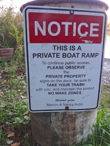
He wrote: “My best guess is that I learned that the Autio ramp requires the permission of the Autio family. And the Nature Conservancy closes parts of the slough during certain seasons to protect the birds. And launching at Knappa is not very easy. Those three factors convinced me to no longer recommend the trip.”
I had paddled Blind Slough a couple of times. I remembered that where it entered the Columbia River it was forested, thick with underbrush and without structures. Not unusual. Further looking on the internet revealed a fine write up of this Sitka spruce stand as posted by the North Coast Land Conservancy. Turns out that this is one of the last, and Oregon’s finest, Sitka spruce estuary swamp areas. Almost nine hundred acres are now preserved, including Sitka spruce up to 400 years old that have not been lost “to logging, diking and other development”. It was finally established in 2019.
This called for another trip.


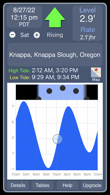
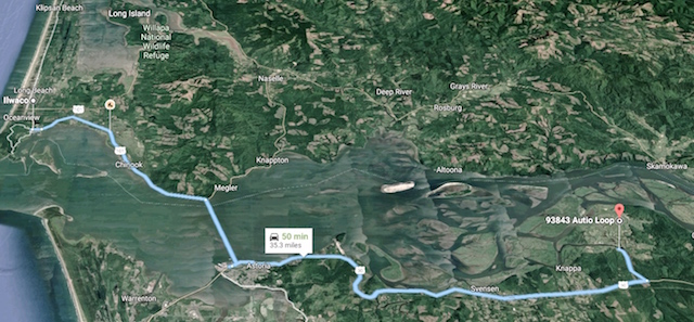
Knappa is between Astoria and Wauna Oregon. Below is an example of tide table differences along the Columbia River. I concluded that the highest tide would be about 4:30 pm, and a noonish launch would work.
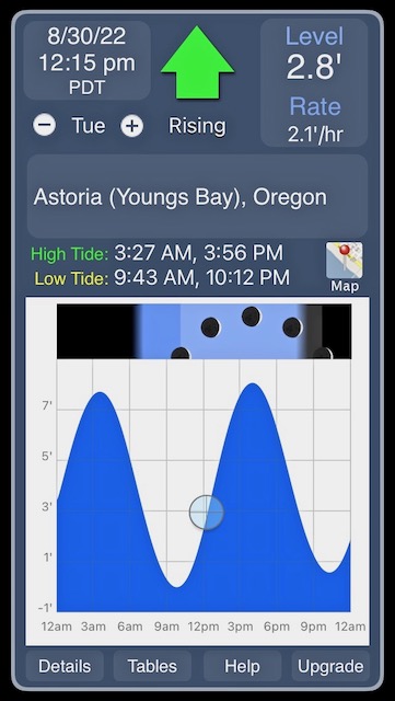

UPDATE: These charts are all from the free app ‘Tide Graph’. Just above the graph on the right is the icon ‘Map’. From there I discovered a tide station at Knappa. Different from the above charts, the high tide would arrive at sooner than either of the above at 3:20 PM. So much for mean averaging.
This launch site was quiet today. At home, the Port of Ilwaco has been very busy with trucks and their fishing boats for tuna and salmon.

I met a local who lives on Blind Slough launching his commercial boat. I had apparently portaged over his land and seen his cows while I accessed the Brownsmead Sloughs. His land had been passed down through the family. Launching under a bridge next time would be better. Regarding sloughs, he told me about an eagle nest up one of the channels. Grizzly, Little Grizzly, Warren Sloughs and Gnat Creek were all good to visit. The first slough was in front of me.
- BLIND SLOUGH
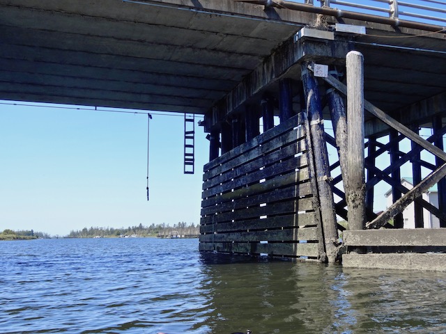
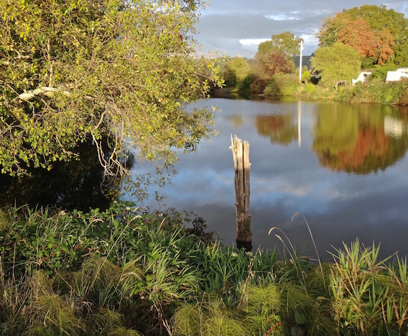
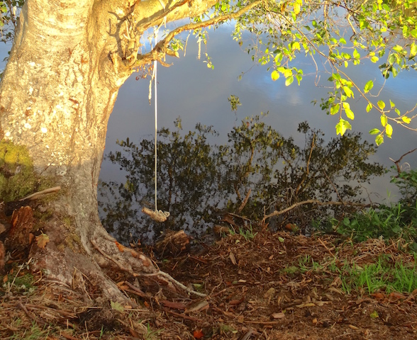
The first bridge is a third of a mile towards the Columbia River.
There is a rope swing and ladder built to a casual building code.
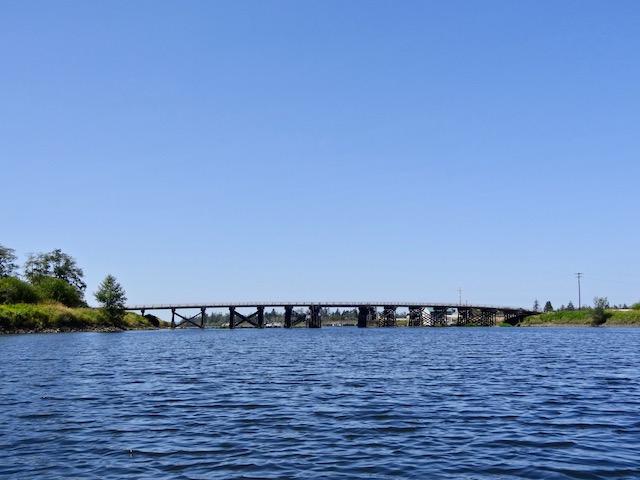
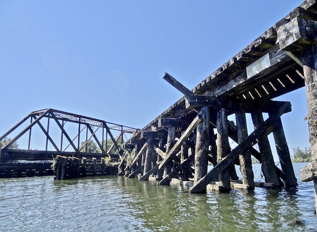
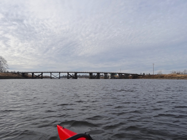
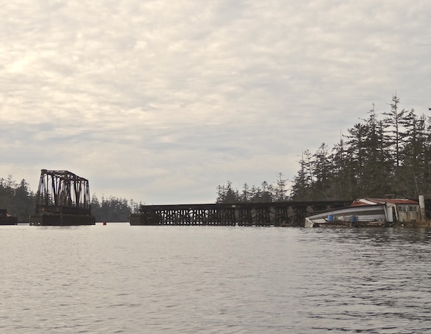
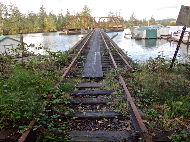
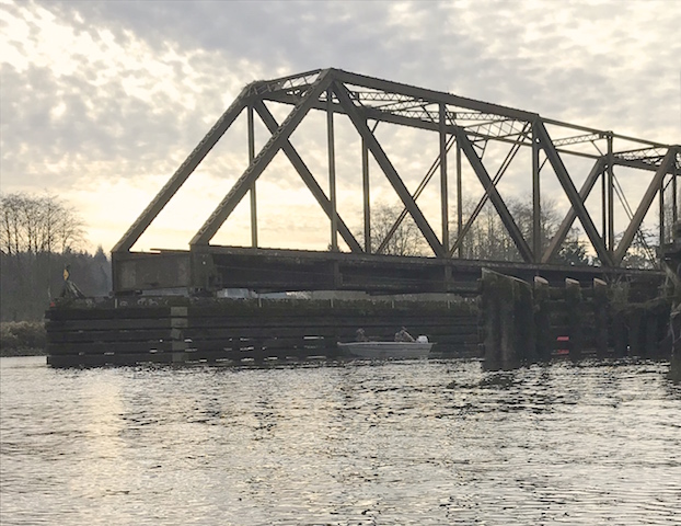
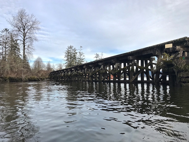
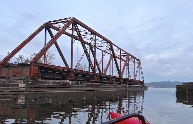
On to the second bridge almost a mile away, a railroad swing bridge.

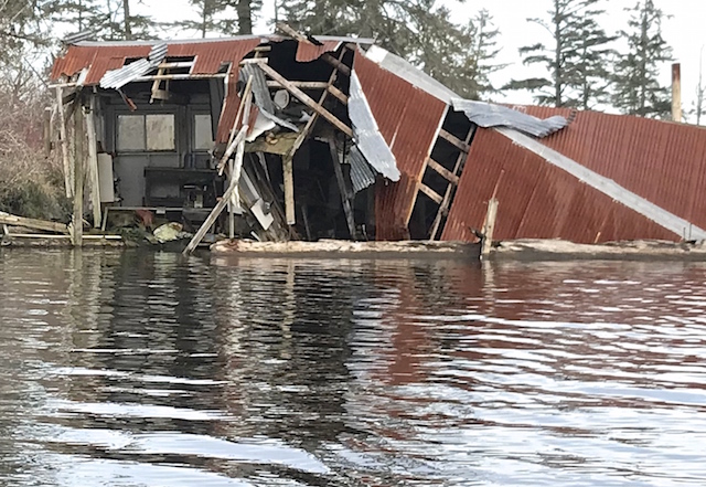
The slough isn’t always tranquil. Tragedies can happen.
This railroad bridge carried its last train in 2005 for weekend passenger service. It was called the Lewis & Clark Explorer Train
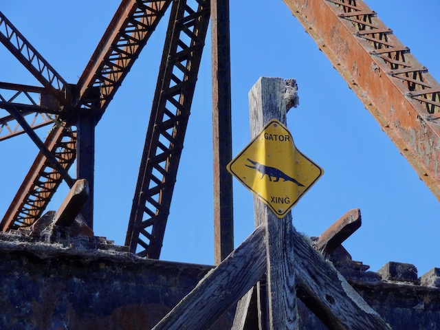
The sign? “GATOR XING”? The popular local band called the Brownsmead Flats have written a song whose lyrics warn: “…You better watch out, the gator’s goin to getcha. It’s a real alligator, yeah sure, you betcha.” as documented in the song The Gator in Old Blind Slough from their CD Rain. It shares local knowledge and ends with advice for kayakers so here’s the YouTube version as it may prove important if you’re planning a visit: https://www.youtube.com/watch?v=4Rr4WeupMZM
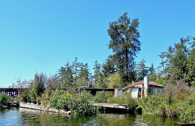
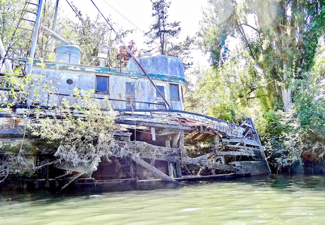
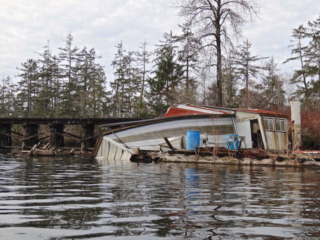
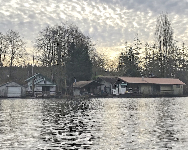
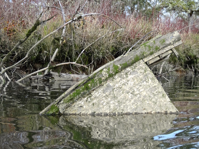
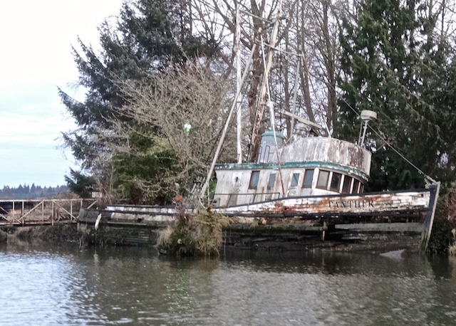
Adjacent to the bridge is the old F/V Panther.


2. GRIZZLY SLOUGH
Below the railroad bridge is the entrance to Grizzly Slough and the dog’s hind leg route I took. I was setting up bridge pictures and bug movies, which is another reason I usually paddle alone.

Here is Grizzly Slough’s entrance from the main channel with the railroad bridge to the right.

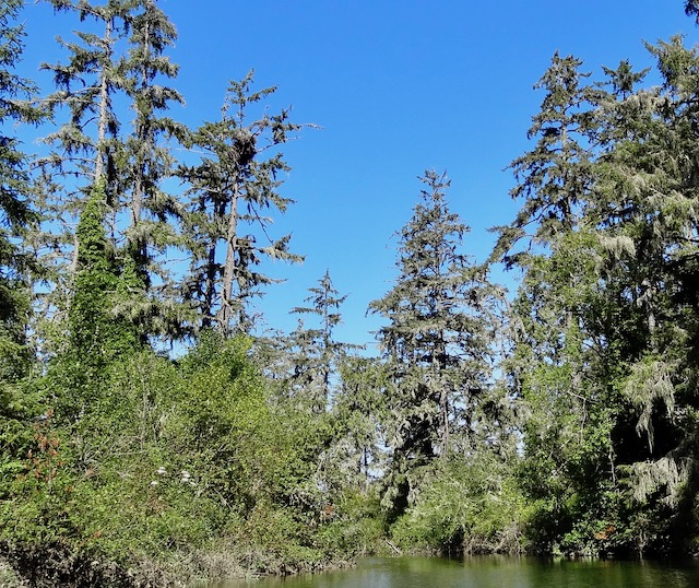
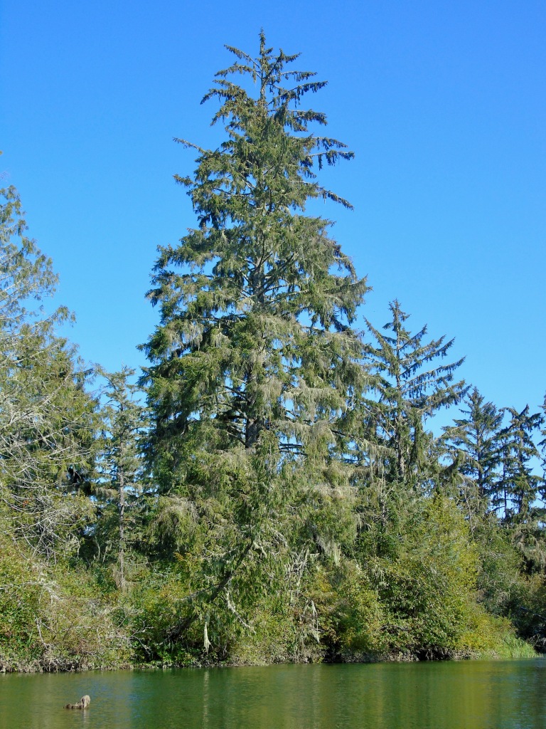
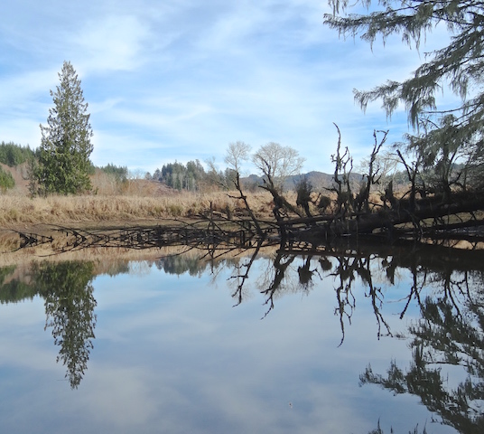
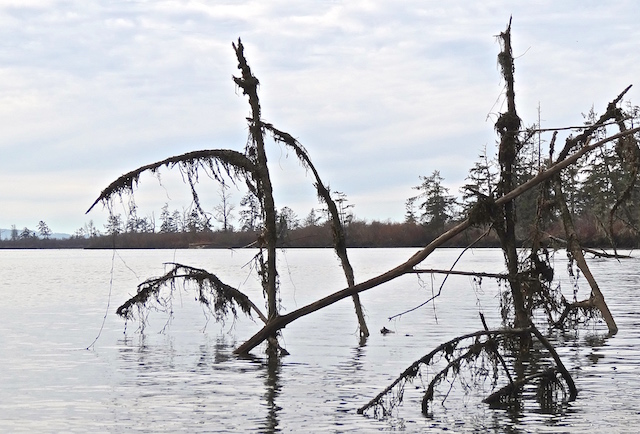
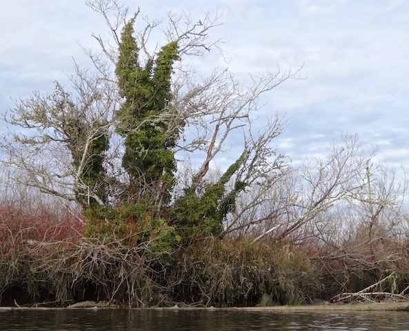
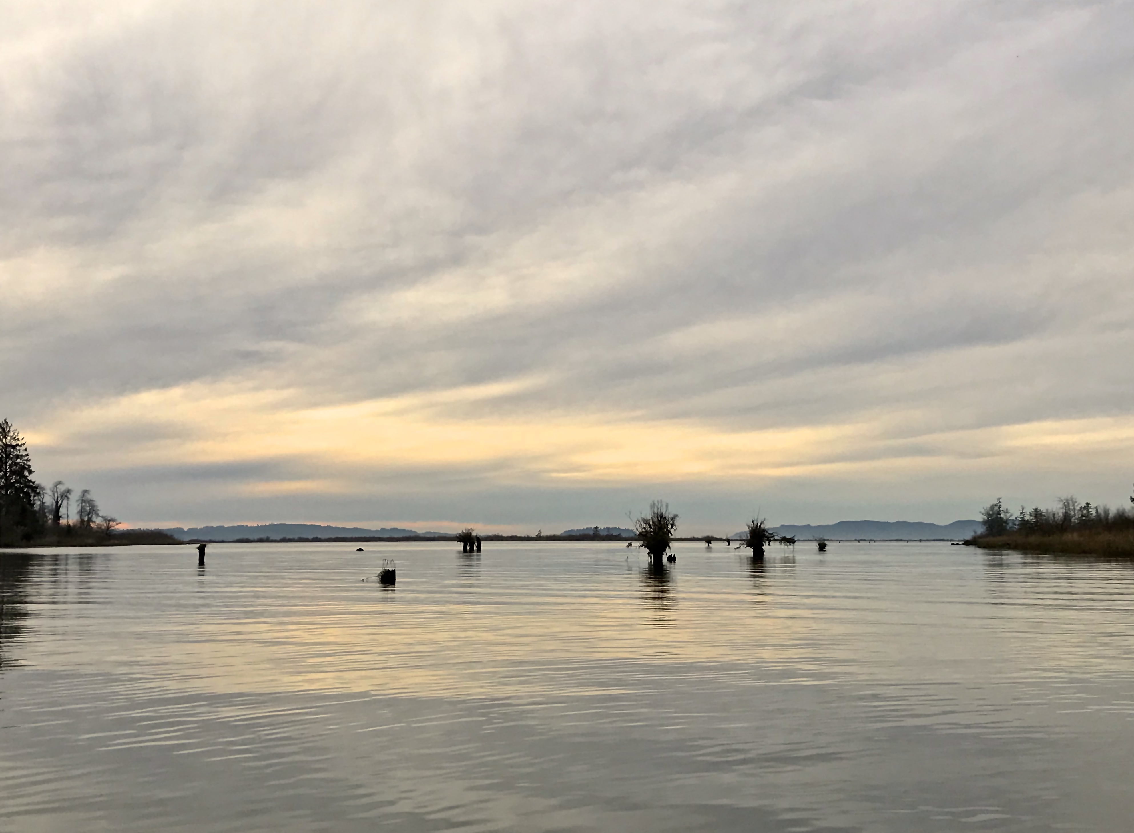
A tree stands sentinel. Lichen reflects good air quality and doesn’t damage the tree, though this tree is not having an easy life.

Here are a few seconds of dragonflies gathering on a floating veggie island.
There was a quiet overgrown blind…

… or maybe more storm wreckage.

There is a dike at the end, with a private driveway and a house nearby. No reason to continue. Here is the view a third of a mile back to Blind Slough.

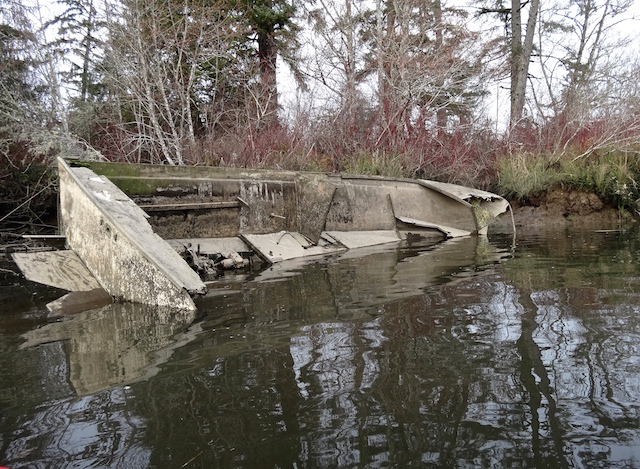
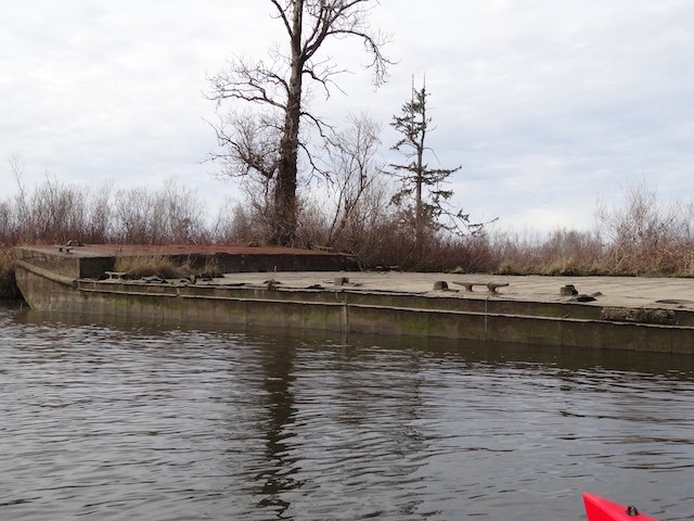
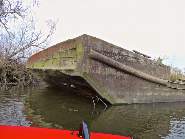
Back in the main channel, I passed a couple of wrecks that were slowly disappearing.
From my trip in 2019, here are some comparisons:


The F/V Panther is losing her planks and more.

3. A CHANNEL WITH A NEST
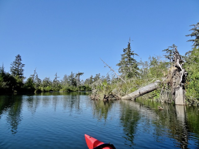
Next up was to cross Blind Slough and enter a small unnamed channel to maybe find a Bald Eagle nest. The feeder creek to give it a proper name was too small to find on a USGS map.

In a twisty and narrow channel, I was stopped about 800 feet in by a fern and its host tree. The danglies show the tide is still coming in.

I spotted the eagle’s nest on the way out. It would be a good place to tie up and watch, as I had seen the likely nest owner out hunting when I entered, but I had other places to check out today.
My wind protection disappeared as I entered the Blind Slough. Here is about a minute as I partially unfurl the sail (reefing) to retain better boat control as I continue tacking towards the Columbia.
4. KNAPPA SLOUGH
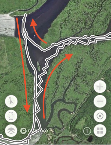
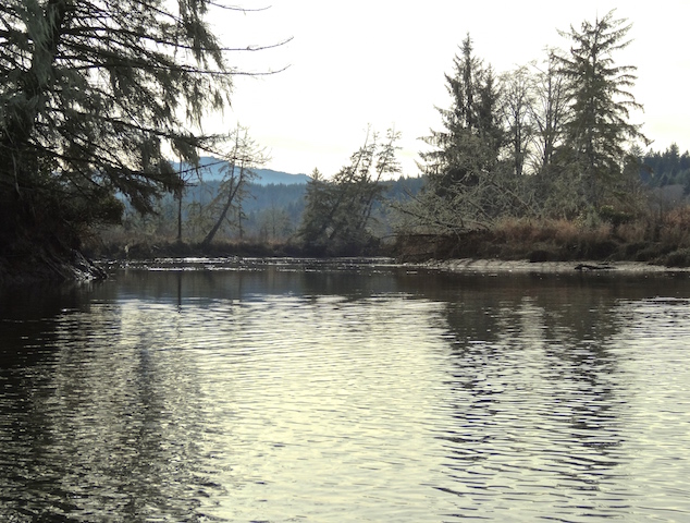
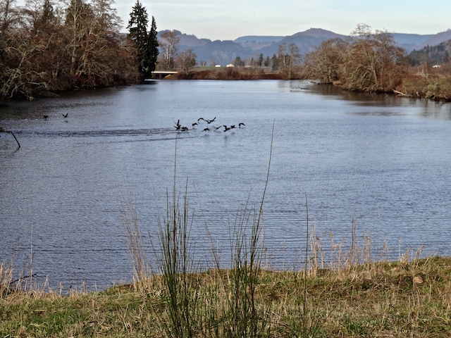
There was enough time to continue towards the Columbia River and tuck in for a sheltered trip downstream behind Karlson Island. This is the Knappa Slough that I’ve used to paddle from Svensen. Today I would not lose my way back as I did earlier when I visited nearby Marsh Island.
What happened that day was another lesson in orientation. I came out of Blind Slough (from the right) to where I landed on Marsh Island. From there I sighted what I thought would be the other side of Blind Slough and paddled off towards Knappa instead. I soon recognized its dock and turned around using up my extra time margin.
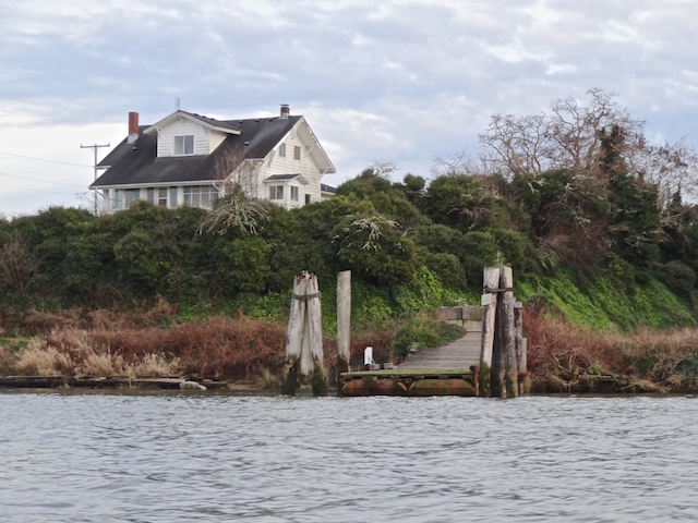
Speaking of Knappa, I was approaching the Knappa dock again located below its landmark house on the right.
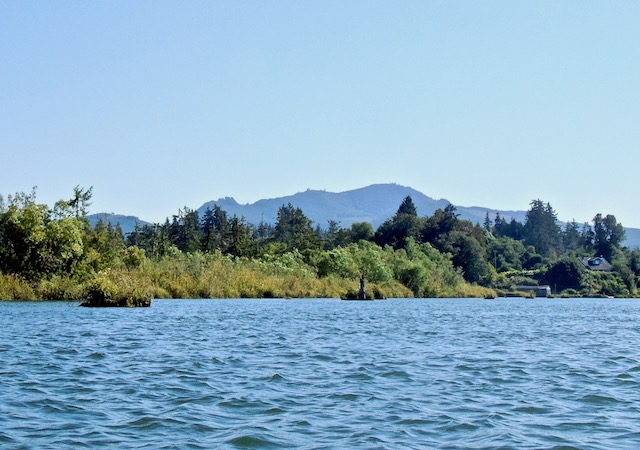
Behind me I could see hills across Marsh Island and the Columbia River to Washington state below Grays River, near Pillar Rock.

5. WARREN SLOUGH

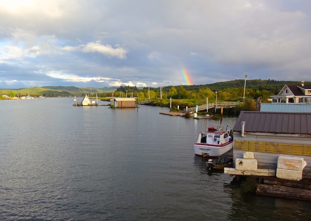
The first time I paddled into Warren Slough in 2018 I had forgotten my map, so I just followed a motorboat. They knew of someplace to go. It is a loop route with a community of interesting floating homes. Today I was following the local’s tip and traveling “a long way” up a dead end branch off to the left.
A quarter mile in there is another branch port side, but I’ll save that for another trip. We’re bearing right at this point.

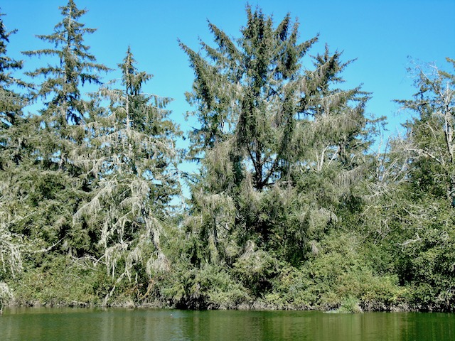
More magnificent trees lined the shore.
After almost a mile, “a long way”, I finally reached an end that would require a log portage, a poor idea when the tide is just beginning to ebb from about +7.0 feet.

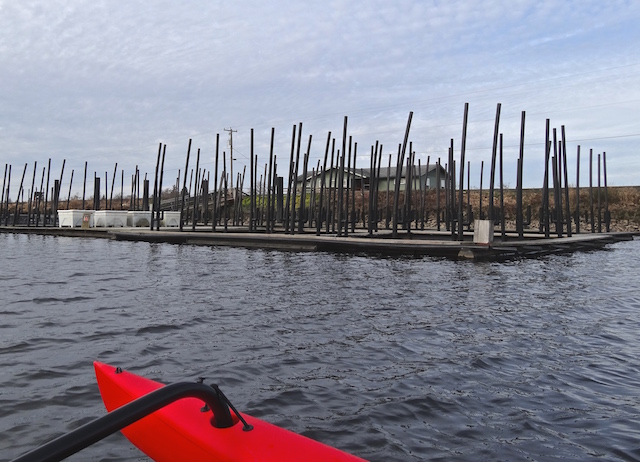
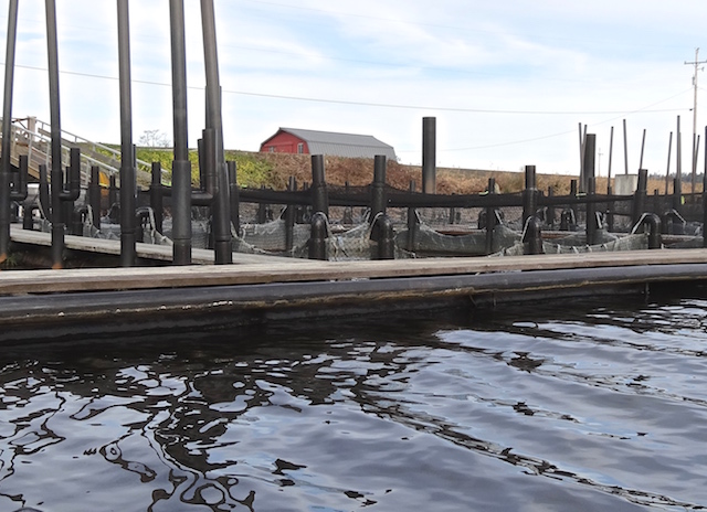
New steel pilings are being stuck in for something new at the Warren Slough entrance to the Columbia. Do I sense some helpful tourist advice on where I can stick my mast?


The rest of the Warren Slough loop is still unvisited but the best slough was yet to come. It was back to Blind Slough and to look for what the local had referred to as Little Grizzly Slough. It was well marked on the GPS and easy to find, or so I thought. I am looking at my GPS track a week later and apparently missed it.
6. ALMOST LITTLE GRIZZLY SLOUGH

The entrance.

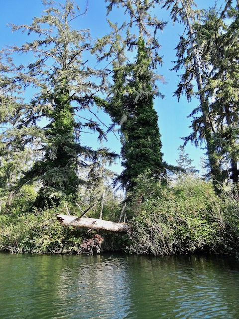
Five hundred feet in there is a log. I photographed it, made note of a narrow gap along the shore and almost turned back. But then, I figured I had enough depth to return, so I folded the boat skinny and slipped through.

This is the heart of the recently purchased Blind Slough Swamp Preserve. Recently, the North Coast Land Conservancy hosted a work party August 6, 9am to 4pm to: “Spend the day at Blind Slough Swamp Habitat Reserve ridding the rare Sitka spruce swamp of purple loosestrife”. From the link you can look for their future work party events and mingle with good people who really know this stuff much better than I. At this event they provided canoes and tools for up to 16 people. Below is an example of an English ivy invasion that will need a bit of work.
Here is the place for a little ten to twelve foot kayak. Just 2.5 miles from today’s launch or 1.8 miles from the Knappa dock. I had planned it safe with today’s predicted 15+ mph wind, but here I was with a long and extra wide sea kayak in a narrow channel. It worked in a bang about way. I held the camera (with a float) for a couple of minutes while pedaling. I could have more accurately navigated using the good old paddle if wasn’t trying to share a video.
After almost a mile roundtrip, it was out of the shadows and calm back into the windy Blind Slough.
I remember passing another small channel. That must have been the Little Grizzly.
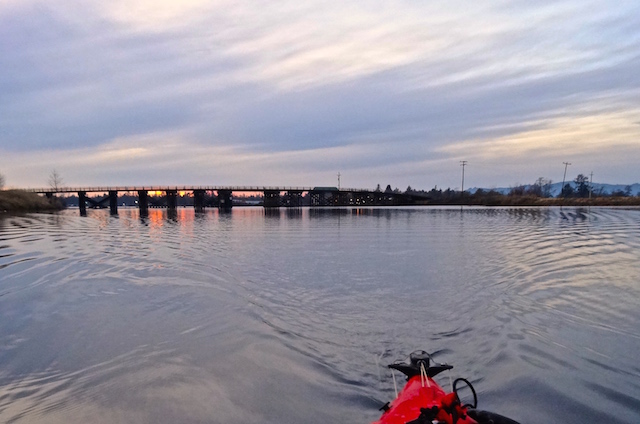
Now the wind came from the stern. I learned more about controlling a sail whipping back and forth over my head depending on my angle. Late in the day I passed the railroad bridge.

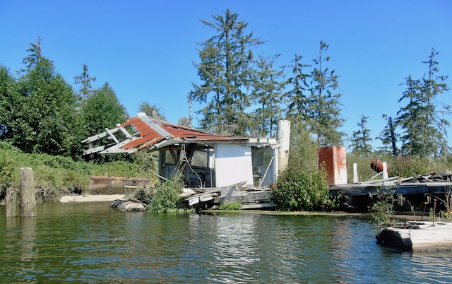
Remember the house boat destroyed at the base of the railroad bridge? I think this is a community that likely shares resources to save each other’s stuff when disaster strikes.
With the evening coming to this waterside community, the fishing, the working, fixing the truck, were all about done for the day.

I saw (and heard) a jet ski towing a boogie board coming from beyond the next bridge.
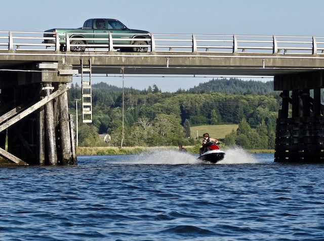
Someone turned up their music, there was cheering and awws. Boat dogs barked at me as I moved in closer out of the channel. The kid being towed rose up and splashed down, again and again.

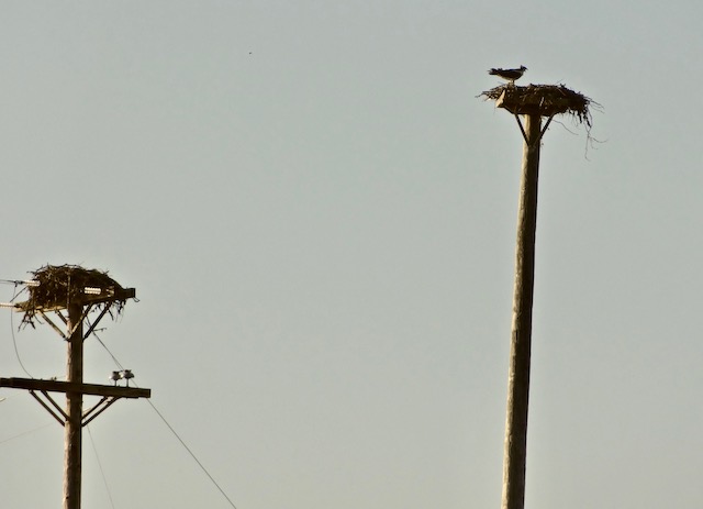
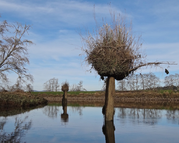
Beyond the bridge it became quiet again. An osprey nest cheeped as its dinner delivery came and left.

The local had said it was also possible to paddle up the Blind Slough to Gnat Creek. I figure that would be about a four and a half mile round trip with the right tide, but as with Warren Slough, Little Grizzly, the islands, and more, that would be another day.
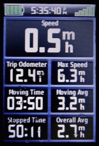
The phone app “Map My Tracks” below show a top speed of 13.6 mph but I don’t believe it. The back up Garmin was reset partway through the trip (31 miles!?). It indicated a top speed of a more attainable 7.0 mph averaging 2.8 mph. Yeah, sure. No gators sighted, this time.


Up, Down and Sideways on Blind Slough
26 January 2019
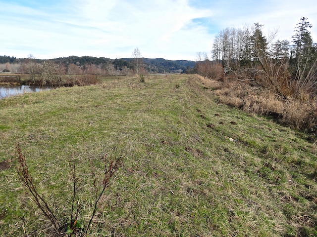
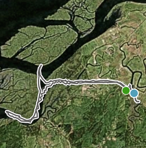
The Brownsmead plain looked ripe for kayaking as it includes many quiet miles through farm country adjacent to the Columbia River.
It lies east of Astoria and north off the main highway. The Columbia River is up to six miles distant. The roads wind around and it’s easy to get disoriented, but it’s a pleasant place to be lost.
Early October 2016 I drove around Brownsmead looking for places to launch onto its waterways and blogged about that trip here. I found no public ramps to access the interior.
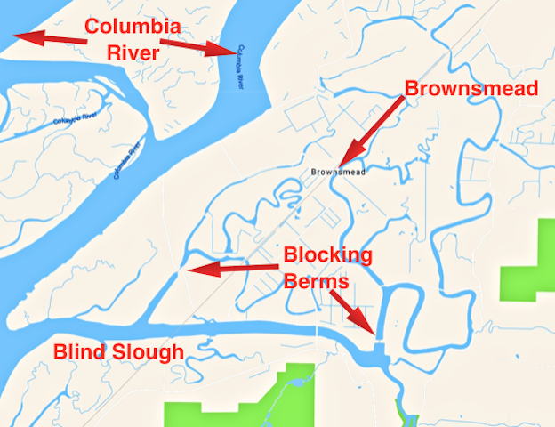
The interior waterways are wide, deep, and calm and look to be isolated from the tides.
With a light boat and a strong set of legs, it would be possible to slide the boat down here across the road from Brownsmead’s Grange.
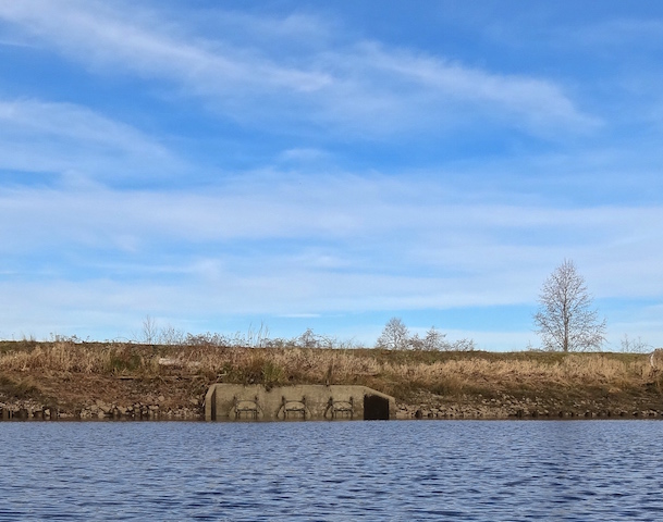
Autio’s ramp (not in the canon of Google Maps) is across the water from one of those blocking berms. There is no public road on the berm, so the best and most pleasant way to check it out is to push a boat into the water and look. I parked with the pickup trucks and trailers.
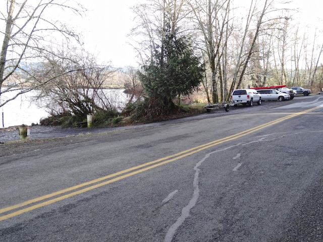
The Autio residence is atop the hill. They also keep a boat garage next door.
This waterway is called Blind Slough, but Google maps just labels it the Columbia River. There is a site called Lewis & Clark’s Columbia River – “200 Years Later” that has hundreds of pictures to enjoy and lots to read. Here is their section about Blind Slough.
Today the tide would be rising from two to nine feet, and the breeze would be less than ten mph. The rising tide would help on the return trip to make sure the launch would be out of the mud. As I was unloading, a truck went by with a hunting boat so camouflaged by tree boughs that I first thought they were landscapers.
One of the locals was waiting there for a ride and recommended I head upstream for about a mile and a half round trip. I managed to take a wrong turn portending the rest of the day.
There was a fork in the stream. I took the one less traveled.
If I had stayed to the right, the channel went about a half mile further to a road.
Couldn’t go through it, can’t go around it, so I landed and climbed over it.
The old railroad recently ran again from Astoria carrying passengers from 2002 to 2005, but landslides have since closed it.
I saw a few holes in the deck and prepared to board for inspection. Then I imagined the likely pool of water inside. It wouldn’t be much to see, so I continued down the river.
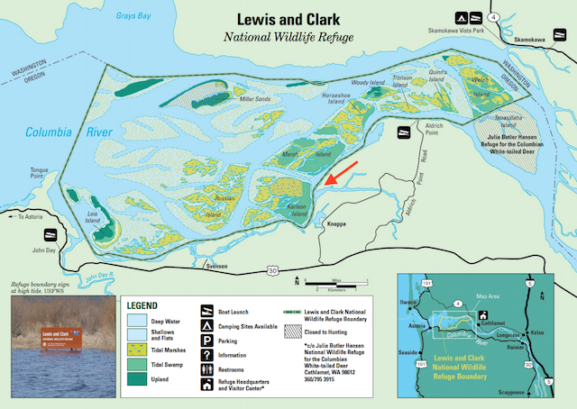
Ahead of me were several offshore islands. The public use USFWS map (above) in my book listed the island below as Karlson Island with Marsh Island just upstream. They are both uninhabited and are part of the Lewis and Clark National Wildlife Refuge.
The wind picked up as I got closer to the main channel. I had seen this happen before when I launched downstream at Svensen. I headed for Marsh Island for the excitement and to put on warmer gear.
Here are 25 seconds of the windy crossing, then cruising later.
Marsh Island was brushy, low and not easy to explore.
It was an hour from the dock to here. I had two hours until sunset. There was a rising tide and a breeze from the side as I started for home.
On the way back I planned to check out the other side of Blind Slough.
I invested 45 minutes down this route. When I went around the bend there was no bridge in sight. I studied my little Garmin GPS much closer, mumbled things, crossed the channel and tacked back. Then I recognized the Knappa dock that I had visited last year on a trip upstream from Svensen. I’ve read and written that it is important to use maps to navigate these islands. I must remember to use the maps more next time.
I passed a retired boat just downstream of the bridge.
I carry a lamp and whistle and kept close to shore but still, I would be returning at dusk.
I waited while two power boats trailered themselves out as all of us had gotten in as much boat time as possible before the sunset.
Bad news and good news. I didn’t get to paddle into Brownsmead but I am making plans to come back and explore new waters next time.

Alan, I love reading your stories mate. I wish I had the boat and time to join you. See you in July, or is it June for the Garden tour?
On Mon, Feb 4, 2019, 7:52 AM Southwest Washington Paddle Trips Tangly Cottage posted: “26 January 2019: Up, Down and Sideways on Blind > Slough The Brownsmead plain looked ripe for kayaking as it includes many > quiet miles through farm country adjacent to the Columbia River. It lies > east of Astoria and north off the main highway. The Columb” >
LikeLiked by 1 person
Thank you. A slow drive east from the John Day River past the Eagle Sanctuary would make a pleasant day too. I’m not sure when the area garden tours are yet.
LikeLike
Thanks for sharing another boating adventure, Allan! I love the photos and especially the video.
LikeLiked by 1 person
Thank you Debra. Paddling, rowing, and the sail was the way they moved boats a hundred years ago. The lack of engine noise is important to my imagination.
LikeLiked by 1 person
Reblogged this on Tangly Cottage Gardening Journal.
LikeLike
Another adventure.
LikeLike
Another informative and enjoyable paddling adventure! Amazing all the derelict and abandoned boats.
LikeLike