March 18, 2023
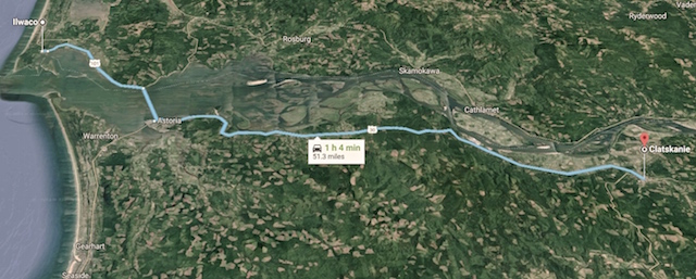
I’ve been wanting to further check this area for a long time. On a map it appears there is a route parallel to the Columbia River from Westport to the mouth of the Clatskanie River, almost. I’ve read feed back from other people who are curious too. There are two gaps labeled on this map.

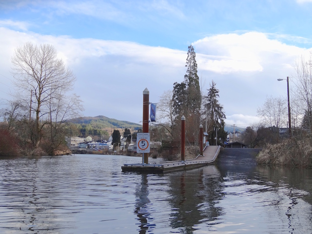
On the left end is the entrance to Westport Slough where there is an excellent ADA kayak launch at Westport, Oregon. The blue marks the Columbia River, the red marks the Westport Slough and part of the Clatskanie River system inland up to the Quincy Mayger Road bridge. I documented a portage through the gap on the left. The bank entering the slough was steep but I was fortunate that it was a slide down and not a pull up through the brush with my heavy boat. I wrote it up here.
If doable, the second gap to the east offered the possibility of sheltered waters paralleling over seven miles of the Columbia. I found an entry regarding this gap in the excellent 2004 book by Keith G. Hay: The Lewis & Clark Columbia River Water Trail available here.

Regarding passage, Mr. Hay offered a paddle through the gap if the tide was low with the possibility of a portage if a person didn’t want the thrill of a culvert:

Today I planned to launch here and observe at what tides the culvert works. When I arrived, the tide was rising at +6.7′ feet and about to turn. I planned to paddle east around Anunde Island, then north around Point Adams onto a sheltered bit of the Columbia. 3.5 miles into trip I would portage back onto Westport Slough and down the steep bank where I would rejoin the main path of Westport Slough four miles into trip. The loop would total about seven miles. When I returned, the tide would have fallen to a bit over +2 feet to show another extreme of the culvert.
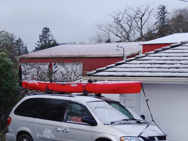
Off I drove to find out.

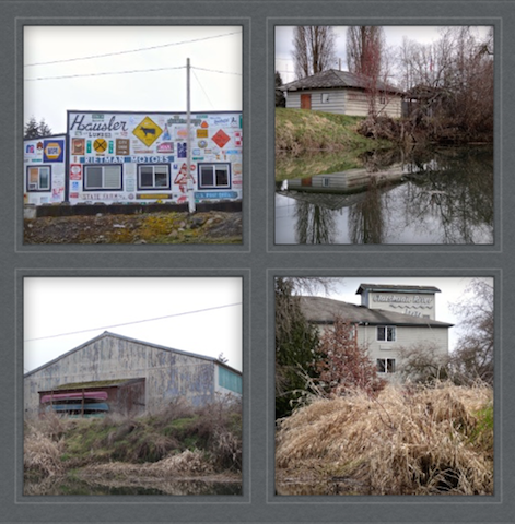
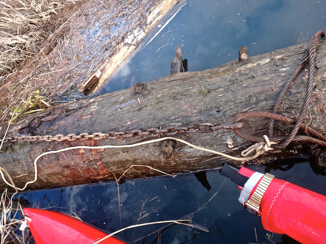
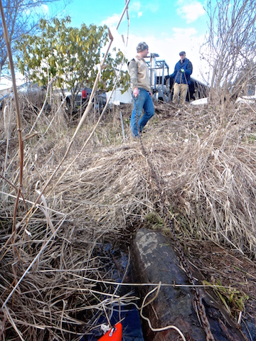
This must be the place. This sign credits the many who made this culvert possible and encourages research to find out more. A quick search revealed from NOAA Fisheries that they “Removed dirt plug between river and slough, replaced with arch culvert to allow fish access to 8 trubitaries (sic) and water flushing of Westport Slough. Should reduce sediment load in slough.”

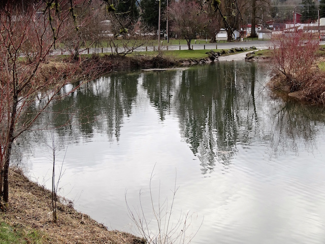
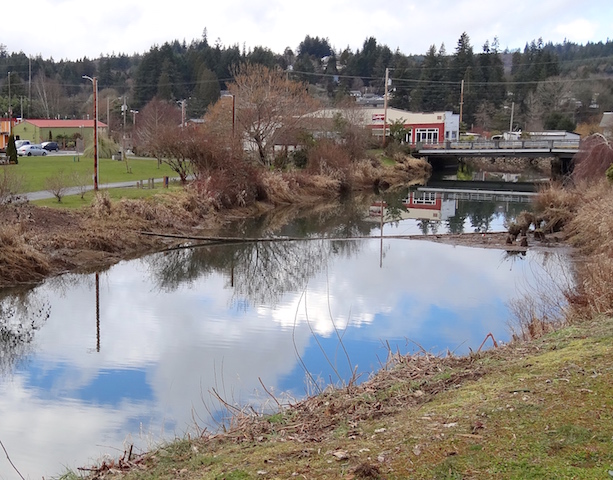
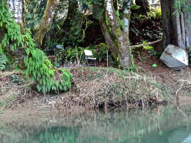
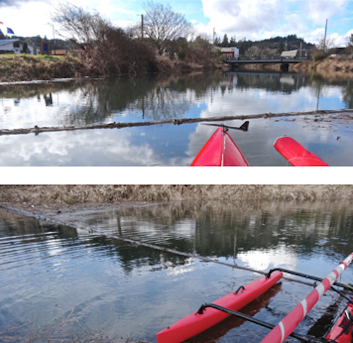
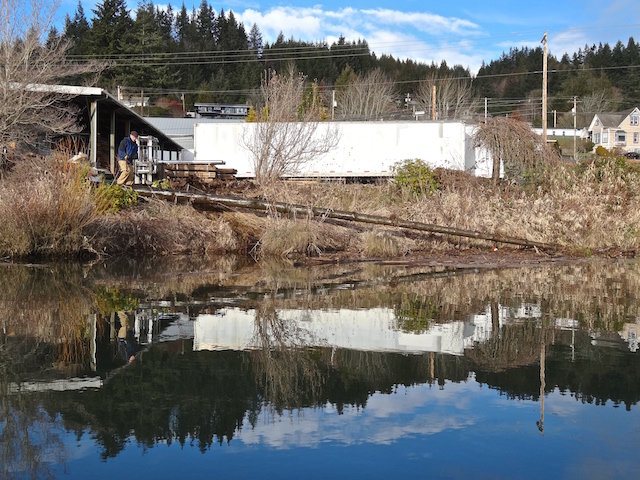
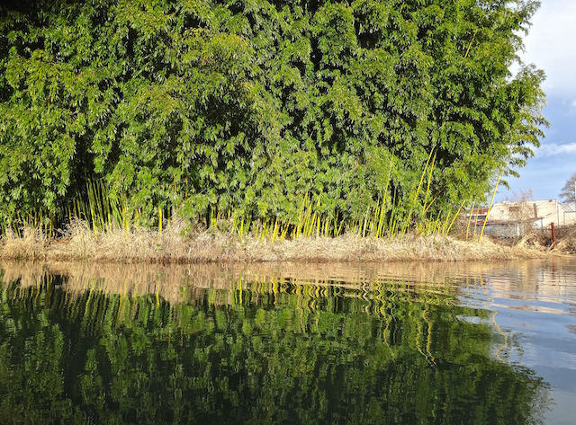
Looking west, here is the slough from Westport. My original plan was to loop back here in four hours after heading in the other direction. In the nineteen years since the book was written the banks have grown thick with Himalayan Blackberry.

There was one short path in the area and it went east to the Clatskanie River. It offered no view of the culvert but pulling aside some blackberries elsewhere I was able to photograph it. There was a small current westward as the tide was turning at +6.9 feet (as measured in nearby Wauna).


Being March, the blackberries are bound to further fill in the launch path during the summer.

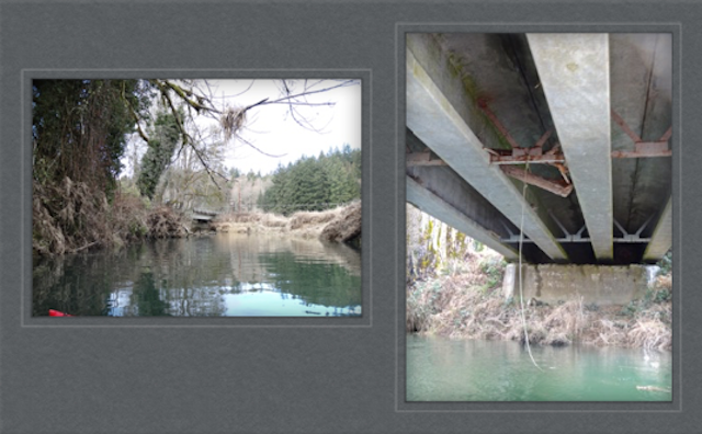
Off I went to get a water’s view of the culvert. The divider was a deal breaker to me.

A local stopped to chat. He lives nearby on the northeast shore and paddles with his grandkids. He recommended that I return before the tide dropped to three feet. He can see the culvert from his dock but has not been tempted to paddle through because the Westport Slough is shallow at this end. I gave him a copy of the Launch Guide book I publish as he was unfamiliar with some of my favorite trips nearby. We both agreed that nearby Jones Beach on the Columbia River can be rough and exposed. Then he told me to watch for a waterway a farmer dug in the 1930s. It would take me through the fields and rejoin the Clatskanie River upstream. After he verified I knew what time to be back to avoid becoming stuck in the mud, I paddled off to find this uncharted route.

This looks like a narrow entrance to something worth exploring.

I had found the passage. It is more shallow than the Clatskanie but plenty wide.

Later research gave it a name: The Kinnunen Gut. That called for a directory which explained that “a ‘gut’ is a relatively small coastal waterway connecting larger bodies of water or waterways.” It is shown as a dead end on my large NOAA chart #18523 and on GoogleMaps where it is labeled the Kinnunen Cut. Calling it a gut will raise an eyebrow.
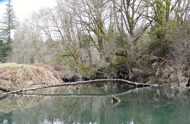
It was not a dead end as I later paddled into the Clatskanie River on a falling +5.8 foot tide.

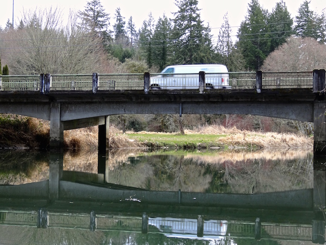
It was a mile and a quarter paddle downstream to the Columbia River overlapping a trip I have previously written about here. On that trip, I was trying to figure out a large mysterious concrete structure that looks so out of place on a satellite view. The local land owner I had met didn’t know about it, and it still remains a mystery.

On their return trip the Lewis and Clark Expedition camped further down down the Columbia River near Aldrich Point on March 24, 1806. On March 25, they camped here at Point Adams. What is also here is this interesting fishing industry relic.

Gear is still stored on the precarious looking upper story of this building above the many old docks.

I spotted an otter or a nutria ahead and paddled to where I though it might emerge.

The critter didn’t appear as maybe it was fishing.

Owners of the vehicles parked nearby were out fishing too.

And there were those who have always fished here.

A bulky camera that had been slowing me down all day got some use.

I circled around to admire this boatbuilder’s style, particularly the compound curves on the bow.

Soon I headed back up the Clatskanie and into the loop with the culvert.


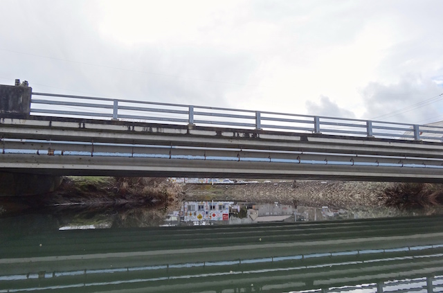
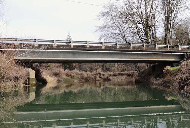
Here is the culvert again at a falling +3.3 foot tide. Water was flowing towards me vigorously turning my bow away, not that I wanted to enter anyway. The entrance path is to the right, now with a soft mud beach.

Here’s a minute plus of video demonstrating the decision not to paddle through.
The book was right. From the blackberry launch it is only a mile to the Columbia, which is closer than the 2.75 mile paddle from the Beaver Boat Ramp in Clatskanie.

A Red-winged Blackbird entertained me as I loaded for home.
Did I find an island? According to the Inventory of the Julia Buttler Hansen Refuge, Appendix F, under Islands: …the “Kinnunen Cut is not being considered because it is a human-made cut, which was previously part of the Oregon Mainland.” Apparently digging a trench does not create a new island. Here is a map from Anyplace America that provides the best satellite view of today’s trip. The tracking information from my phone’s MapMy Tracks app.


I recently read an excellent book of kayaking (and towing his kayak with his bicycle) across the the United States titled The Misadventures of a Cross-America Kayaker released late in 2022. He described headwinds, fog, rough water and silent freighters sneaking up from behind as he paddled upriver on the Oregon side of Puget Island and around the nearby Wallace Island. He could have entered the Westport Slough and exited near the upstream end of Wallace as he was also using Mr. Hay’s book as a guide. I wrote to him regarding his thoughts of the Westport Slough and he replied…

“…In retrospect I wish I had taken it. I suspect I did not for the same reason you cited; uncertainty about the culvert (and running aground in the slough at low water). The Columbia River Water Trail Guide was a little light on the details and didn’t provide a photo. Oh, well, there is always next time.”
I have more trips planned in the area too.
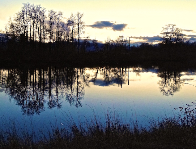
As I left, I stopped at the first bend to take a parting picture westward of the Westport Slough. The +2.6 tide would leave a paddler feeling poorly in this gut.

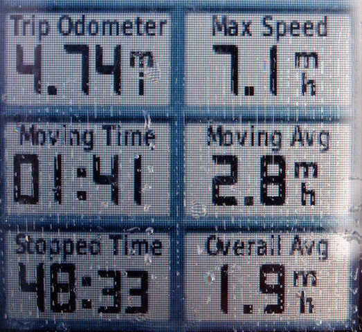
Here are the numbers that don’t quite agree with each other from MapMy Walk and Garmin.


Let’s keep: 6 miles traveled in 2 hours 20 minutes (according to the Garmin that measured stopped time) with a maximum speed of 5.3 mph averaging 2.4 mph.