Here is a list I put together to help explore the Willapa Bay and its tributaries. It’s not the only one but reflects my abilities and preference to keep close to a shoreline. The Washington Water Trails Association also posts their list of thirteen Willapa Bay Water Trail Access Points here. Importantly, they offer a page of frequently asked questions about the Willapa Bay here. My modest expertise ends at the launch site where I have been known to drop my boat off the van (once). I don’t work for any of the many groups that study and preserve this area. I hope you get ideas for your adventures ahead on Willapa Bay and enjoy my posts of this region. This was updated July 2023 as South Bend repaired their city kayak dock to as it was before their big dock sank and Raymond replaced their kayak platform with a pull-by-paddle kayak dock identical to the one in Wheeler Oregon.
Working clockwise from Willapa Bay’s entrance to the Pacific Ocean, I am starting at this intersection located at the north end of Raymond. Turning west towards Grayland and Westport will take us to the most northern launch points onto the Willapa Bay on SR 105.
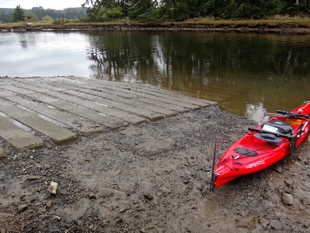
#1 Tokeland Marina From the intersection of US 101 and SR 105 in Raymond, drive 22 miles west. If you choose to launch from the marina you’ll find yourself on open water near the Pacific Ocean requiring a careful appraisal of the tide, weather, and your skills. Below is the ramp and a view towards the Willapa River.
The nearby Cedar River flows through a weir and tide gate into the Willapa Bay. Its entrance is a 7 mile round trip paddle from the Tokeland Marina. It requires a portage up a steep riprap beach and across SR 105. I enjoyed a 3.6 mile round trip paddle up to its shallows by driving to its mouth as written about in this post. Shown is the Cedar River’s gate to the bay and a view upstream.
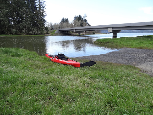
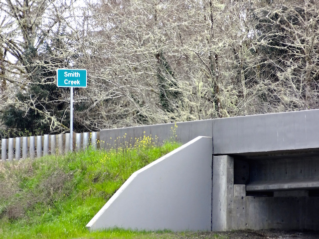
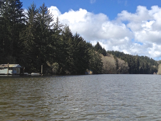
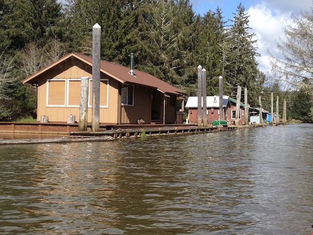
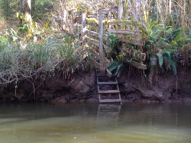
#2 Smith Creek From the intersection of US 101 and State Route 105 in Raymond, drive west 10 miles and launch by the Smith Creek bridge. An undeveloped quiet 9 mile round trip written about here. Staying close to shore, with cautious planning for the weather and tide, it’s a 7 mile one way trip to the Tokeland Marina, South Bend or the beach below the Bruceport Campground.
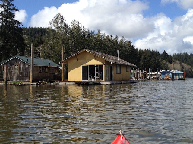
#2 Smith Creek The access to North River is a 500 foot paddle from the adjacent Smith Creek. I paddled a quiet 13.2 mile round trip past floating cabins and the occasional recreational fishing boat as posted here.
#3 Wilson Creek. At the intersection of US 101 Hwy. and SR 105 at Raymond, drive east on Monohon Landing Road 4 miles up the Willapa River. From here you can paddle up or downstream towards the Willapa Bay 11.5 miles away through Raymond and South Bend with over 25 miles of the Willapa River’s forks and sloughs to explore as partly shown here.
#4 Raymond Riverfront Park.Next to Willapa Paddle Adventures, the Willapa Seaport Museum and the NW Carriage Museum is a hand carry dock with an added easy kayak launch. The Willapa River forks here giving you three major routes some which are shown here. Below is a view of the dock, the nearby lumber mill and swing bridge.
#5 Helen Davis Memorial Park is on the Willapa River at the west end of South Bend. From here it is a 5 mile round trip to Willapa Bay and a 9 mile round trip to Raymond as shown here. Dock repairs to the hand carry kayak dock adjacent to the Elixir Coffee Shop were completed in 2023.
#6 The Bone River Natural Area Preserve No facilities, limited parking and a steep muddy hand launch at lower tides offers a 5 mile round trip that’s historical and protected from development. Launching from nearby Bay Center would make this a 13+ mile round trip as I did here.
#7 Bay Center From the marina’s dredged ramp you can paddle upstream to the Niawiakum River and/or the Palix River delta. Shown below is the ramp and Goose point Oysters at the entrance to the Niawiakum River.
#8 Palix and Canon Rivers Accesses the three forks of the Palix River and the Canon River through the meadows and forests as written about here. Located 1/3 mile south of the US 101 bridge over the Palix River.
#9Naselle Launching onto the Naselle River at Naselle you can paddle upstream or downstream through pastures and forests before reaching Willapa Bay 12 miles away as I’ve done here.
Shown below is the lot and the nearby Ellsworth Slough.
#11 Willapa National Wildlife Refuge Ramp provides access across to Long Island, with campsites north and on its west side. A collection of posts crossing to the island to hike the trails around the old growth cedars can be found here.
The Willapa National Wildlife Refuge Headquarters has moved from here southwest across the bay adjacent to the Dohman Creek launch.
#12Dohman Creek provides access to Willapa Bay’s southern salt marsh and the Tarlett Slough. This launch opened within the Riekkola Unit late 2018. Turn east off Sandridge Road at 67th Place and drive 2.3 miles to a restroom and parking lot. Below is a picture of the launch and Tarlett Slough as written about here.
#13 Port of Peninsula at Nahcotta: Is located 12 miles north of the intersection of Highway 101 and Sandridge Road at Seaview. From here you can see the the local oyster industry and waterfront homes. Two miles east is the northern end of Long Island, a crossing that is unforgiving to poor planning and may leave you stranded until the tide returns. I’ve written about it here.
Bonus: Posts of Accessible Lakes and Canals on the LB Peninsula
These are collected from my collection of posts that features the Columbia River west of Longview, the Oregon coast from Wheeler north to Ocean Shores Washington.
A guide book is available in several shops, by mail or on Kindle and is available here.
Flowing into the north side of Willapa Bay is the aptly named North River. Twice I have paddled its lower reaches. The first time on the North River I headed left off the main channel to check out a channel of floating homes that compelled me. I learned a lesson in floating log gates too. My second trip on the North River, cosmic signs kept leading me back to a fine day of paddling the Smith Creek instead.
There is a navigational mystery on the Columbia River near Wauna that I’ve recently read about. I would have liked to check out. Today’s low tide and a high wind changed my mind. The wind would be 5 to 15 mph from the north, and the tide on the Columbia would likely not be high enough. It would on the North River near Toke Point. Same sun and moon, it just requires the correct location on the tide graph. Then there’s the flow rate and seasonal flow to consider, but that hasn’t been a problem yet.
I must be missing something, as the half dozen boats I saw today, except mine, were all fishing. If I learned a bit, I could troll a hook the whole trip and maybe come home with dinner. It would add more complexity and cost, but everybody else is doing it. My dad was a dinghy sailor, not a fisherman. We’d also paddle in his home-built canoe before kayaks became popular, so my non-fishing trips are sentimental too.
With the predicted wind from the north to bring me home, I set up the sail kit to hopefully go the furthest. I rationalize this whole set up is cheaper than a small outboard motor and forces a workout.
In my rear view, Smith Creek’s launch is next to the column on the left.
I passed the familiar North River Resort. Another fishing boat is heading upstream by their pilings.
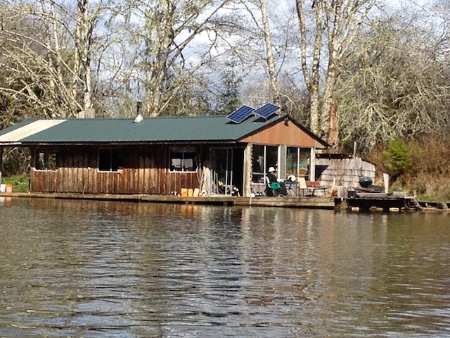
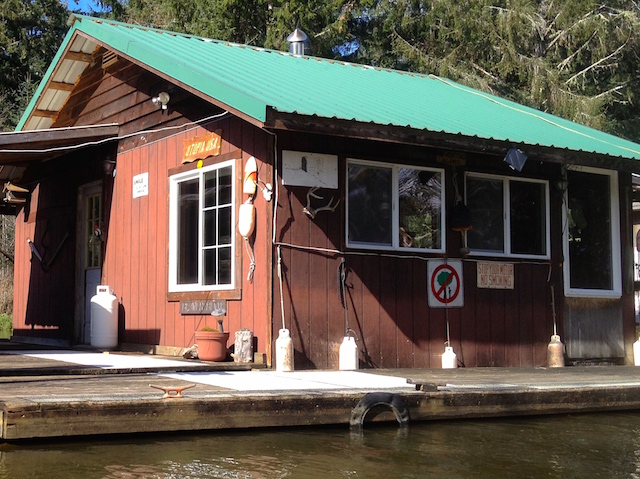
Then come the cabins which are always interesting.
Floating cabins sometimes require big materials to maintain. This one was getting new siding and roofing. After brief pleasantries, I found out that their materials were brought in by boat. Once home, I looked at the map again and still wonder where the residents park their vehicles to boat in. This crew had a four legged supervisor.
Another cabin had homey porch landscaping.
I think I spot tomatoes.
Another porch had their landscaping tools highlighted by an old crosscut saw blade above.
Here is a natural shoreline pattern. Some logs don’t interest saw mills.
Thick mossy branches even at the end of a dry summer.
Here is one of my favorite cabins because on my first trip the owner had guests with their boats tied up and was enjoying sitting by the river with friends and bbq. They had waved and were friendly. I figured this is a terrestrial heaven for people who sport fish.
No one waved today.
Speaking of privacy, not everyone who buys such isolated homes are welcoming of looky loos. I was floating by with no motor sounds to warn them. I used the telephoto and cropping staying thirty feet or more away but, sometimes an owner just needs a solid fence.
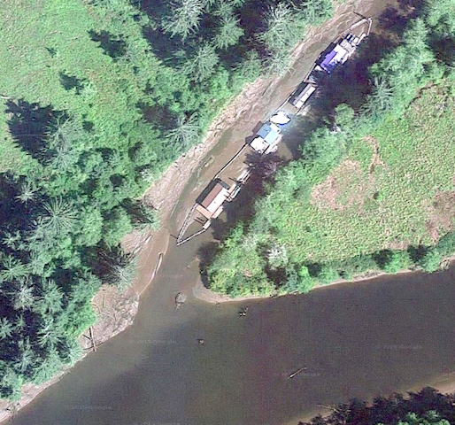
This would aid dropping logs into the river for a tow maybe? The opposite shore was clear without pilings so I don’t think it’s railroad related. A satellite view shows a shadowy trail leading from this dock through the woods to a logged off area.
A clever water system. At the top of the bank the creek is sandbagged and fed into this flexible pipe for boat access. It was waterfall sound in the quiet.
If there was a breeze, it didn’t descend into this valley.
I was fortunate be here at the right time when the reflected sun dappled the trees.
Here is a minute video of the light show.
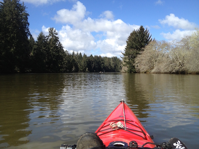
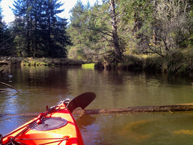
The river narrowed.
I crossed the county line and had reached the shallows where I had predicted in my book of paddle launch sites. The book covers the area from Ocean Shores to Nehalem and west up the Columbia to Stella and Clatskanie. Here a shallow gravel bar extended across the river offering me the option to walk but not to float ahead. Sometimes dragging the boat is the answer but it was getting late. The tide was coming in but the water was flowing out.
The last view upstream. The little ‘Wind in the Willows’ wind vane on the foredeck was ready while its ceramic figures waited at home.
On the way downstream I passed a container garden of locally sourced moss, ferns and grasses.
There were fish. Impressive were the silver ones over a foot long. Too fleeting for my camera but maybe not for an alert dog and a fisherman.
After about a mile and a half I returned to what a fisherman referred to as ‘The Bend’.
There are houses hidden on one shore and the floating cabin furthest from ‘civilization’ of them all. Today it radiated power saw noises as the owner finished improvements before the coming winter.
The river returned to being calm. The fish jumped, a heron squawked as it moved downstream, and LGBs (Little Gray Birds) entertained. I would have had more time on the water leaving the sail kit at home, the numbers bear that out. Kayaking is best enjoyed when it’s simple.
Further downstream I glided by more dolphins in this thirty second video.
It was late afternoon, the workers had left. The North River Resort’s dock came into view.
Off to the left was another side channel. I could see what looked like a dairy shelter behind a dike. Then it was back to the Smith River launch.
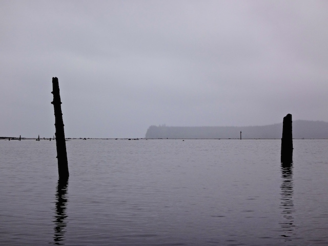
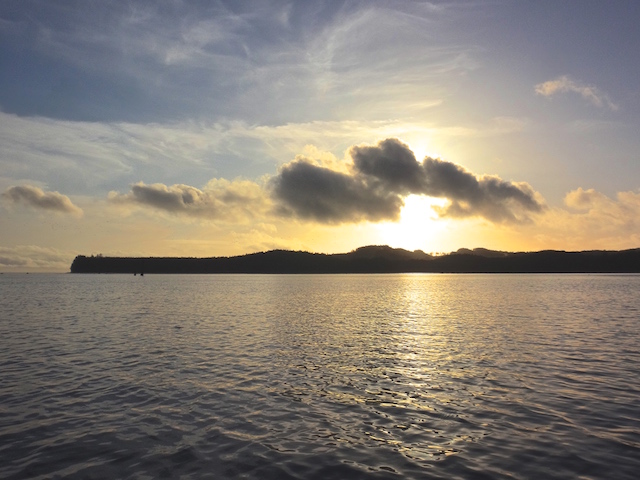
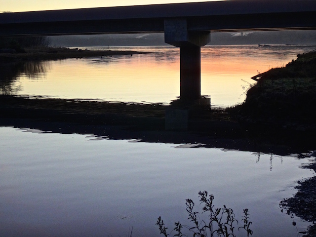
Sunset time. Here the sun is falling over Hawks Point and Tokeland.
Driving home, I briefly stopped to enjoy the sun setting over Willapa Bay at Bone River…
…where the birds seen above took off west.
The free Map My Tracks app recorded my route.
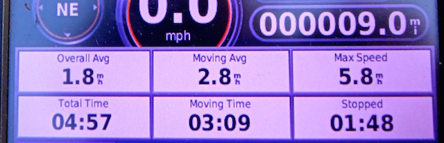
The little waterproof and floatable Garmin with marine maps recorded statistics today. The phone’s free ‘Maps’ app was handy to cross reference the upper river reaches where the ‘big boat’ maps don’t go.
13.2 miles traveled in 4 hours and 52 minutes with a maximum speed of 5.2 mph averaging 2.7 moving mph.
There are 3 posts here, one above the other. This is meant to keep together all the posts regarding North River and its launch sites for easier reference later. This system made more sense to me than a scattered chronological order of all trips everywhere.
September 18, 2022, I launched the Hobie kayak with sail kit at the Smith Creek launch and went up the North River as far as I could go without walking.
October 21, 2015, I launched the Hobie kayak at the Smith Creek launch and went up the North River a short ways before heading up Smith Creek instead.
March 23, 2015, I took the Hobie kayak from the Smith Creek launch up the North River and west on a side channel lined with houseboats until it ended.
Northernmost on the North River
18 September 2022
Flowing into the north side of Willapa Bay is the aptly named North River. Twice I have paddled its lower reaches. The first time on the North River I headed left off the main channel to check out a channel of floating homes that compelled me. I learned a lesson in floating log gates too. My second trip on the North River, cosmic signs kept leading me back to a fine day of paddling the Smith Creek instead.
There is a navigational mystery on the Columbia River near Wauna that I’ve recently read about. I would have liked to check out. Today’s low tide and a high wind changed my mind. The wind would be 5 to 15 mph from the north, and the tide on the Columbia would likely not be high enough. It would be however, on the North River near Toke Point. Same sun and moon, it just requires the correct location on the tide graph. Then there’s the flow rate and seasonal flow to consider, but that hasn’t been a problem yet.
I must be missing something, as the half dozen boats I saw today, except mine, were all fishing. If I learned how to fish, I could troll a hook the whole trip and maybe come home with dinner. It would add more complexity and cost, but everybody else is doing it. My dad was a dinghy sailor, not a fisherman. Dad and I would paddle about in his home-built canoe before kayaks became popular, so my non-fishing trips are plenty sentimental.
With the predicted wind from the north to bring me home, I set up the sail kit to hopefully go the furthest. I rationalize this whole set up is cheaper than a small outboard motor and forces a workout.
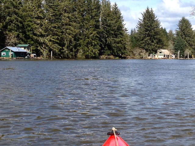
In my rear view, Smith Creek’s launch is next to the column on the left.
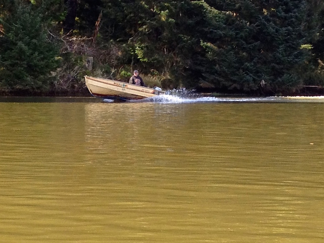
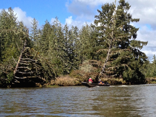
I passed the familiar North River Resort. Another fishing boat is heading upstream by their pilings.
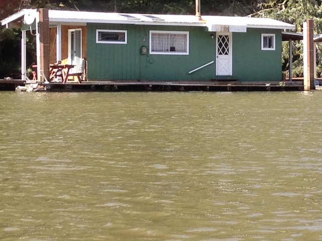
Then come the cabins which are always interesting.
Floating cabins sometimes require big materials to maintain. This one was getting new siding and roofing. After brief pleasantries, I found out that their materials were brought in by boat. Once home, I looked at the map again and still wonder where the residents park their vehicles to boat in. This crew had a four legged supervisor.
Another cabin had homey porch landscaping.
I think I spot tomatoes.
Another porch had their landscaping tools highlighted by an old crosscut saw blade above.
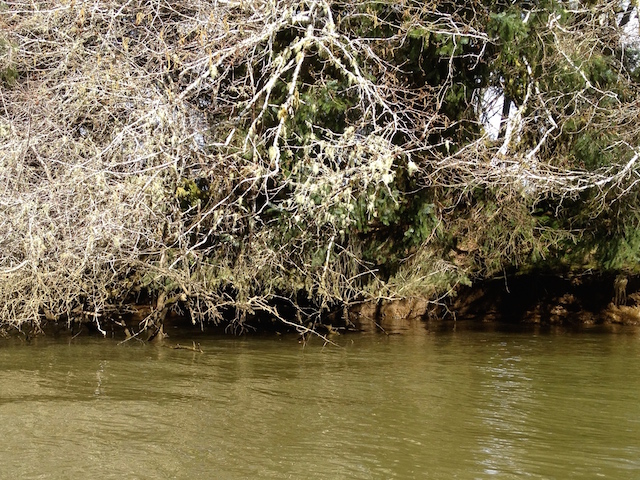
Here is a natural shoreline pattern. Some logs don’t interest the saw mills.
This tree has thick mossy branches even at the end of a dry summer.
Here is one of my favorite cabins because on my first trip the owner had guests with their boats tied up and was enjoying sitting by the river with friends and a BBQ. They had waved and were friendly. I figured this is a terrestrial heaven for people who sport fish.
No one waved today.
Speaking of privacy, not everyone who buys such isolated homes are welcoming of looky loos. I was floating by with no motor sounds to warn them. I used the telephoto and cropping staying thirty feet or more away but, sometimes an owner just needs a solid fence.
This would aid dropping logs into the river for a tow maybe? The opposite shore was clear without pilings so I don’t think it’s railroad related. A satellite view shows a shadowy trail leading from this dock through the woods to a logged off area.
A clever water system. At the top of the bank the creek is sandbagged and fed into this flexible pipe for boat access. It was a waterfall sound in the quiet.
If there was a breeze, it didn’t descend into this valley.
I was fortunate be here at the right time when the reflected sun dappled the trees.
Here is a minute video of the light show.
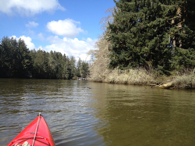
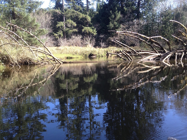
The river narrowed.
I crossed the county line and had reached the shallows where I had predicted in my book of paddle launch sites. The book covers the area from Ocean Shores to Nehalem and west up the Columbia to Stella and Clatskanie. Here a shallow gravel bar extended across the river offering me the option to walk but not to float ahead. Sometimes dragging the boat is the answer but it was getting late. The tide was coming in but the water was flowing out.
The last view upstream. The little ‘Wind in the Willows’ wind vane on the foredeck was ready while its ceramic figures waited at home.
On the way downstream I passed a container garden of locally sourced moss, ferns and grasses.
There were fish. Impressive were the silver ones over a foot long. Too fleeting for my camera but maybe not for an alert dog and a fisherman.
After about a mile and a half I returned to what a fisherman referred to as ‘The Bend’.
There are houses hidden on one shore and the floating cabin furthest from ‘civilization’ of them all. Today it radiated power saw noises as the owner finished improvements before the coming winter.
The river returned to being calm. The fish jumped, a heron squawked as it moved downstream, and LGBs (Little Gray Birds) entertained. I would have had more time on the water leaving the sail kit at home, the numbers bear that out. Kayaking is best enjoyed when it’s simple.
Further downstream I glided by more dolphins in this thirty second video.
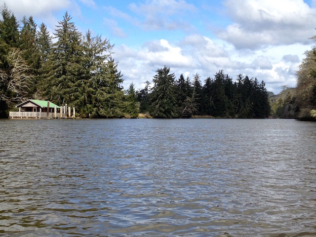
It was late afternoon, the workers had left. The North River Resort’s dock came into view.
Off to the left was another side channel. I saw what looked like a dairy shelter behind a dike. Then it was back to the Smith River launch.
Sunset time. Here the sun is falling over Hawks Point and Tokeland just before returning to the mouth of Smith River.
Driving home, I briefly stopped to enjoy the sun setting over Willapa Bay at Bone River…
…where the birds seen above took off west.
The free Map My Tracks app recorded my route.
The little waterproof and floatable Garmin with marine maps recorded statistics today. The phone’s free ‘Maps’ app was handy to cross reference the upper river reaches where the ‘big boat’ maps don’t go.
13.2 miles traveled in 4 hours and 52 minutes with a maximum speed of 5.2 mph averaging 2.7 moving mph.
21 October 2015: A Short Paddle North River (before heading up Smith Creek instead)
Last time I headed up North River, I turned left when I saw the second string of houseboats and continued on until it ended. Turns out, the main channel continued on the right for maybe eight more miles, and more houseboats to see too but, three things put a rethink to that.
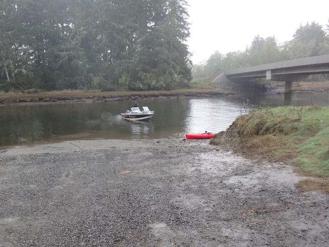
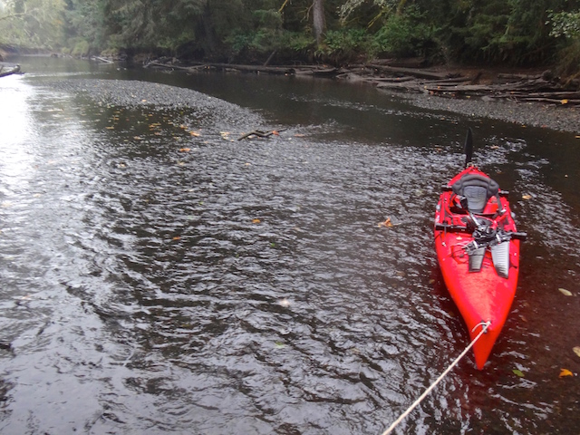
The launch at the mouth of Smith Creek.
Rethink #1: It started raining. I saw four open boats with bundled up fishermen heading back. When I was growing up, my dad wouldn’t cancel a trip because of the rain. He said we would have been canceling a lot of trips and just included rain in the plan.
A wet and cold day, with no breeze to use a sail.
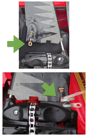
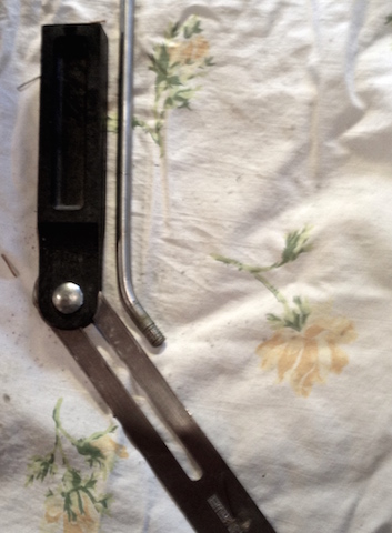
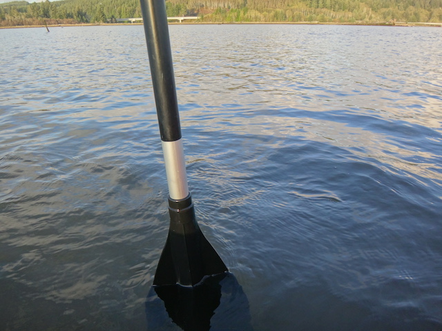
Rethink #2: A drive flipper almost fell off. I had ‘improved’ the original attachment bolts to more quickly take apart the system. (I seem to hit sunken stuff a lot). The salt water had frozen my pliers so I could not install a spare replacement bolt I carried. My fix with zip ties and wire held it together the rest of the day. The two flexing flippers swing back and forth to power the boat. I didn’t think it wise to keep going further away with my plastic repair.
The 2nd picture is flipped left to right but, the flipper on the top picture almost slid off its rod because the retaining bolt fell off.
Rethink #3: No drinking water for me, my water bottles were back in the car. A PB sandwich and crackers plus a four-hour trip ahead, oops.
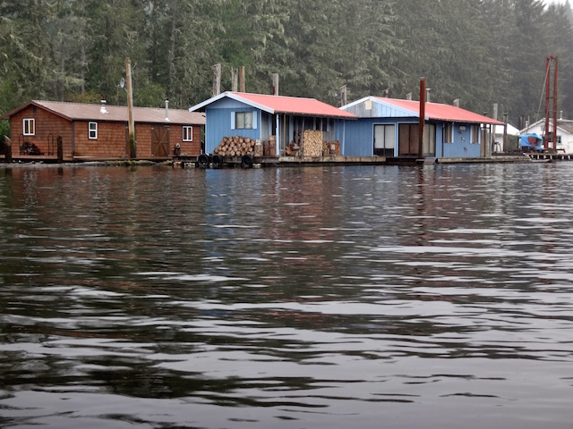
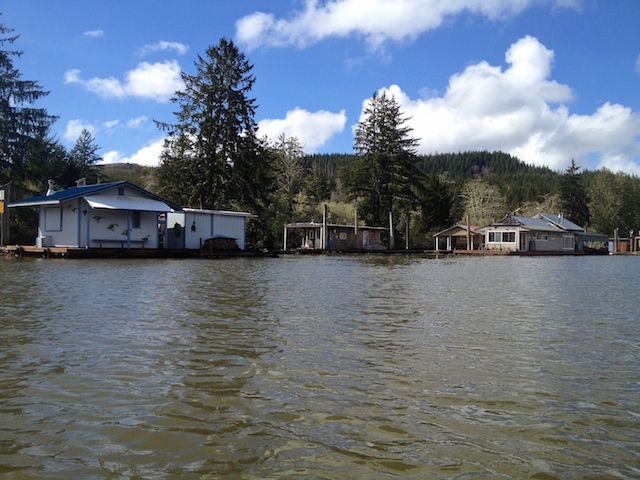
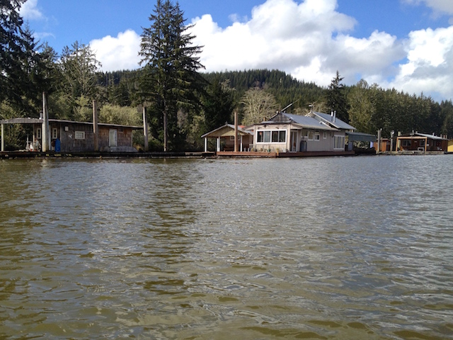
Here’s a look at some of the river houses.
In 2010 a 1,250 sq. ft. 3 bedroom house tied along here sold for $20,000. Here’s the listing.
Here’s a small tree that must wish it could reach a root down into the river.“Aha! We found ourselves a kayak, heh heh.” (It’s not easy to lock up a boat). They had caught a sixteen-inch jack – a young adult salmon that had returned early before having fully grown.
I didn’t want to go home, the fun hadn’t really started yet. Smith Creek shouldn’t take too long. It actually took me two hours up and back and is posted under ‘Smith Creek.’
23 March 2015: Paddling up the North River
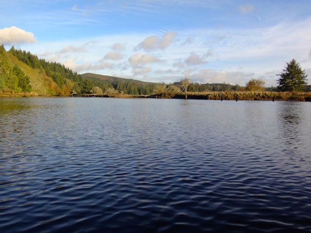
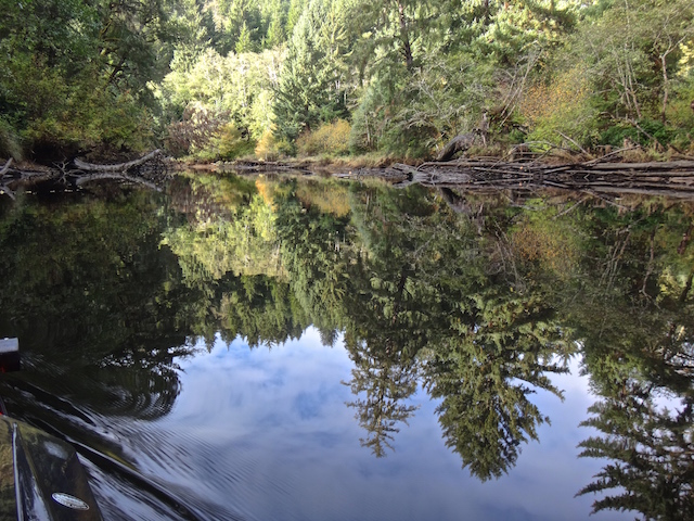
The North River is at the top of Willapa Bay, a little over an hour away from Ilwaco. Further upstream it also crosses Highway 101 near Artic. A local told me today that he once paddled 35 miles downstream from Artic to Willapa Bay. Well, sorry, we’re just going upriver three and a quarter miles, but, this isn’t just an ordinary woodsy river.
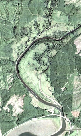
Lower North River at low tide. The launch is at the lower right.
See those white dots in the river above the ‘105’ sign? I found out from poking around the internet that those are floating cabins. There are no access roads, nor do any cabins seem to be for sale as far as my searches can determine. Zillow.com doesn’t place a value on these cabins either but if you want a 500 square foot cabin in Seattle, $275,000 will get you one next to Gas Works Park. http://seattlehouseboatrentals.com/sales.htm
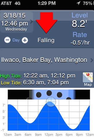
The tide was plus-eight feet and falling but I had previously seen the ramp without mud at a one-foot tide. The incoming tide could have helped me upstream if I had arrived earlier. I was sure of a quick trip back. Turned out my speed upstream was about 2-3 mph but I later got a 6.9 mph top speed reading downstream for a 2.9 mph moving average overall.
Smith Creek launch at the 8-foot tide.
Let’s check out the cabins.
Under the first bridge & leaving Smith Creek.
Smith Creek and the rest of the North River are going to have to be another trip. The other boats I saw today had motors and probably could explore a lot more quickly but, not quietly.
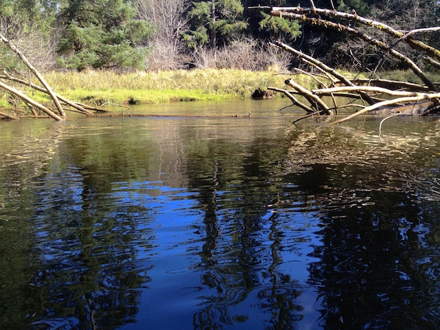
Pilings to the left and the North River bridge ahead.
Rounding the point and heading upstream.
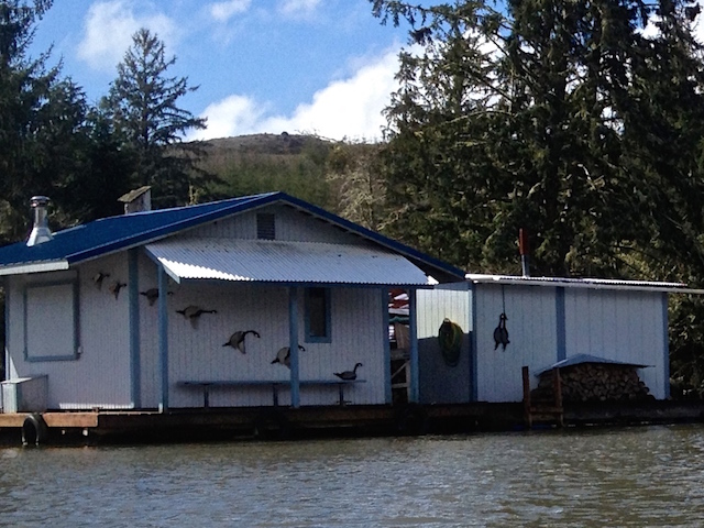
The first neighborhood of cabins.There is a nice artistic sequence of a landing goose on the first cabin. Their next cabin has a goose strung up by its little neck. This is the land where fresh food delivers itself.A home with a boat garage……and a glassed-in porch and covered wood pile/work area.Here is a place ready for fishing off the back porch.
Out of respect for their privacy, I tried to stay mid-river or on the other side. I can’t imagine people in cabins out in nowheresville like to have boaters gawk at them all day.
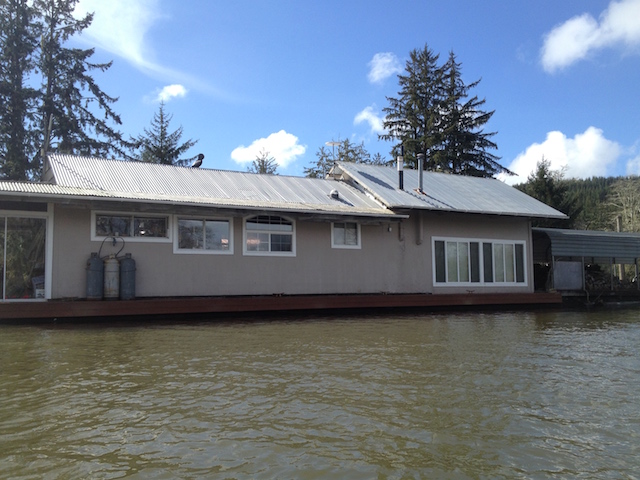
Enclosed porches often had the workshops combined with their storage rooms to leave the rest of the cabin less cluttered.More cabins upstream.
These places must have been built elsewhere and towed in.
I was on the opposite shore to give this guy his privacy and got a wave anyway. On the way back a couple of boats were docked, the deck was full of friends on chairs, and the smell of barbecue drifted over.I hear the sound of an outboard coming downstream.
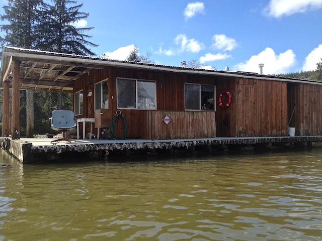
There’s a tunnel under the branches.Another lone cabin
Protected by pilings.
This boat slowed down until I put out a thumbs up sign. I also noticed that when I came back with the tide pretty low, a pair of vehicles with their boats already trailered waited until I beached before they drove off. I like to think people watch out for each other out here.
‘google earth’ doesn’t show any access roads – the river is their highway (low tide view).
This fork in the river might have been an island, maybe not. Given a choice of a wide empty river or a narrow branch with cabins, of course, I took the cabin route. The woods and muddy banks on the main channel could wait. On the Chinook River trip, I heard from another kayaker that it’s sometimes hard to remember features of the individual rivers. I’m being a little heavy on the pictures so I can relive these trips later. I discovered later that the wider branch was the one to Artic and beyond. Yah sure, maybe if I was going downstream I could try but not today. It’s upstream and against the tide.
An ‘on the water’ view of the string of cabins shown previously from a satellite.
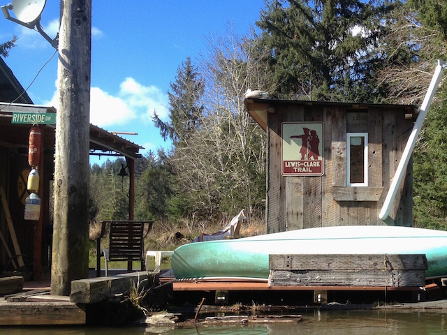
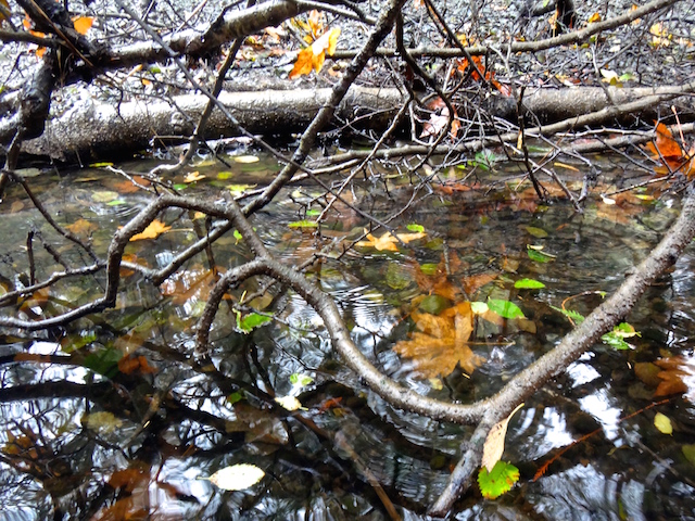
Huzzah, a canoe here on ‘Riverside Drive’.A freshwater system.
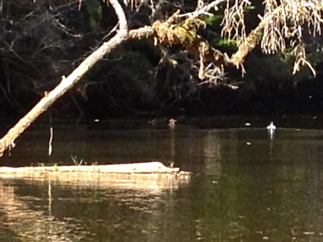
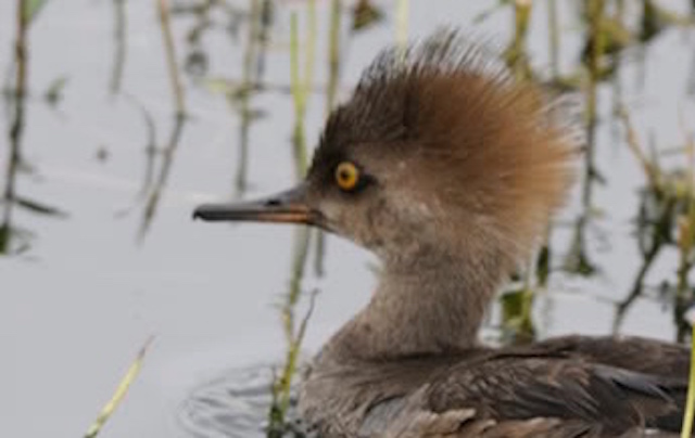
That little duck above the end of the log is a female hooded merganser I think, hanging with a male mallard. She had lovely light brown feathers done up in a mohawk that let the sun filter through. They were the best looking couple on the river and posed for a couple of movies. They did fancy footwork swim-bys, log-hops and aerial feats for me that I couldn’t do. First here’s a generic picture of her from the web:
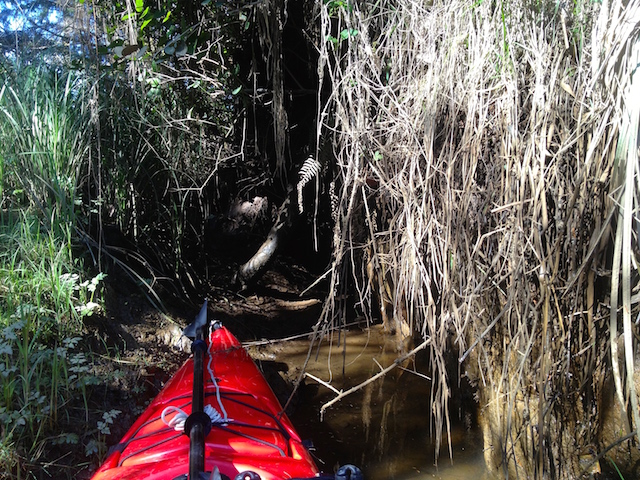
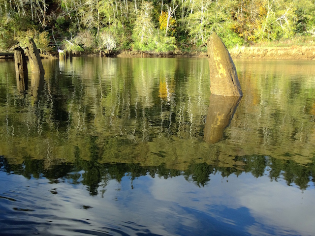
This floating log was hooked between two fallen trees. Just a little push to the left would have freed it and let it float away but I couldn’t slide it sideways. I was able to push it upstream and paddle through, and then, it closed behind me.
A boat garage.
I parked in the garage, got out some food, turned around and went to undo the gate again.
Now, all I have to do is grab the left side of the log, and pull it open against the current. Just like pushing but backward. It really wasn’t the same at all and wouldn’t open.up & over
Instead, it was a push down on the shallow end of the log and pulling myself over.
Greetings from Chinook!
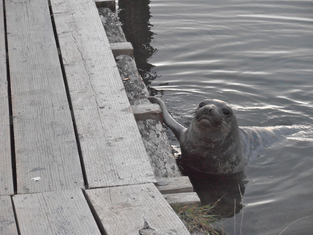
As I approached the bridge at the mouth of North River, I used up the last of the camera battery stalking a seal that had splashed off a dock. Didn’t get a picture but above is a cute picture of a seal I took on the Columbia River.
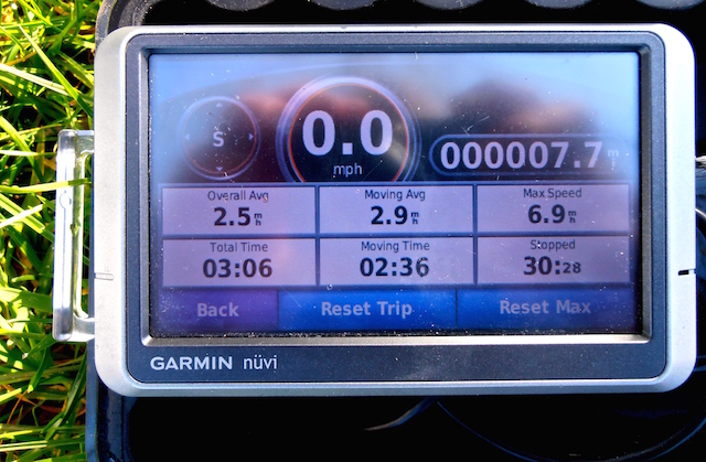
‘MapMyWalk’ took me straight overland at the end when the battery totally died while looking for the seal.The Garmin’s timer is correct so the rest should be too. This also included a mile round trip off the main channel into an interesting slough. (7.7 miles traveled in 2 hours 36 minutes with a maximum speed of 6.9 mph averaging 2.9 mph.)The rod is supposed to be straight.
The trip must have been fun as I had to unbend both flipper rods on the foot drive when I got home. It seemed to have run OK and I wasn’t trying to jump the log gate either. The shallow side channels did grind me to a halt a few times as I looked for relics of the timber industry that used to be here but I’m not sure what I hit.
Next time maybe it will be less cabin shopping and more upriver paddling for an easy trip back. I’m not done with this river yet.
I had just returned from looking at the first series of floating houses on the North River. It was only 3PM and about I didn’t want to go home, the fun hadn’t really started yet. Smith Creek wasn’t too long, it took me two hours up and back.
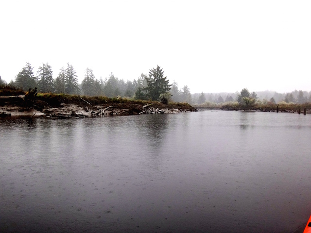
Here is Smith Creek with rain.
Two hours later here is the Smith Creek entrance without rain.
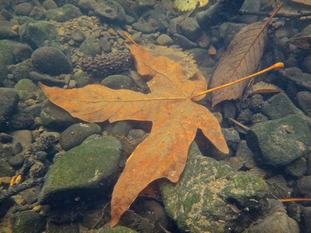
Fall colors under a maple.
Fall colors of a maple under the water. (I discovered later that an underwater camera doesn’t shed water spots off its lens).
The river was wide and gravelly here but shallow enough to tow it.
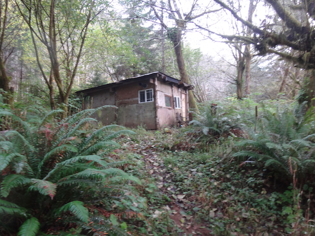
I believe its an empty cabin, I think.
A place that could only be reached by boat, like the floating cabins.
I tied up to a dock and cautiously checked it out. I mistakenly enlarged the mapping app on the phone before doing a screenshot, so, the location of this cabin is a mystery which is just as well to protect it.
A rumex obtusifolius (bitter dock).
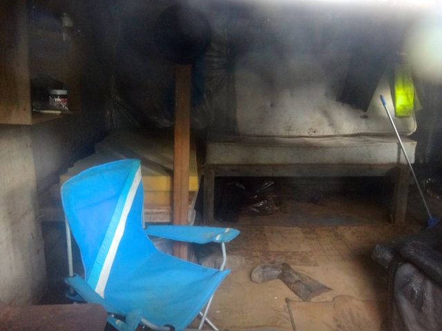
At great peril, I looked in a window and snapped a pic, for the blog.
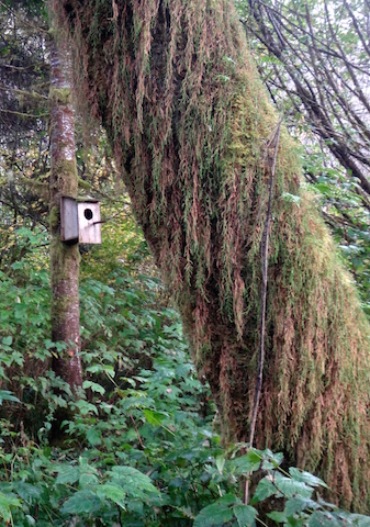
The owner’s birdhouse. The mossy tree indicates just how damp it is.
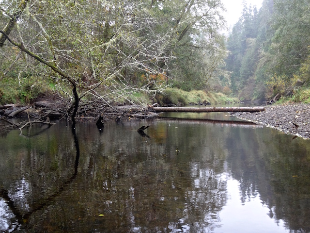
End of the road for me, a bridge for someone else, and a passable obstacle for some others.
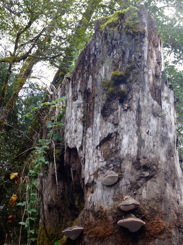
Fungi, blackberry, and moss.
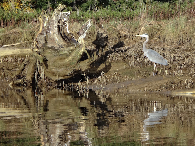
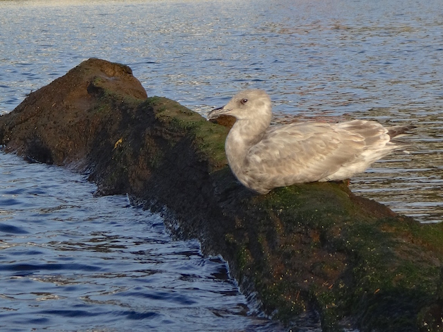
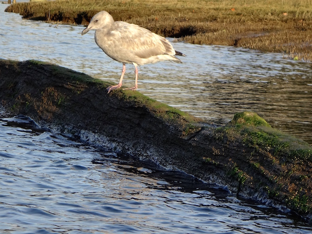
To me, the eyes set this gull apart from the flock.
With some extra time before dark, I headed out into the bay.
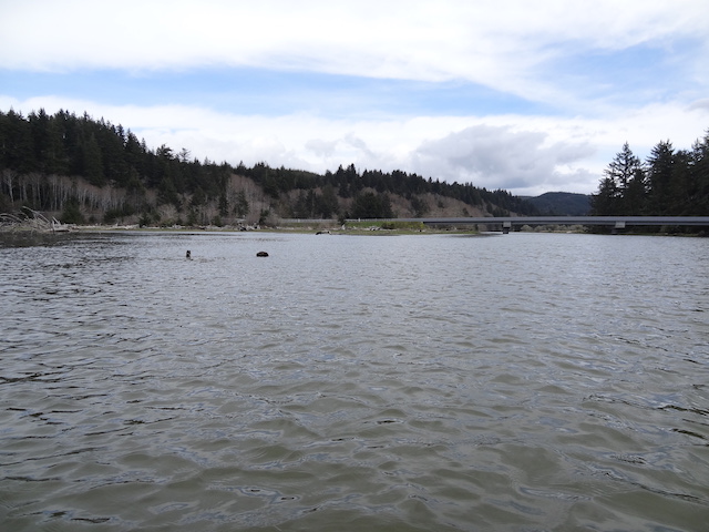
Hawks Point, about two miles away, with Tokeland beyond.
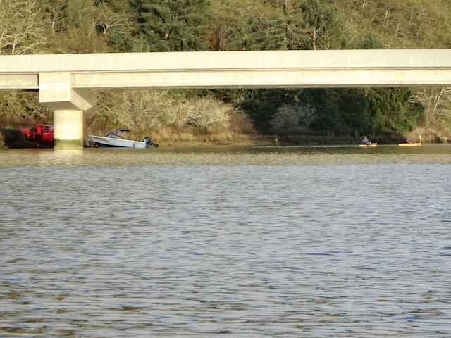
Paddle touching the bottom of the shallow delta. North River bridge is on the left, Smith Creek bridge is on the right in the distance.
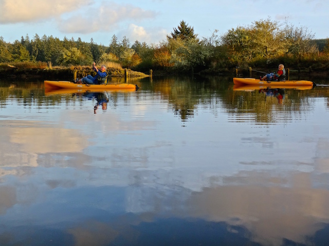
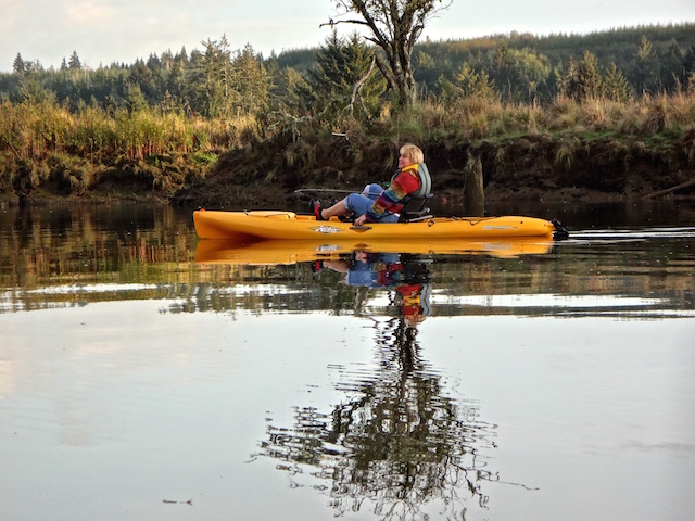
Little kayaks just launching and headed up Smith Creek.
It’s a couple fishing from a pair of pedal Hobie Outbacks they bought last spring.
Looking like an ad. I gave them a card with my email and left them to their fishing. We saw several jumping.
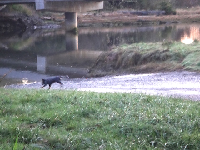
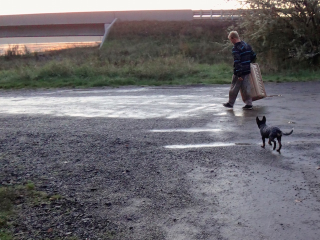
While loading the car, I saw a dog walker go by, then pick up his dog and toss it into the river. Turns out Otis had rolled in something smelly and needed a bath.
Happy Otis, the four-month-old puppy scampering back to the river.
Otis tagging along as his cage gets a cleaning too.
Now it’s time to leave, except for those two kayakers still out fishing.
Nine miles on two rivers and a bay, and lots of stuff to fix and dry out at home. (9.0 miles traveled in 3 hours 9 minutes with a maximum speed of 5.8 mph averaging 2.8 mph.)
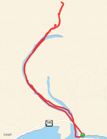
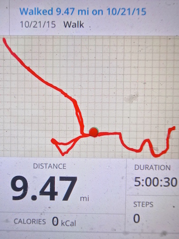
Smith Creek is the part that’s right of the dot, a 4-5 mile round trip.
I think I may have cropped the map on the right as I have read Smith Creek is navigable 4-5 miles which leaves little accounting for the distance I went up North River. Perhaps the log I photographed didn’t stop the other authors.