North River

There are 3 posts here, one above the other. This is meant to keep together all the posts regarding North River and its launch sites for easier reference later. This system made more sense to me than a scattered chronological order of all trips everywhere. 

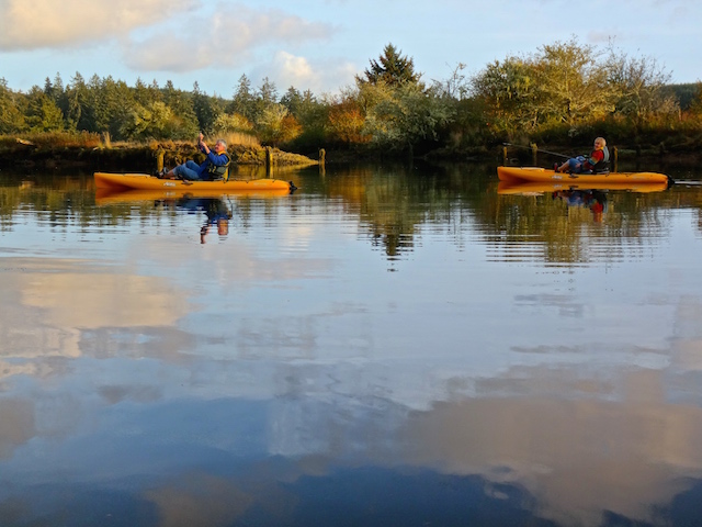
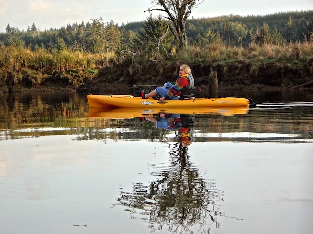
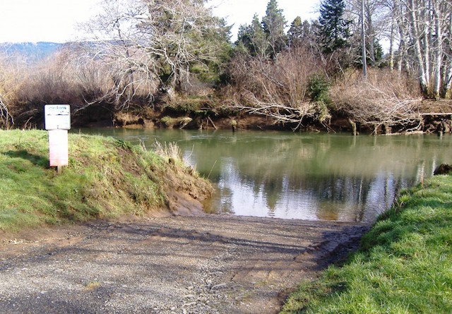
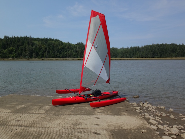
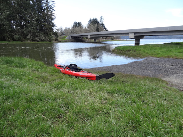
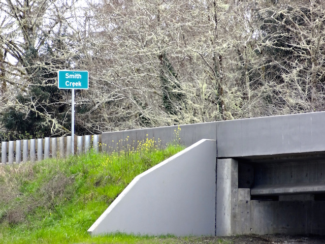
September 18, 2022, I launched the Hobie kayak with sail kit at the Smith Creek launch and went up the North River as far as I could go without walking.

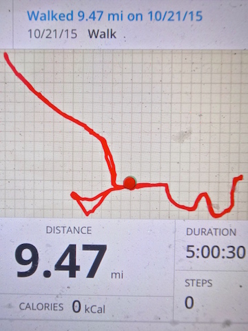
October 21, 2015, I launched the Hobie kayak at the Smith Creek launch and went up the North River a short ways before heading up Smith Creek instead. 

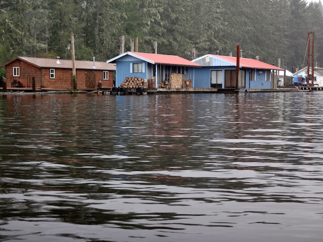
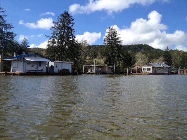
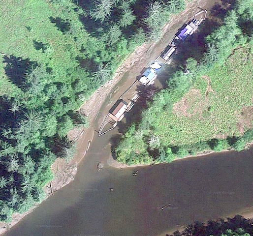
March 23, 2015, I took the Hobie kayak from the Smith Creek launch up the North River and west on a side channel lined with houseboats until it ended.

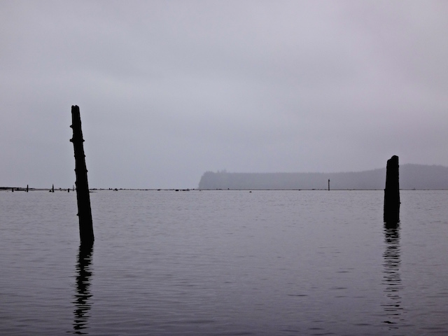
Northernmost on the North River
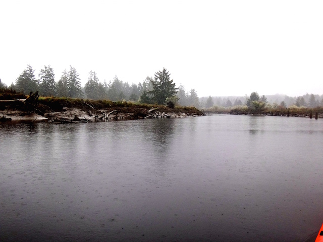
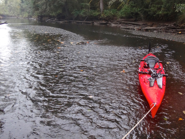
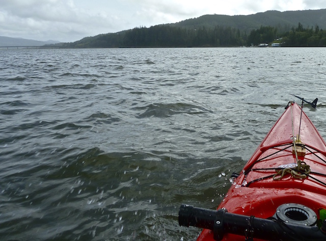
18 September 2022

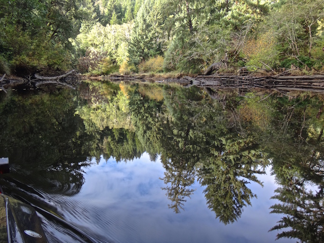
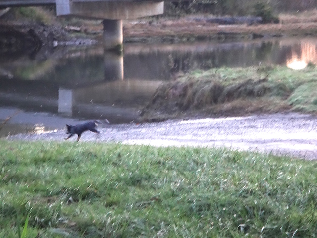
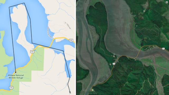
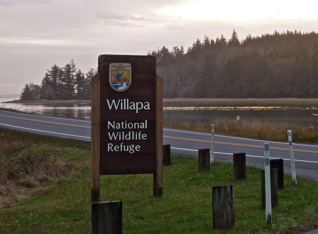
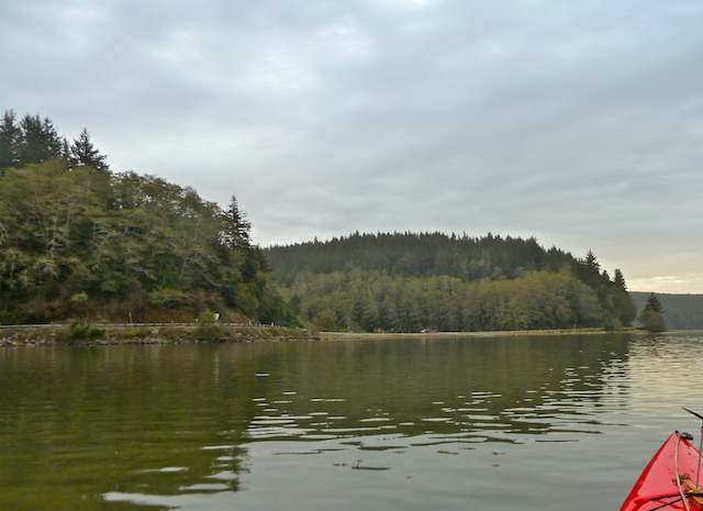
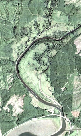
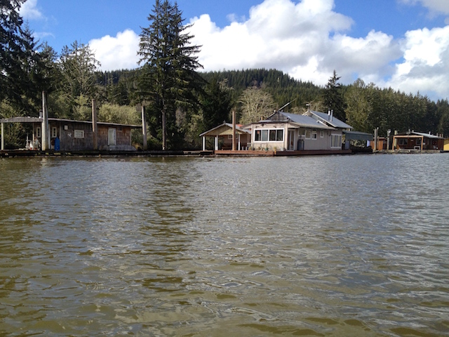
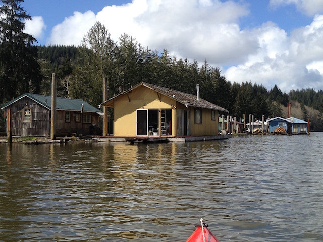
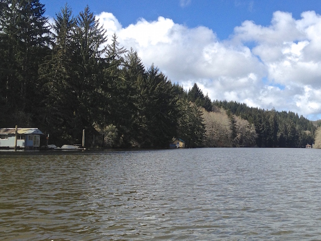
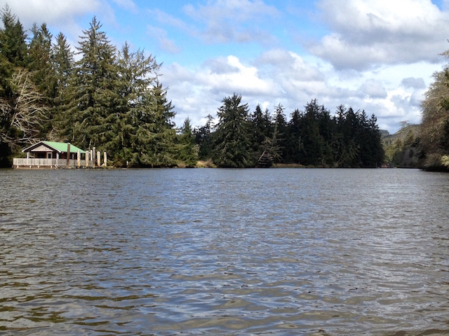
Flowing into the north side of Willapa Bay is the aptly named North River. Twice I have paddled its lower reaches. The first time on the North River I headed left off the main channel to check out a channel of floating homes that compelled me. I learned a lesson in floating log gates too. My second trip on the North River, cosmic signs kept leading me back to a fine day of paddling the Smith Creek instead.

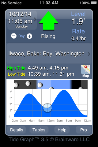
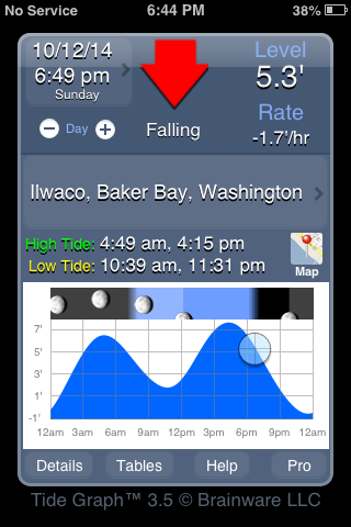
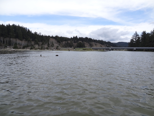
There is a navigational mystery on the Columbia River near Wauna that I’ve recently read about. I would have liked to check out. Today’s low tide and a high wind changed my mind. The wind would be 5 to 15 mph from the north, and the tide on the Columbia would likely not be high enough. It would be however, on the North River near Toke Point. Same sun and moon, it just requires the correct location on the tide graph. Then there’s the flow rate and seasonal flow to consider, but that hasn’t been a problem yet.

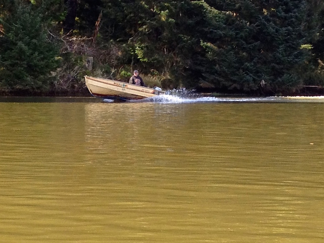
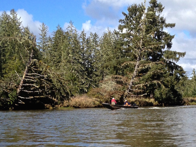
I must be missing something, as the half dozen boats I saw today, except mine, were all fishing. If I learned how to fish, I could troll a hook the whole trip and maybe come home with dinner. It would add more complexity and cost, but everybody else is doing it. My dad was a dinghy sailor, not a fisherman. Dad and I would paddle about in his home-built canoe before kayaks became popular, so my non-fishing trips are plenty sentimental.

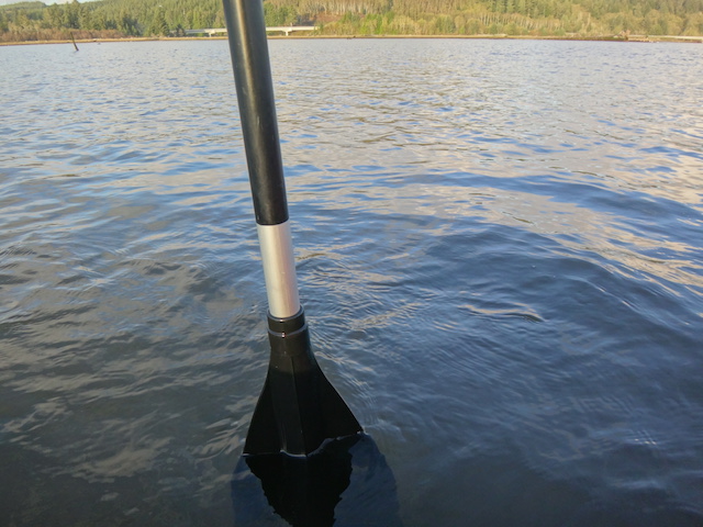
With the predicted wind from the north to bring me home, I set up the sail kit to hopefully go the furthest. I rationalize this whole set up is cheaper than a small outboard motor and forces a workout.

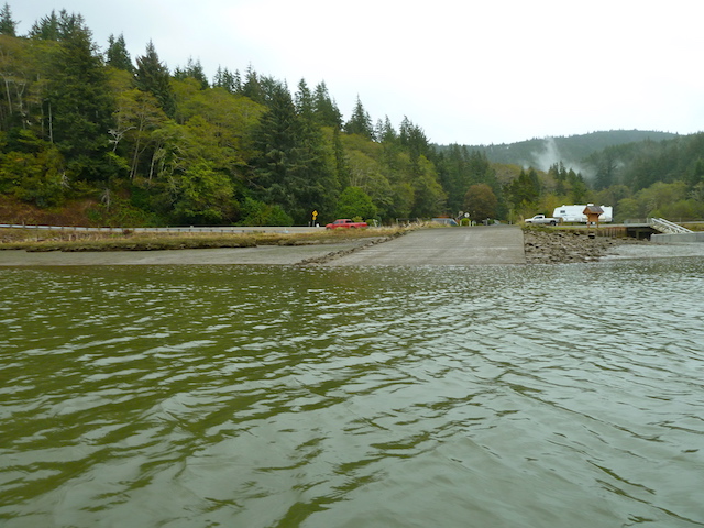
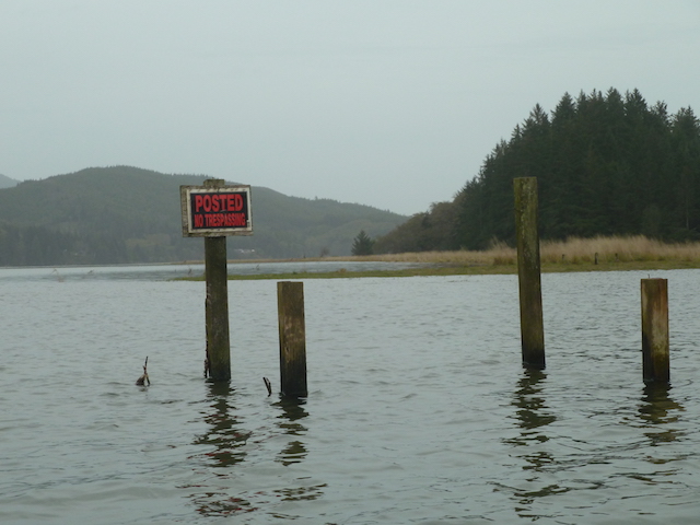
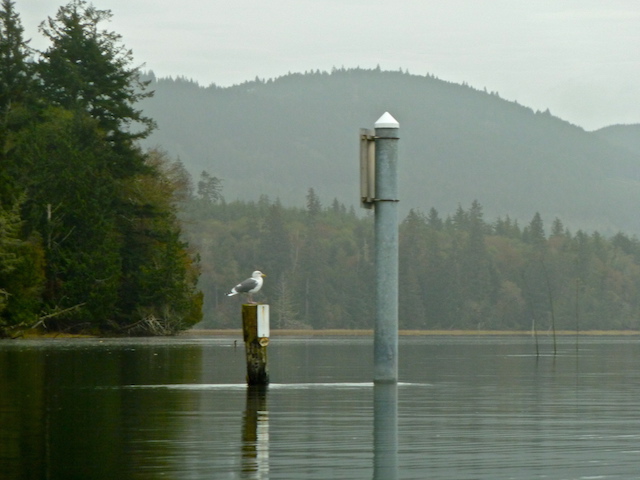
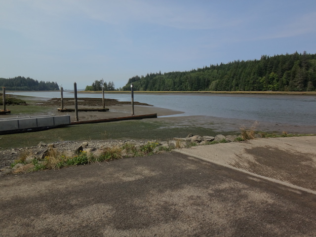
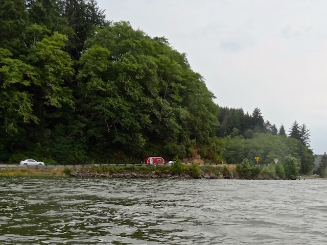
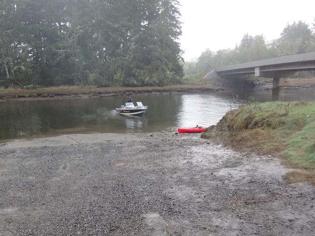
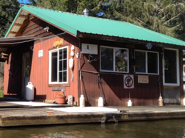
In my rear view, Smith Creek’s launch is next to the column on the left.

I passed the familiar North River Resort. Another fishing boat is heading upstream by their pilings.

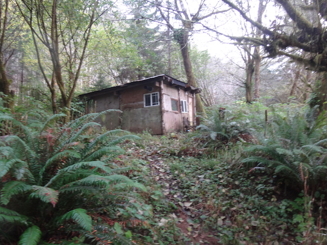
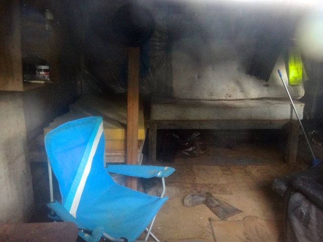
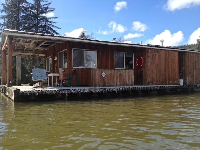
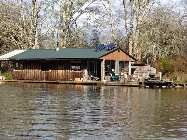
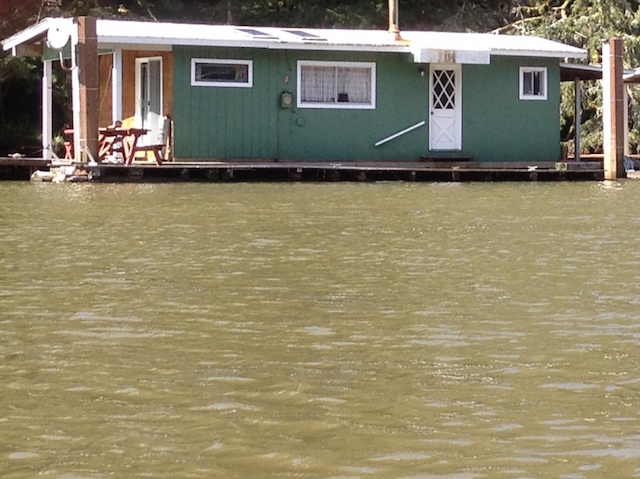
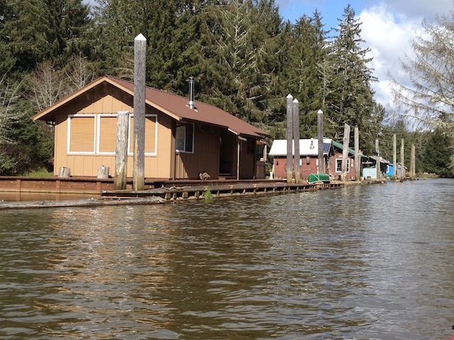
Then come the cabins which are always interesting.

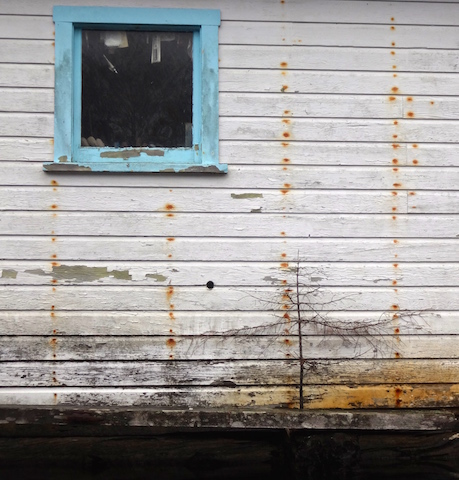
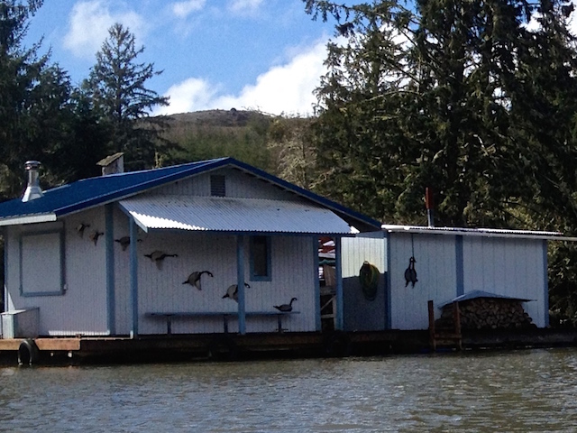
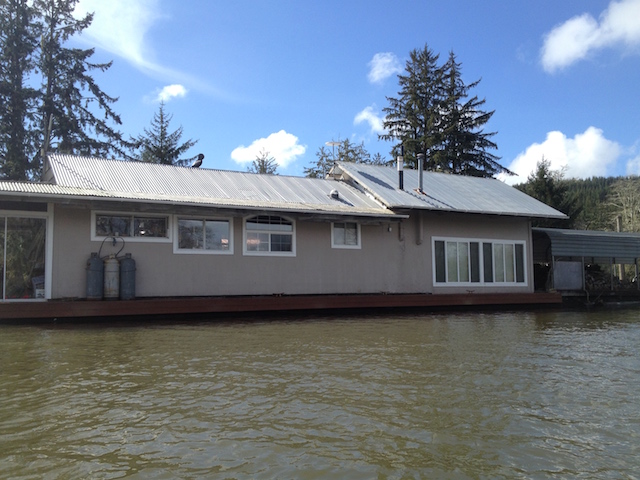
Floating cabins sometimes require big materials to maintain. This one was getting new siding and roofing. After brief pleasantries, I found out that their materials were brought in by boat. Once home, I looked at the map again and still wonder where the residents park their vehicles to boat in. This crew had a four legged supervisor.

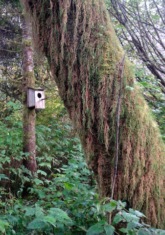
Another cabin had homey porch landscaping.

I think I spot tomatoes.

Another porch had their landscaping tools highlighted by an old crosscut saw blade above.

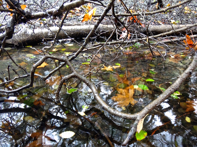
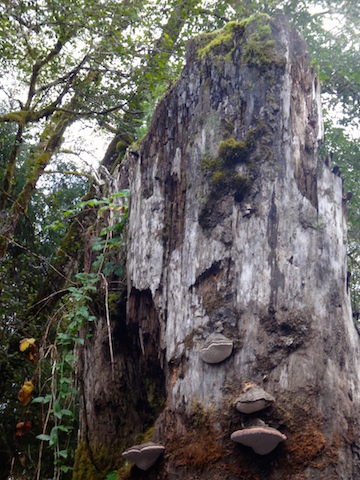
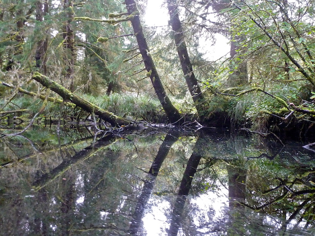
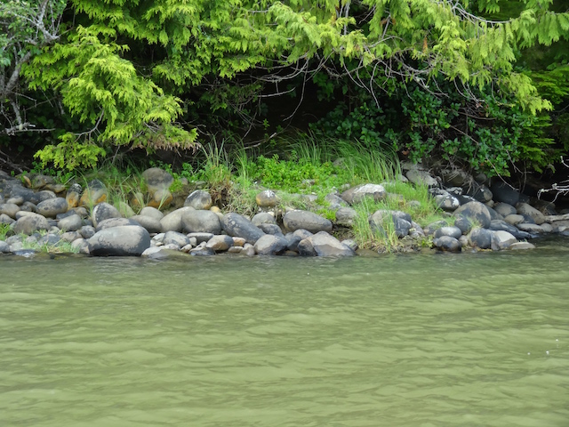
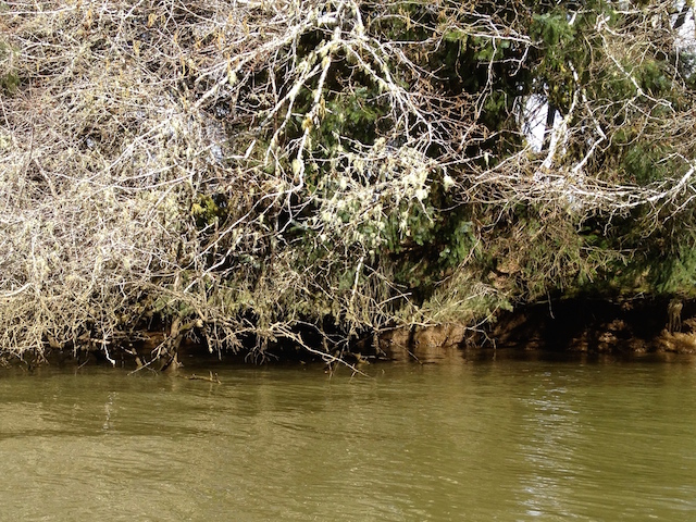
Here is a natural shoreline pattern. Some logs don’t interest the saw mills.

This tree has thick mossy branches even at the end of a dry summer.

Here is one of my favorite cabins because on my first trip the owner had guests with their boats tied up and was enjoying sitting by the river with friends and a BBQ. They had waved and were friendly. I figured this is a terrestrial heaven for people who sport fish.

No one waved today.

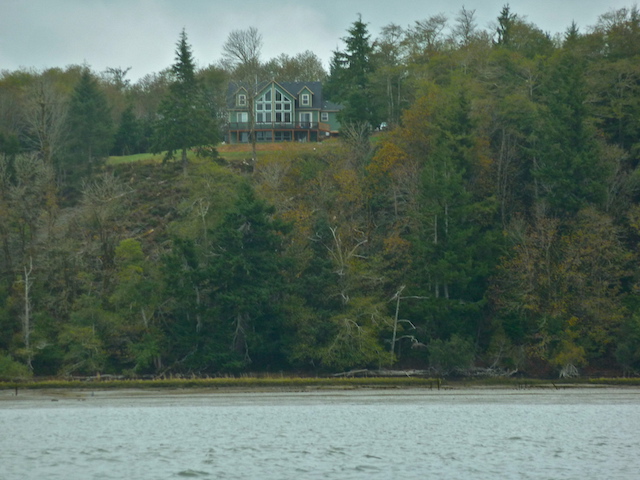
Speaking of privacy, not everyone who buys such isolated homes are welcoming of looky loos. I was floating by with no motor sounds to warn them. I used the telephoto and cropping staying thirty feet or more away but, sometimes an owner just needs a solid fence.

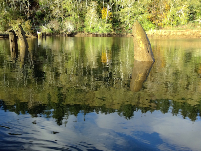
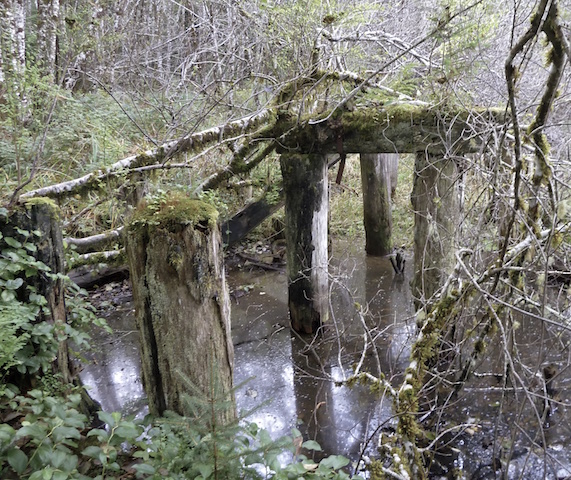
This would aid dropping logs into the river for a tow maybe? The opposite shore was clear without pilings so I don’t think it’s railroad related. A satellite view shows a shadowy trail leading from this dock through the woods to a logged off area.

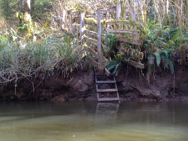
A clever water system. At the top of the bank the creek is sandbagged and fed into this flexible pipe for boat access. It was a waterfall sound in the quiet.

If there was a breeze, it didn’t descend into this valley.

I was fortunate be here at the right time when the reflected sun dappled the trees.

Here is a minute video of the light show.
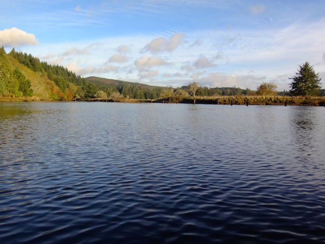
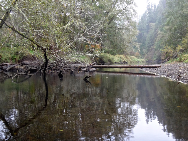
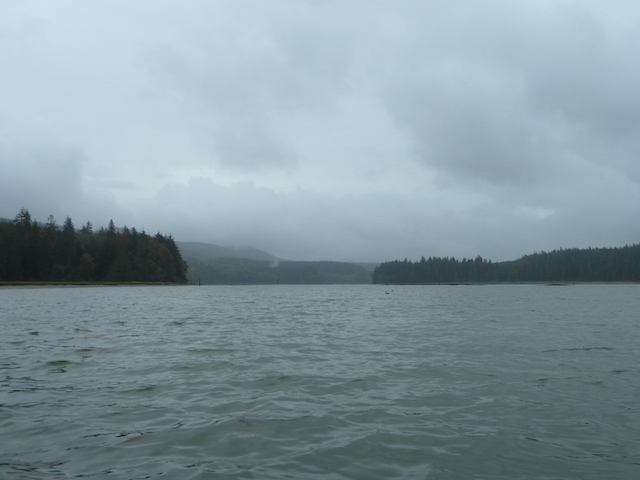
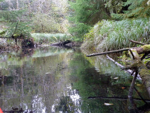
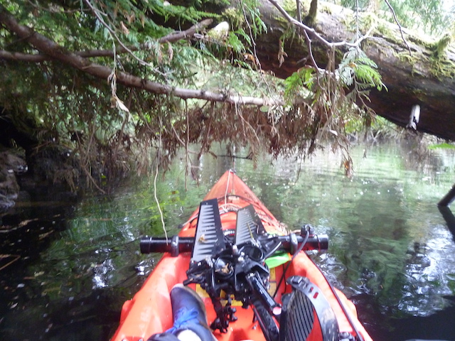
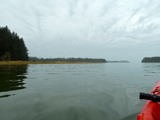
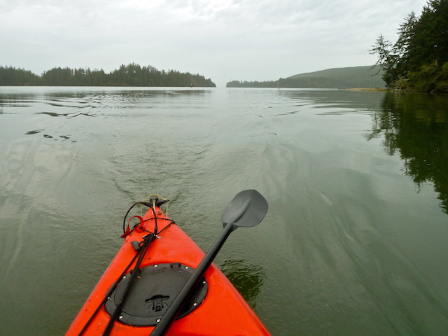
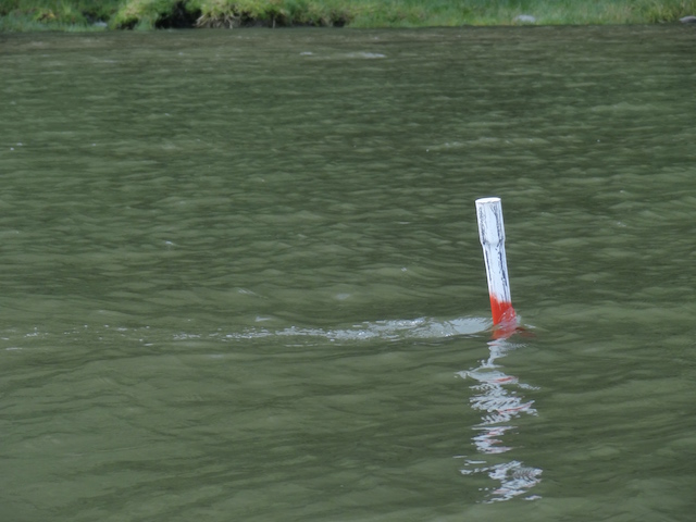
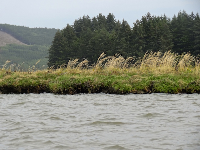
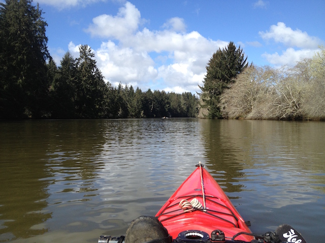
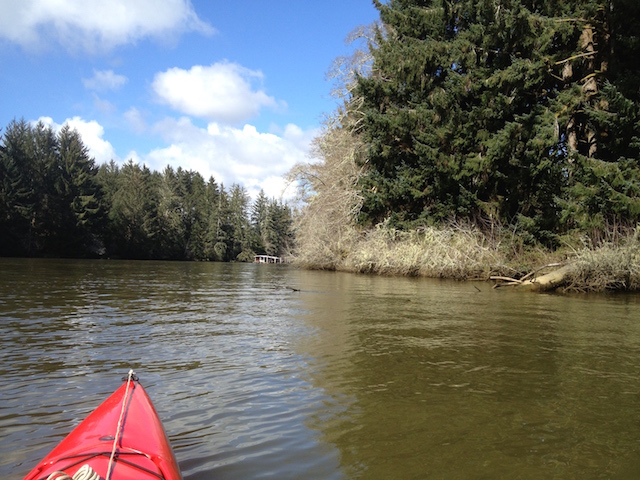
The river narrowed.

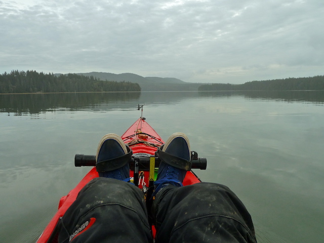
I crossed the county line and had reached the shallows where I had predicted in my book of paddle launch sites. The book covers the area from Ocean Shores to Nehalem and west up the Columbia to Stella and Clatskanie. Here a shallow gravel bar extended across the river offering me the option to walk but not to float ahead. Sometimes dragging the boat is the answer but it was getting late. The tide was coming in but the water was flowing out.

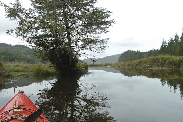
The last view upstream. The little ‘Wind in the Willows’ wind vane on the foredeck was ready while its ceramic figures waited at home.

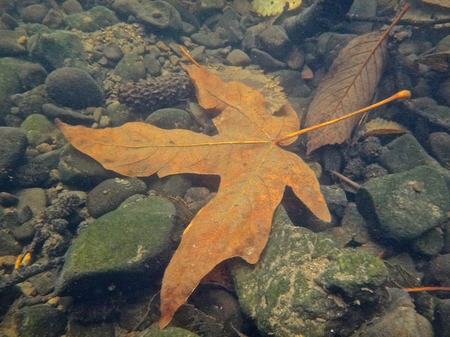
On the way downstream I passed a container garden of locally sourced moss, ferns and grasses.

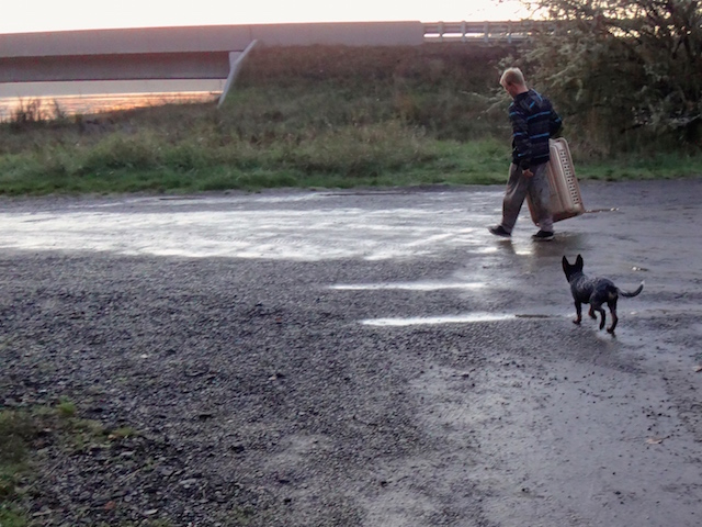
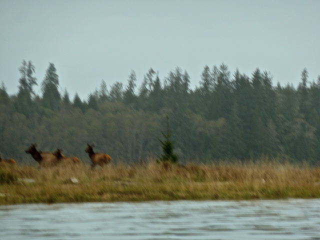
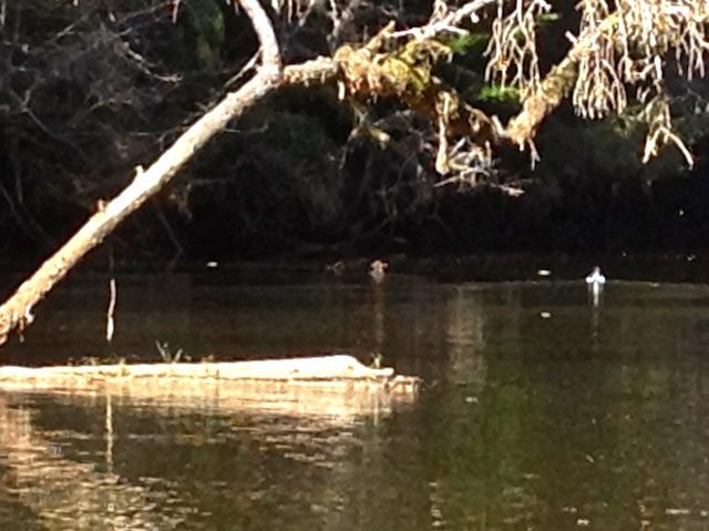
There were fish. Impressive were the silver ones over a foot long. Too fleeting for my camera but maybe not for an alert dog and a fisherman.

After about a mile and a half I returned to what a fisherman referred to as ‘The Bend’.

There are houses hidden on one shore and the floating cabin furthest from ‘civilization’ of them all. Today it radiated power saw noises as the owner finished improvements before the coming winter.

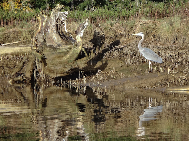
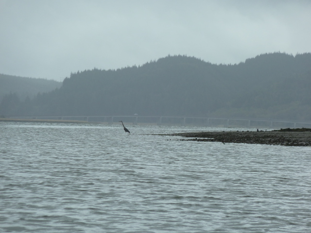
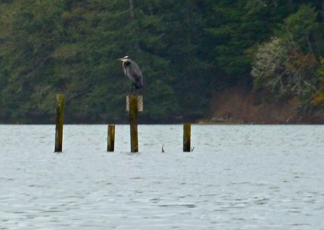
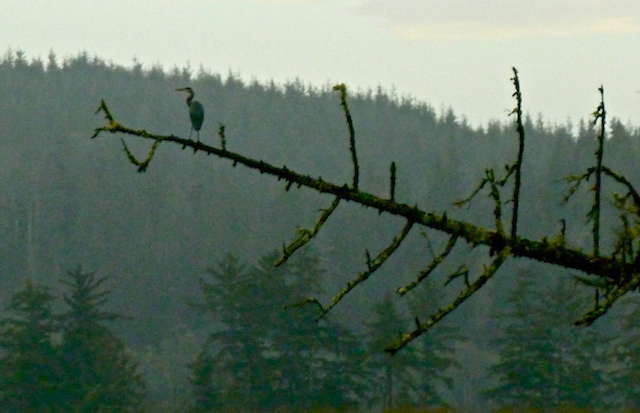
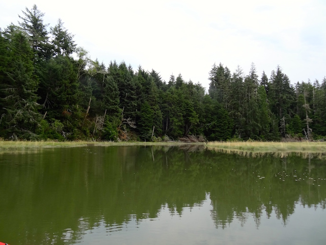
The river returned to being calm. The fish jumped, a heron squawked as it moved downstream, and LGBs (Little Gray Birds) entertained. I would have had more time on the water leaving the sail kit at home, the numbers bear that out. Kayaking is best enjoyed when it’s simple.

I first ran across the term ‘dolphin’ marked on my GPS navigator while doing the Wallooskee on the Youngs River.

Further downstream I glided by more dolphins in this thirty second video.

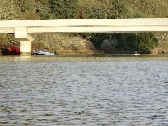
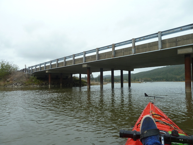
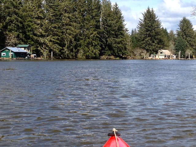
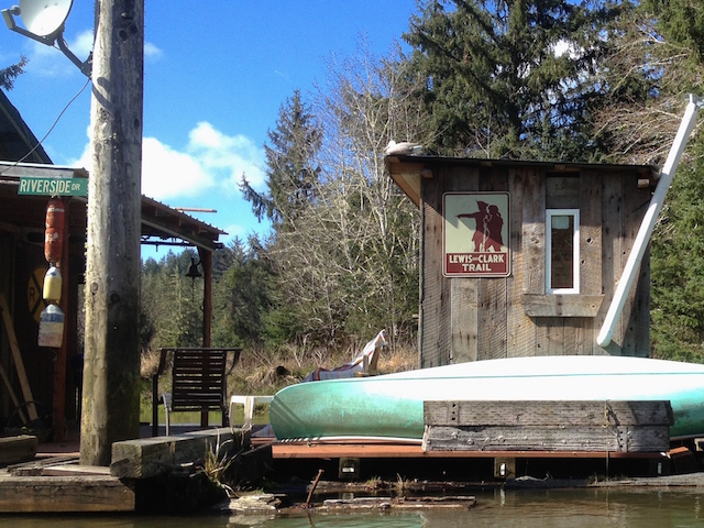
It was late afternoon, the workers had left. The North River Resort’s dock came into view.

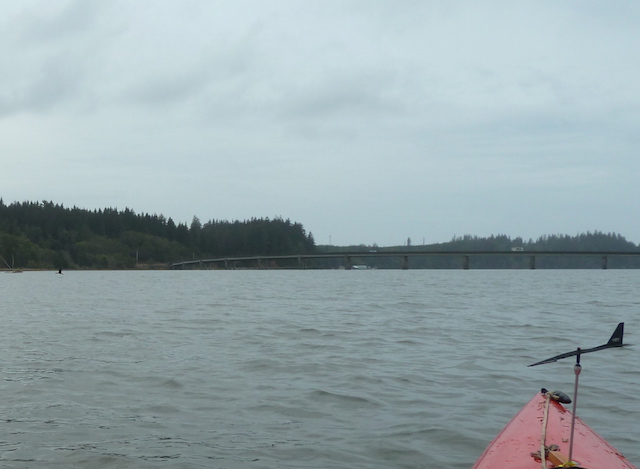
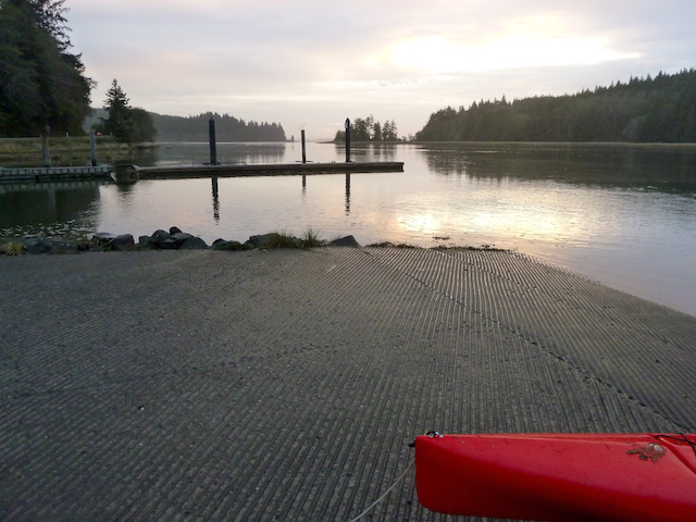
Off to the left was another side channel. I saw what looked like a dairy shelter behind a dike. Then it was back to the Smith River launch.

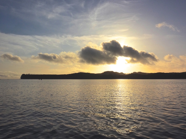
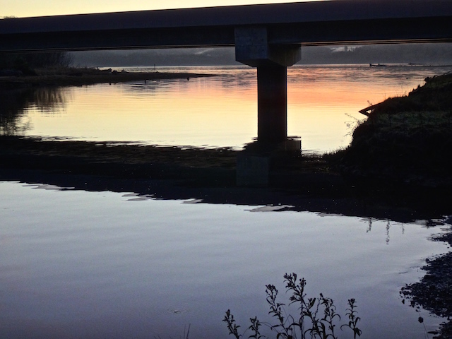
Sunset time. Here the sun is falling over Hawks Point and Tokeland just before returning to the mouth of Smith River.

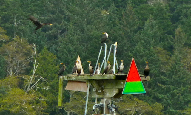
Driving home, I briefly stopped to enjoy the sun setting over Willapa Bay at Bone River…

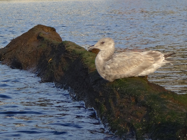
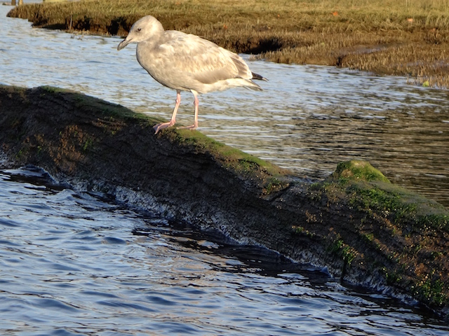
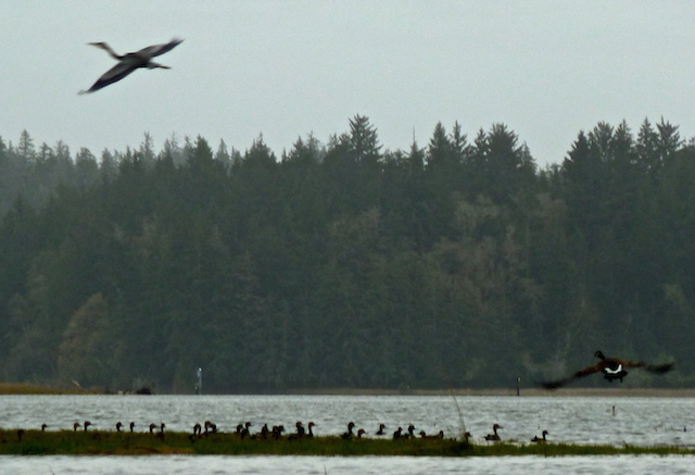
…where the birds seen above took off west.

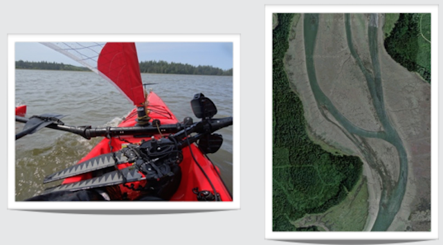
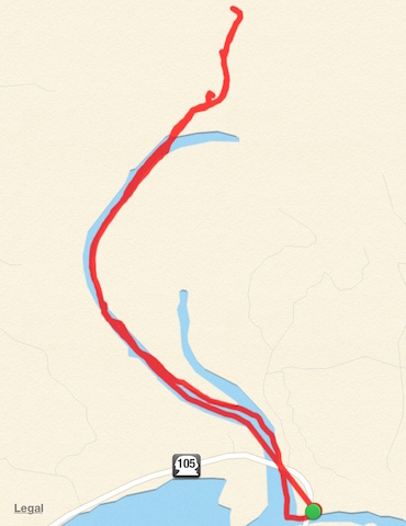
The free Map My Tracks app recorded my route.

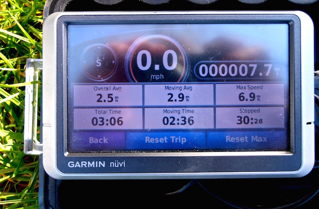
The little waterproof and floatable Garmin with marine maps recorded statistics today. The phone’s free ‘Maps’ app was handy to cross reference the upper river reaches where the ‘big boat’ maps don’t go.

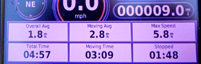
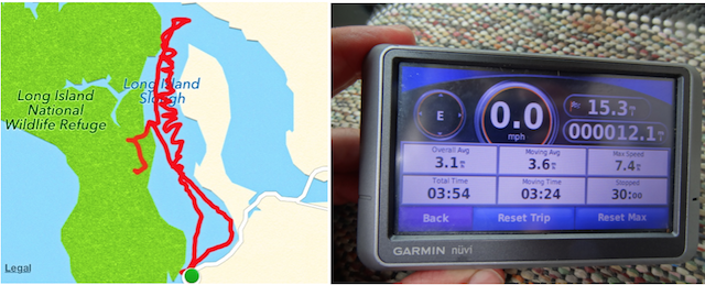
13.2 miles traveled in 4 hours and 52 minutes with a maximum speed of 5.2 mph averaging 2.7 moving mph.

21 October 2015: A Short Paddle North River (before heading up Smith Creek instead)

Last time I headed up North River, I turned left when I saw the second string of houseboats and continued on until it ended. Turns out, the main channel continued on the right for maybe eight more miles, and more houseboats to see too but, three things put a rethink to that.

DSC00402
The launch at the mouth of Smith Creek.

Rethink #1: It started raining. I saw four open boats with bundled up fishermen heading back. When I was growing up, my dad wouldn’t cancel a trip because of the rain. He said we would have been canceling a lot of trips and just included rain in the plan.

DSC00403.JPG
A wet and cold day, with no breeze to use a sail.

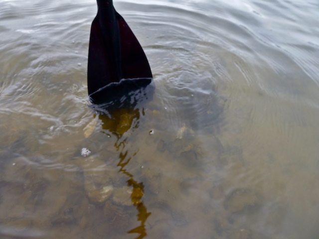
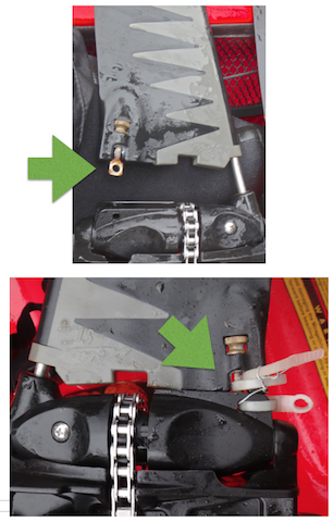
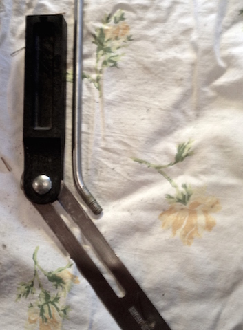
Rethink #2:  A drive flipper almost fell off. I had ‘improved’ the original attachment bolts to more quickly take apart the system. (I seem to hit sunken stuff a lot). The salt water had frozen my pliers so I could not install a spare replacement bolt I carried. My fix with zip ties and wire held it together the rest of the day. The two flexing flippers swing back and forth to power the boat. I didn’t think it wise to keep going further away with my plastic repair.

Screen Shot 2015-10-25 at 5.47.36 PM.png
The 2nd picture is flipped left to right but, the flipper on the top picture almost slid off its rod because the retaining bolt fell off.

Rethink #3: No drinking water for me, my water bottles were back in the car. A PB sandwich and crackers plus a four-hour trip ahead, oops.

DSC00408.JPG
Here’s a look at some of the river houses.

In 2010 a 1,250 sq. ft. 3 bedroom house tied along here sold for $20,000. Here’s the listing.

DSC00416.JPG
Here’s a small tree that must wish it could reach a root down into the river.
DSC00433.JPG
“Aha! We found ourselves a kayak, heh heh.” (It’s not easy to lock up a boat). They had caught a sixteen-inch jack – a young adult salmon that had returned early before having fully grown.

I didn’t want to go home, the fun hadn’t really started yet. Smith Creek shouldn’t take too long. It actually took me two hours up and back and is posted under ‘Smith Creek.’

23 March 2015: Paddling up the North River

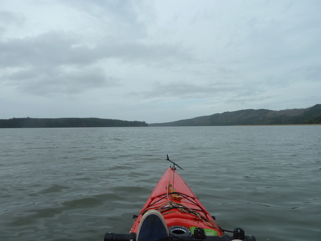
The North River is at the top of Willapa Bay, a little over an hour away from Ilwaco. Further upstream it also crosses Highway 101 near Artic. A local told me today that he once paddled 35 miles downstream from Artic to Willapa Bay. Well, sorry, we’re just going upriver three and a quarter miles, but, this isn’t just an ordinary woodsy river.

Screen Shot 2015-03-21 at 8.21.55 PM.jpg
Lower North River at low tide. The launch is at the lower right.

See those white dots in the river above the ‘105’ sign? I found out from poking around the internet that those are floating cabins. There are no access roads, nor do any cabins seem to be for sale as far as my searches can determine. Zillow.com doesn’t place a value on these cabins either but if you want a 500 square foot cabin in Seattle, $275,000 will get you one next to  Gas Works Park. http://seattlehouseboatrentals.com/sales.htm

IMG_1853.jpg

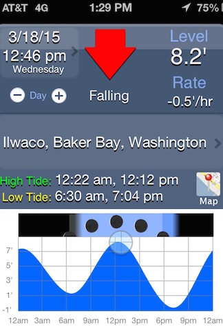
The tide was plus-eight feet and falling but I had previously seen the ramp without mud at a one-foot tide. The incoming tide could have helped me upstream if I had arrived earlier. I was sure of a quick trip back. Turned out my speed upstream was about 2-3 mph but I later got a 6.9 mph top speed reading downstream for a 2.9 mph moving average overall.

DSC01226.JPG
Smith Creek launch at the 8-foot tide.

Let’s check out the cabins.

DSC01227.JPG
Under the first bridge & leaving Smith Creek.

Smith Creek and the rest of the North River are going to have to be another trip. The other boats I saw today had motors and probably could explore a lot more quickly but, not quietly.

DSC01228.JPG
Pilings to the left and the North River bridge ahead.

Rounding the point and heading upstream.

IMG_1855.jpg
The first neighborhood of cabins.
IMG_1855 - Version 2.jpg
There is a nice artistic sequence of a landing goose on the first cabin. Their next cabin has a goose strung up by its little neck. This is the land where fresh food delivers itself.
IMG_1856.jpg
A home with a boat garage…
IMG_1857.jpg
…and a glassed-in porch and covered wood pile/work area.
IMG_1858.jpg
Here is a place ready for fishing off the back porch.

Out of respect for their privacy, I tried to stay mid-river or on the other side. I can’t imagine people in cabins out in nowheresville like to have boaters gawk at them all day.

IMG_1859.jpg
Enclosed porches often had the workshops combined with their storage rooms to leave the rest of the cabin less cluttered.
IMG_1860.jpg
More cabins upstream.

These places must have been built elsewhere and towed in.

IMG_1861.jpg
I was on the opposite shore to give this guy his privacy and got a wave anyway. On the way back a couple of boats were docked, the deck was full of friends on chairs, and the smell of barbecue drifted over.
IMG_1864.jpg
I hear the sound of an outboard coming downstream.

IMG_1866.jpg

IMG_1867.jpg
There’s a tunnel under the branches.
IMG_1868.jpg
Another lone cabin

IMG_1869.JPG

IMG_1870.JPG

IMG_1871.JPG
Protected by pilings.

IMG_1872.JPG

This boat slowed down until I put out a thumbs up sign. I also noticed that when I came back with the tide pretty low, a pair of vehicles with their boats already trailered waited until I beached before they drove off. I like to think people watch out for each other out here.

Screen Shot 2015-03-21 at 8.24.26 PM.jpg
‘google earth’ doesn’t show any access roads – the river is their highway (low tide view).

This fork in the river might have been an island, maybe not. Given a choice of a wide empty river or a narrow branch with cabins, of course, I took the cabin route. The woods and muddy banks on the main channel could wait. On the Chinook River trip, I heard from another kayaker that it’s sometimes hard to remember features of the individual rivers. I’m being a little heavy on the pictures so I can relive these trips later. I discovered later that the wider branch was the one to Artic and beyond. Yah sure, maybe if I was going downstream I could try but not today. It’s upstream and against the tide.

IMG_1873.JPG
An ‘on the water’ view of the string of cabins shown previously from a satellite.

IMG_1874.JPG

IMG_1875.JPG
Huzzah, a canoe here on ‘Riverside Drive’.
IMG_1877.JPG
A freshwater system.

IMG_1879.JPG

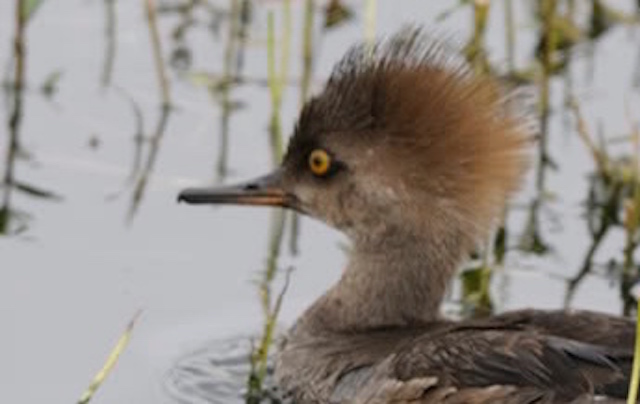
That little duck above the end of the log is a female hooded merganser I think,  hanging with a male mallard. She had lovely light brown feathers done up in a mohawk that let the sun filter through. They were the best looking couple on the river and posed for a couple of movies.  They did fancy footwork swim-bys, log-hops and aerial feats for me that I couldn’t do.  First here’s a generic picture of her from the web:

Screen Shot 2015-03-23 at 1.19.28 AM.jpg

And here is a 45-second video of this couple’s performance:     North River ducks video 

IMG_1882.JPG
A very old cattle chute?
IMG_1883.jpg
A gate

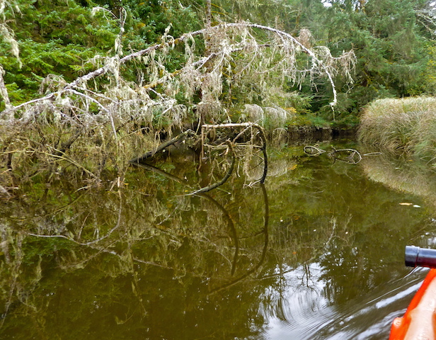
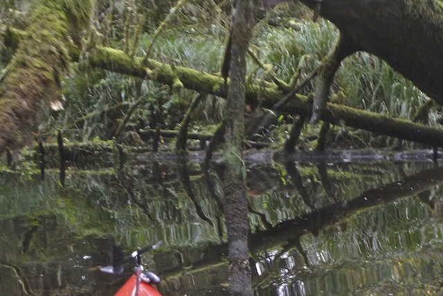
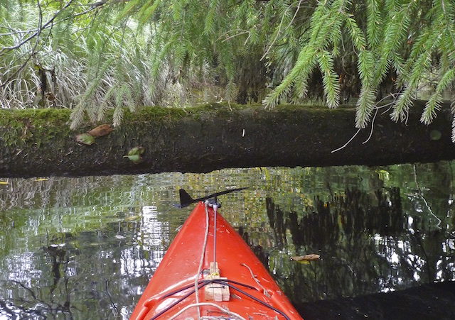
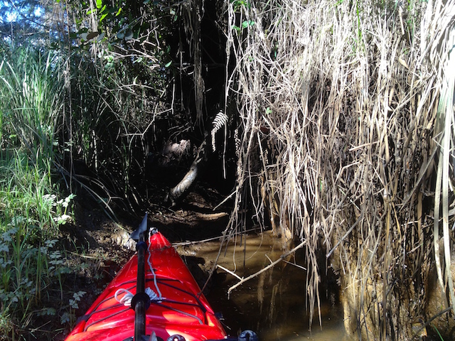
This floating log was hooked between two fallen trees. Just a little push to the left would have freed it and let it float away but I  couldn’t slide it sideways.  I was able to push it upstream and paddle through, and then, it closed behind me.

IMG_1885.jpg
A boat garage.

I parked in the garage, got out some food, turned around and went to undo the gate again.

IMG_1887.jpg
Now, all I have to do is grab the left side of the log, and pull it open against the current. Just like pushing but backward.  It really wasn’t the same at all and wouldn’t open.
IMG_1888.jpg
up & over

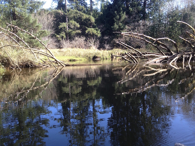
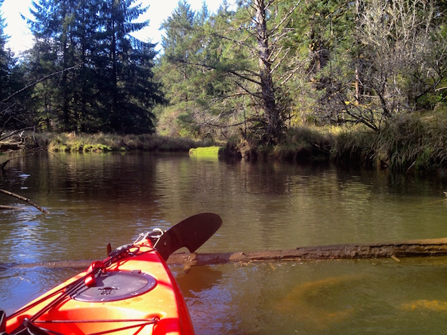
Instead, it was a push down on the shallow end of the log and pulling myself over.

P9180027.JPG
Greetings from Chinook!

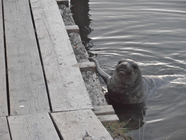
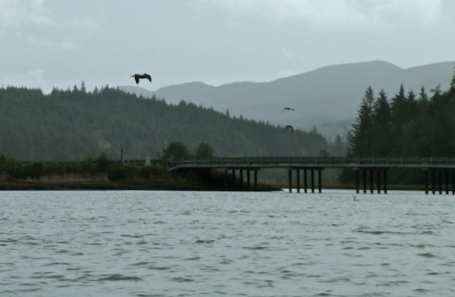
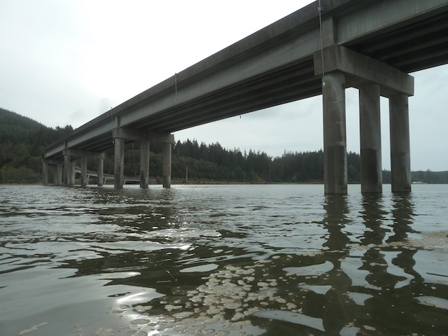
As I approached the bridge at the mouth of North River, I used up the last of the camera battery stalking a seal that had splashed off a dock. Didn’t get a picture but above is a cute picture of a seal I took on the Columbia River.

IMG_1893.jpg
‘MapMyWalk’ took me straight overland at the end when the battery totally died while looking for the seal.
P3180001.JPG
The Garmin’s timer is correct so the rest should be too. This also included a mile round trip off the main channel into an interesting slough. (7.7 miles traveled in 2 hours 36 minutes with a maximum speed of 6.9 mph averaging 2.9 mph.)
IMG_1894.jpg
The rod is supposed to be straight.

The trip must have been fun as I had to unbend both flipper rods on the foot drive when I got home. It seemed to have run OK and I wasn’t trying to jump the log gate either. The shallow side channels did grind me to a halt a few times as I looked for relics of the timber industry that used to be here but I’m not sure what I hit.

Next time maybe it will be less cabin shopping and more upriver paddling for an easy trip back. I’m not done with this river yet.

Smith Creek

21 October 2015: Paddling up Smith Creek

I had just returned from looking at the first series of floating houses on the North River. It was only 3PM and about I didn’t want to go home, the fun hadn’t really started yet. Smith Creek wasn’t too long, it took me two hours up and back.

DSC00436.JPG
Here is Smith Creek with rain.

DSC00506.JPG
Two hours later here is the Smith Creek entrance without rain.

DSC00448.JPG
Fall colors under a maple.

DSC00447.JPG
Fall colors of a maple under the water. (I discovered later that an underwater camera doesn’t shed water spots off its lens).

DSC00452
The river was wide and gravelly here but shallow enough to tow it.

I believe its an empty cabin, I think.

DSC00464.JPG
A place that could only be reached by boat, like the floating cabins.

I tied up to a dock and cautiously checked it out. I mistakenly enlarged the mapping app on the phone before doing a screenshot, so, the location of this cabin is a mystery which is just as well to protect it.

DSC00462.JPG
A rumex obtusifolius (bitter dock).

DSC00472.JPG
At great peril, I looked in a window and snapped a pic, for the blog.

DSC00468.JPG
The owner’s birdhouse. The mossy tree indicates just how damp it is.

DSC00454.JPG
End of the road for me, a bridge for someone else, and a passable obstacle for some others.

DSC00482.jpg
Fungi, blackberry, and moss.

DSC00485

DSC00499

DSC00496.JPG

DSC00507
To me, the eyes set this gull apart from the flock.

DSC00509.JPG

With some extra time before dark, I headed out into the bay.

DSC00514.jpg
Hawks Point, about two miles away, with Tokeland beyond.

DSC00523.JPG
Paddle touching the bottom of the shallow delta. North River bridge is on the left, Smith Creek bridge is on the right in the distance.

DSC00526.JPG
Little kayaks just launching and headed up Smith Creek.

DSC00530.JPG
It’s a couple fishing from a pair of pedal Hobie Outbacks they bought last spring.

DSC00527.JPG
Looking like an ad. I gave them a card with my email and left them to their fishing. We saw several jumping.

While loading the car, I saw a dog walker go by, then pick up his dog and toss it into the river. Turns out Otis had rolled in something smelly and needed a bath.

DSC00544.JPG
Happy Otis, the four-month-old puppy scampering back to the river.

DSC00547.JPG
Otis tagging along as his cage gets a cleaning too.

DSC00550.JPG
Now it’s time to leave, except for those two kayakers still out fishing.

DSC00541.JPG
Nine miles on two rivers and a bay, and lots of stuff to fix and dry out at home. (9.0 miles traveled in 3 hours 9 minutes with a maximum speed of 5.8 mph averaging 2.8 mph.)

DSC00543.JPG
Smith Creek is the part that’s right of the dot,  a 4-5 mile round trip.

I think I may have cropped the map on the right as I have read Smith Creek is navigable 4-5 miles which leaves little accounting for the distance I went up North River. Perhaps the log I photographed didn’t stop the other authors.

Willapa National Wildlife Refuge (points north)

A couple of hours on a rising tide then into a falling tide that’s not below 4 feet is my personal guideline. “When the tide drops to the 5-foot level it is time to head for shore, or risk getting stuck on the tide flats far from land.” (Washington Water Trails FAQ) There are no houses, and few easy beaches. Circumventing the island should include provisions for an overnight camping trip or using a powerboat as the safe tide window is short.

UPDATE: April 2022 a new pdf map of the campsites, tent sites and restrooms was made available here.

There are 3 posts here, one above the other. This is meant to keep together all the posts regarding paddling north from the Refuge and nearby launch sites for easier reference later. Newest posts will be added to the top of this list as I’d likely lose stuff trying to re-sequence the 3 posts so far.

September 4, 2023 I launched from under the SR101 curved bridge just north of the Willapa Refuge launch and paddled a short way up the Naselle River to the Ellsworth and Raging Creek Sloughs. Adding it here (because you can go up this river launching from the Refuge launch) is being troublesome but a good link to that trip is here.

October 12, 2020, I paddled north close to the island to Lewis Campground & back to Sawlog Campground, photographed & GPS’d  both. Hit stuff in a low tide on return.

October 12, 2014, I paddled north, up the Naselle River under the 101 bridge and into Smith Creek and the Ellsworth Slough.

August 2, 2015, I launched the Hobie sailboat from the Refuge and sailed to the entrance to the Naselle River then back and into the wetlands south of Sawlog campground. 


Long Island: Browsing the Eastern Campsites

12 October 2020: Willapa National Wildlife Refuge (points north)

Willapa Bay’s Long Island is often mentioned when kayakers ask about where to find remote camping away from it all. I realized I had never actually seen Sawlog or Lewis Campgrounds on the east side though I had paddled near them. We once visited the Pinnacles Rock and Smokey Hollow Campgrounds on the lower west side and that post is here. Sawlog Campground on the Baldwin Slough is just two and a half miles measured straight from the Willapa National Wildlife’s launch ramp. Today I’d find it.

With Covid-19 still on the rise, this trip would be close to home.
A couple stopping to admire the view. Free parking across the street but facilities are closed.

Here is an overview of the island from the 2017 Long Island Unit Map. A link to a topographical map of Long Island showing its trails for non-motorized boaters is a PDF download on this page. On this date six years ago I took this same boat, when it was new, up this channel and headed up the Naselle River instead off to the right.

The campground and covid-19 rules.

The posted chart below shows that it’s currently bear season on the island. Calling the Refuge’s headquarters (M-F 7:30-4:00) at (360) 484-3482 can help clear things up if you’re planning to explore.

Otherwise, the ramp’s instructions are pretty simple.

Not the best of tides. It would be falling from 8.1′ to 3.5′ for the six and a half hour trip. The receding tide would help pull me north and I was expecting a breeze from the NW to help push me home. I had maps of the channels available and the usual safety gear. Below a 5′ tide, the oyster beds sometimes scrape the boat and the extended beaches are extra muddy.


Once I reached the island’s shore, the barnacles were eye level. The tide is often a couple of feet higher.

Soon I noticed a passenger. The little guy remained for several minutes.

Before reaching Baldwin Slough with its Sawlog campsite, I spotted a shorter slough.

It was in the middle of the grasslands so it was unlikely Sawlog but it was worth a look. Several camera-shy plovers were nearby foraging.

As I paddled north a white line of floats were extending from the shore. Maybe the net would not quite reach the other shore. I took evasive action away from the island to see if there was room to pass.

If the trawler was going shore to shore I’d be trapped, and soon. Two gunshots echoed from somewhere.

I still had a chance to turn around and set a course south but the other ship had left passage near the shore. Meanwhile, once again I must have missed Baldwin Slough and the Sawlog campsite.

Pretty soon, I was further north around Paradise Point looking at another marshland. My paper map misplaced, the height of this southern facing bluff looked good for a campsite so I turned and followed a slough southwest of the bluff. Soon I decided to land and look to see if the Lewis Campground was here.

Here is Lewis Campground. It had taken me two hours.

It was not far from where I landed.

It’s not a straight paddle west as the map might imply. It was more like looking south and doing a U-turn while paddling north. The coordinates for where I beached are N46º 28.769’ W123º 58.312’. Loaded into your search box you can see how it could be missed on a satellite view map.

I met a shy local, and it was not a hedgehog.


Here was another practical use for using telephoto. Skyler’s black labrador, Bertie Woofter, got into TWO nose-quilling battles with porcupines, because he just did not learn. Dogs aren’t allowed on the island by the way.

Two campsites and latrine. Thank you U.S. Fish & Wildlife Service and the Willapa National Wildlife Refuge staff for maintaining a beautiful site.

The tide had dropped from 7.7′ to 7.2′. Unloading to camp would require a dedicated set of shoes, pants and hand-rinsing water. I headed back.

A good reference to find Lewis Slough is the number 4 tower.

A crew of birds take shifts perching there facing the breeze to indicate the prevailing wind direction.

The tide was falling at 1.2′ per hour leaving a swirl of water around the base.

This is where the planned tailwind from the NW, as the gull had indicated, would help push me home. The moving average soon to dropped from 2.9 mph to 2 mph. I put on a little burst of speed to 2.4 so as not to have a pitiful picture.

This is how to contain a salal planting, as it can become a garden thug. 

The piling’s stains reflected how the tide had dropped 3′.

This image has an empty alt attribute; its file name is dsc04407.jpeg


That cluster of pilings is a good indication that you are north of the Sawlog Campground. 

Continuing southwest I found Baldwin Slough.

A muddy bank at a 4.4′ tide did not encourage a walkabout. The camp’s sign is straight ahead.

The sign’s GPS position is N46º 26.930’ W123º 57.331.

I took a short walk left and right from the sign as indicated but did not see any of the six campsites or facilities. There was only 3 hours until sunset. I discovered later that a better landing place is a little further up the slough. I heard the same tale of “where are the campsites” from a couple that paddled back to the ramp and slept in their car instead. A proper map of the campsites is here.

The boat and I were muddy as a good ORV should be. I go for old canvas sneakers and a NRS bib with sewn in socks to keep dry, as boots were often inches too short.

With the breeze gone, it was going to be a long, quiet plod home. Unlike walking or riding a bike, I could safely close my eyes and not hit anything, yet. It was no longer a straight paddle to the point as the tide was now 3.5′ and the mudflats were appearing.

Over and through the oyster beds.

The left picture below shows one of many small oyster islands that line the channel. The center shows a foot drive with an unusual broken shaft after thumping too many intrusions into the channel. The pink line is the boat’s route, the blue marks a channel that is 4.9′ above mean low tide whereas the more narrow channel on the right becomes a deeper 9.8′. The delta shows the boat’s direction is left.

I can change the flipper’s shaft in a few minutes, or just pull it off and use one flipper. Shafts are made to bend and the other shaft was now bent but functional. Foot drive is great for using a camera and (according to their ads) keeping up with stronger paddlers. Or, I could do what I should have been doing earlier, using the paddle.

It took a casual hour and a quarter to return from the original destination at Sawlog Campground.

The route from the free phone app ‘MapMyTracks’.

Here is a less muddy look at my nautical, floating GPS. It comes with loaded charts. Several times it has shown that my paper maps and observations were wrong. Such as entering a bay off Wheeler, Oregon that was not the Nehalem River and showing a route through the islands on Elk River and the Columbia. It also continually marks the route from where I came. That helped alert me once that I was not heading home when I managed to take a wrong turn on the tidal Youngs River. It’s better than a phone or the automotive Garmin Nüvi I used to carry. The arrow marks the Refuge’s ramp.

The moving average going north with the tide had been 3.1 mph or better but came down to 2.6 overall.

13.8 miles traveled in 5 hours 20 minutes with a maximum speed of 5.5 mph averaging 2.6 mph. One hour 4 minutes stopped gathering mud, contemplating broken parts and having fun.

I found a couple of YouTube videos paddling up the Baldwin Slough from the Refuge with ambient music (there isn’t any in real life). A 2006 canoe trip with various professional angles here . The other is mostly a front camera’s view on a sea kayak in 2014 to the very end here .

UPDATE: April 2022 a new pdf map of the campsites, tent sites and restrooms was made available here.

12 October 2014: Paddling from the Willapa Wildlife Refuge north up the Naselle River and into  Ellsworth Slough and back

Driving north out of the Long Beach Peninsula, Highway 101 has a curved bridge over a wide river I wanted to explore. Its called the Naselle River and upstream is the town of Naselle. I thought maybe I could try to make it up to the town and back in a day.

Naselle River.png

Naselle also has a boat ramp upstream on the river. After looking at it I thought that maybe if I launched there I’d be swept downstream. It would then be a walk back to the car if the river was too swift or shallow. I’d start at the mouth instead.

Naselle ramp.jpg
The boat ramp at Naselle. (Image from lunkersguide.com) (note: I later launched very successfully from this ramp).

The closest official point to paddle up the Naselle River is down the bay at the Willapa National Wildlife Refuge boat ramp off Highway 101.  The Washington Water Trails FAQ also says its about nine miles from there to the town of Naselle.

P1120166.JPG
Highway sign across the highway from the launch.

It was my day off and I got the boat into the water not so promptly at noon. Well, it was my day off.

photo 2.PNG
The tide was at its lowest and safe to go until after dark.

Someone asked before I left whether they could pick the oysters.  These are private farms, I said. It would be like stealing from a farmer’s fields. Someone else inquired about the outrigger mounts. I had decided to leave the outriggers and sail kit at home again as there was very little wind and a slender kayak can explore more stuff.

P1110975.JPG
Looking back at the boat ramp.


P1110980.JPG
A house above the twisty road that we will never see while driving. A house like this might be common elsewhere but is the exception here. There is very little development along the shores of Willapa Bay in order to protect the oyster farms.


P1110984.JPG
The first destination was the mouth of the Naselle River. It is a straight three-mile paddle according to the site, and another six miles upriver to the town of Naselle.  Ahead on the right is a point about halfway there. I prefer to hug the shore as there is more to see.


P1110991.JPG
Here is where my foot drive flippers ground to a noisy halt. I discovered I was on an oyster bed. The paddle shows the depth even though I was pretty far from shore. The beds are marked with vertical branches but I thought my shallow boat could clear them all.


P1110992.JPG
This tower marks the entrance to the Naselle River. Ever notice people watching as you parallel park? Eight birds are checking out whether this other bird can land.


P1120004.JPG
Heading up the Naselle after an hour fifteen minutes. The 101 bridge is beyond the heron.


P1120009.JPG
The remains of an old dock on the Stanley Peninsula.


P1120013.JPG
Approaching a small oyster operation straight ahead on Teal Slough. I once approached this place by motorcycle but their dogs didn’t make me feel welcome. The 101 bridge is on the left. The waves were a bit splashy.


P1120019.JPG
A closer view of the oyster place and a discarded boat.

P1120020.JPG

P1120024.JPG

P1120025.JPG
A bucket of oyster shells on the dock.


P1120033.JPG
A boat’s eye view of the last curve before northbound drivers see the 101 bridge.


P1120040.JPG
A troll’s eye view of the bridge.


P1120048.JPG
I pulled ashore looking for a place to park for the next trip as it was already 2:30. I was not going to make it up any six miles to the town of Naselle and back by dark.


P1120051.JPG
An old dock or trestle parallel to Parpala road.

I continued further upriver to find one of the two Smith Creeks that feed the bay.  Maybe it would be a closer place to launch for the town of Naselle. Later I found out that the other Smith Creek by South Bend has the official boat ramp. Here you would have to leave your car on the highway and find a trail to the water.

P1120061.JPG
Before Smith Creek is the Ellsworth Slough with more birds and a wide entrance.


P1120066.JPG
Since I started at noon, and it was now 2:40 I went in quickly as the sun set at 6:30.


P1120071.JPG
It was shallow, quiet, and with lots of interesting obstacles.

P1120080.JPG

P1120082.JPG
This is where Humphrey Bogart might hop out dragging a rope to pull me upstream.

P1120084.JPG

P1120086.JPG
This log would have made a good footbridge but there was no trail I could see. After just over a mile I was stopped and had to head back.


P1120089.JPG
This is where I leaned back so far I pulled out a seat mount and covered everything in sticks and needles.


P1120090.JPG
Quietly hurried back toward the main river.


P1120097.JPG
Back under the Ellsworth Slough bridge.


P1120102.JPG
It was now 4:00 and I went for the shortest route across Chelto Harbor to Stanley Point.


P1120105.JPG
From the bridge, it’s a boring 40 minutes to the tip of the Stanley Peninsula. That worked out to over 3 mph, which is also a good walking speed.


P1120110.JPG
Stanley Peninsula as seen from the bridge. A boring paddle into a wind so I learned how to play music from my phone.


P1120115.JPG
Shot lots of pictures as I approached these elk but only this picture caught them. They were shy.

The northern breeze I was counting on to help push me home faded away.

P1120118.JPG
Back into the smooth bay. From here, the misty point to the left of the clear passage marks the halfway point to the dock. It was so smooth I could see fish jump.


P1120122.JPG
This heron was watching for fish too.

P1120124.JPG

P1120125.JPG
The tower marking the entrance to the Naselle River fell behind me.


P1120133.JPG
“POSTED NO TRESPASSING” above a hidden oyster farm.


P1120136.JPG
It’s now 5:18 and the sun sets at 6:35. I still am trying to get a good picture of a bird splashing through its take off. It’s not getting any earlier but I have packed with me a flashlight and a whistle.


P1120144.JPG
The water is so calm I actually leave a wake pretty far back. I’m just passing the halfway point down the Long Island Slough.


P1120145.JPG
Just a shot of how this boat has me sit like I’m in a recliner, or some gym device that floats and takes you places.


P1120157.JPG
The last heron and its squawk are coming soon.


P1120163.JPG
The 25 mph bend in the highway and the boat ramp coming up. It’s almost 6:00.


P1120167.JPG
Looking south at the sunset while packing up.


photo 3.PNG
I still have a good tide, I just ran out of sunlight.

2 August 2015: Sailing north from the Willapa Refuge

The original plan today was to travel WITH the incoming tide from Oysterville south to a residence partway down the bay.  I was going to paddle someone’s skinny sit inside kayak while she sailed my boat downwind and with the current. Then we would stop at the Port of Nahcotta and later pull out in at her house further down the bay. The Hobie with its ‘training floats’ doesn’t tip over unless a bunch of stupid is going on so it’s a good loaner. Her husband had another trip planned that day so off I went alone to the local Willapa National Refuge which is located across the bay.

I had an almost as good day boating as I headed upwind and against the tide on the east side of Long Island.

DSC00209.jpg

DSC00204.JPG
A muddy launch site at a +1.1 tide but there are still channels.

Mud made it a challenge to launch.  I rolled the boat off to the side of the concrete launch to make room for others but the wheels sank deep in the mud.  A couple of tourists asked me, “Can we swim over to the island?” I showed them the deep boat dolly tracks and my muddy boots to discourage them. They weren’t aware that the tide was coming in nor did they try stepping in the mud. She kept teasing her partner to make the short swim.  Then, I told them about the man who had attempted to walk and or swim to Baby Island just south of here. It happened nine years ago. He was never found. The only clue was his empty car at the side of the road, footprints in the mud, and Baby Island only a short distance away.

“Thank you, thank you. Have a nice day” and off they went for other adventures.

Todd, a local who works at the family oyster beds, told us that locals refer to the bay mud as “the mud monster”.  It can be dangerous to sink into it.

DSC00205.JPG
The boat as all assembled: a Hobie Mirage Adventure Island.


Screen Shot 2018-04-05 at 12.32.05 PM.png
The paddle drive got pulled in. Tacking upwind took me out of the channel (I couldn’t see) where I would run the paddle drive & rudder against the sharp oyster beds.

The oyster beds are sometimes right under the surface even with a plus 7-foot tide. The deep channels are located near the shore. At one point I had to get out and stand on the oysters (NOT the mud) and pull the boat free.

DSC03480.JPG
Oyster bed marker showing the incoming current as the tide filled the bay.


DSC03482.JPG
There was 18 mph headwind too, all the better to quickly head home later.


DSC03483.JPG
It might probably sink the boat to bring home rocks for the garden and, it’s against the law.


assorted wild gardens atop the pilings


DSC03490.JPG
The entrance marker to the Naselle River.

What a day. Last time I was here, I went east up the Naselle River and past the curved 101 bridge. Today I wasn’t going to get over the top of the island and go down the west side either as it was getting late. Sawlog campground is on the island nearby but like Captain Vancouver failing to spot the Columbia River (well, a little like it), I sailed past Sawlog and headed into a marsh instead.

DSC03498.JPG
Long Island marsh.


DSC03503.JPG
A cute caravan heading to the beach.


DSC03510.JPG
A couple returning from the south of Long Island. Maybe I’ll head south next time.


Screen Shot 2015-08-12 at 1.24.46 AM.png
‘Walking’ on the water with ‘map my walk’ shows the elusive Sawlog Slough and the Garmin GPS. Got up to 7.4 mph. (12.1 miles traveled in 3 hours and 24 minutes with a maximum speed of 7.4 mph averaging 3.6 mph.)