There are three posts here, one above the other. This is meant to keep together all the posts regarding Naselle River and its launch sites for easier reference later. This system made more sense to me than a scattered chronological order of all trips. Newest posts for the Naselle River near the town of Naselle are henceforth going to be added to the top of the list.
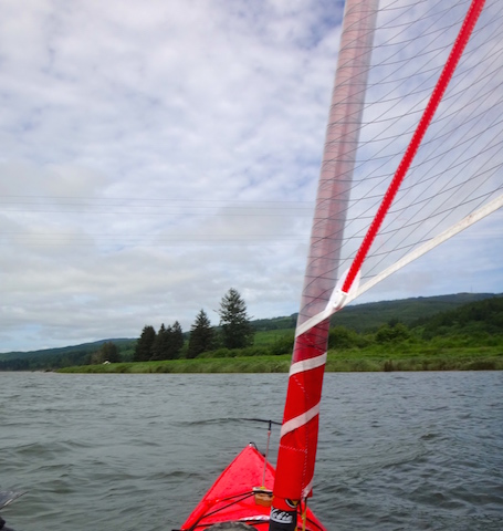
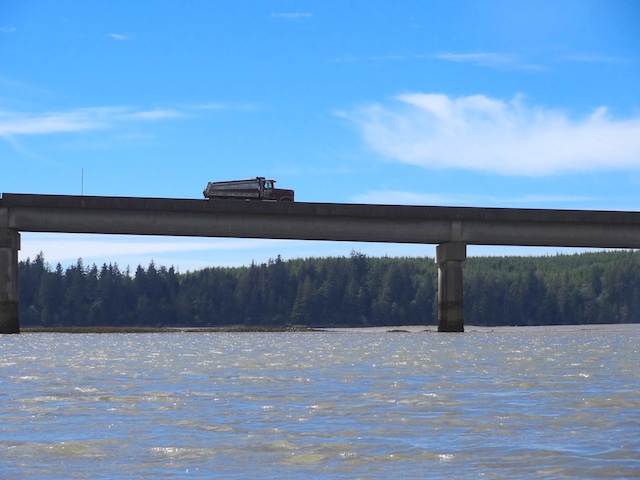
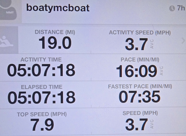
June 19, 2017: I paddled and sailed the Hobie Adventure Island from Naselle down to the 101 bridge and back:
December 15, 2015: I almost launched the Hobie at the town of Naselle but the water was too swift.
February 23, 2015: I launched the Hobie kayak at Naselle, headed upstream to the shallows and downstream a bit:
19 June 2017: Paddling and sailing from Naselle to 101 and back.
It’s going to be the first day of summer tomorrow. Today is going to be the first kayak expedition since last November.
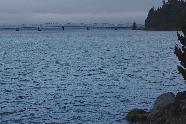
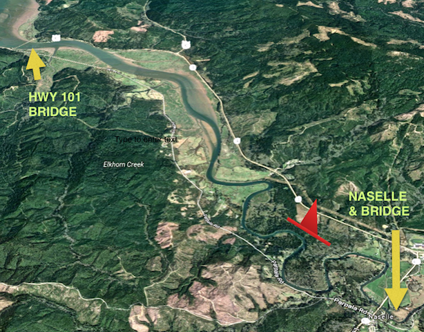
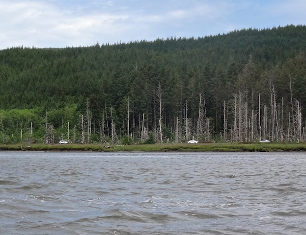
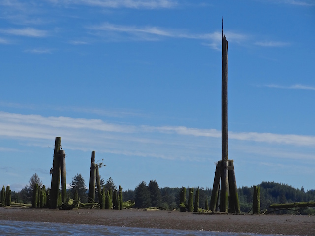
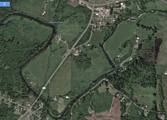
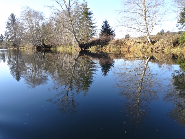
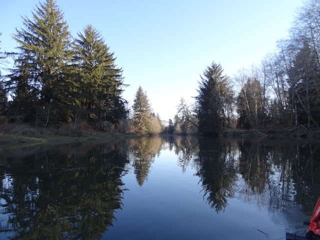
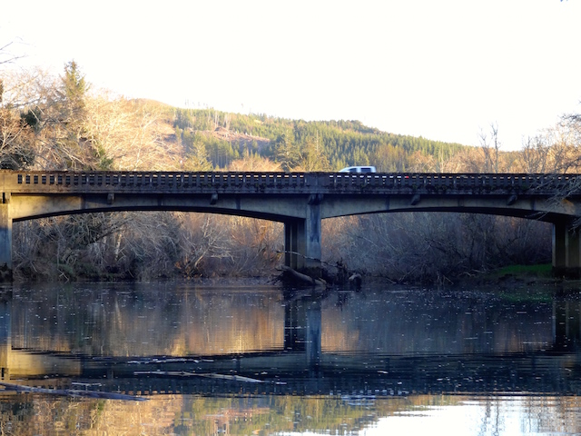
Back in October 2014, I thought I could launch at the Willapa Refuge, head all the way upriver to the town of Naselle and back in one day. In six and a half hours I made it just past the 101 bridge, up the Ellsworth Slough and back. The bit of the river around the town of Naselle I paddled once in February 2015. There is no launch in between unless I pull off the road and drag the boat across a field, which is possible, but too athletic.
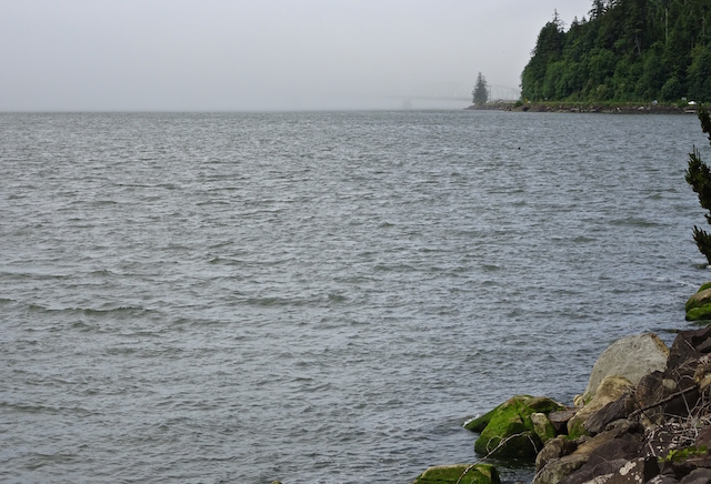
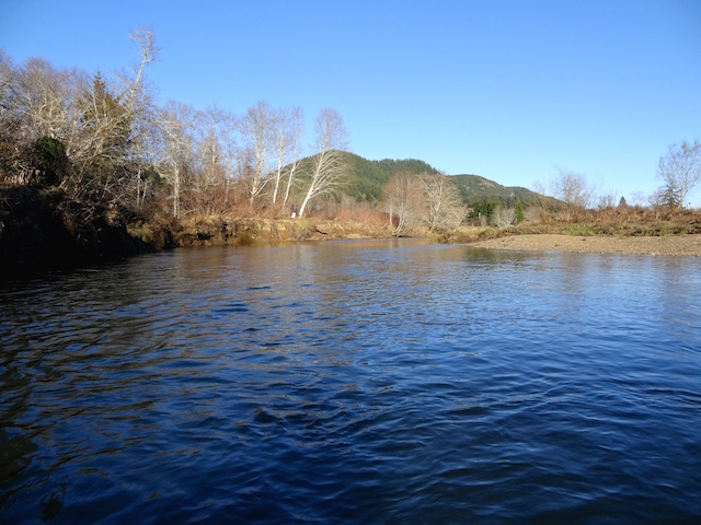
The tide was plus five foot but would be going down all afternoon. The Naselle River stays deep enough for a kayak all the way up to the town of Naselle even when the Willapa Bay is mostly mud. The plan was to launch from Naselle and go out with the tide. The current would be on my side but there would be a headwind with gusts to 20 mph. If I took a sail, I could then sail back upstream and maybe complete the almost 20-mile trip.
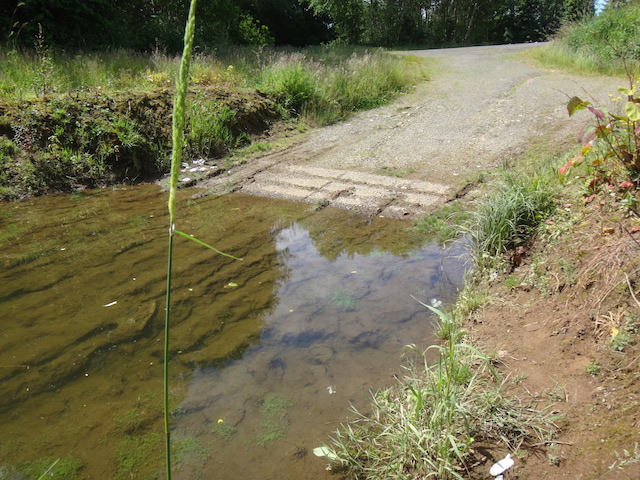
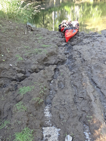
When I returned after the trip, the launch was concrete deprived.
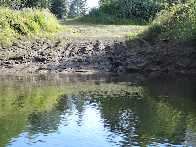

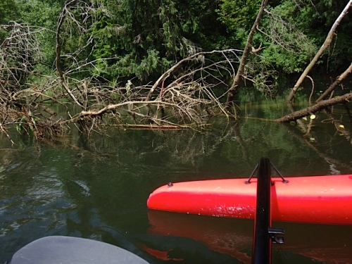
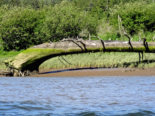
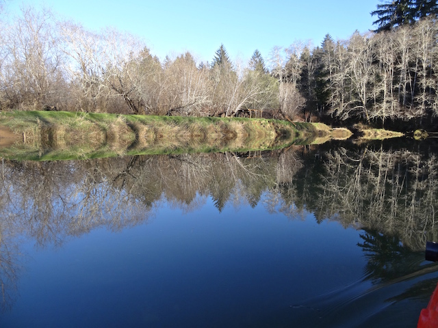
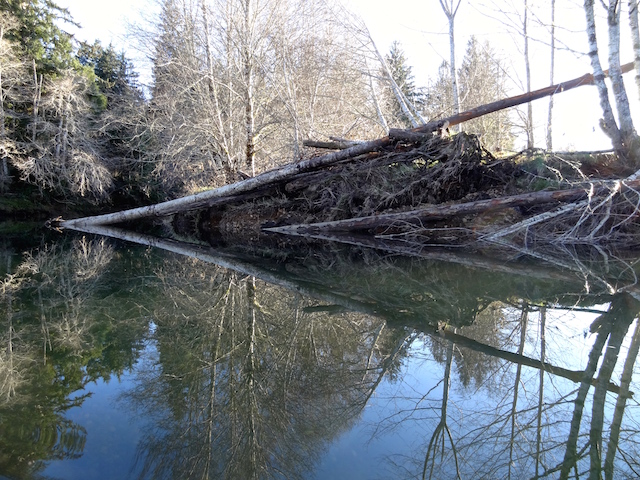
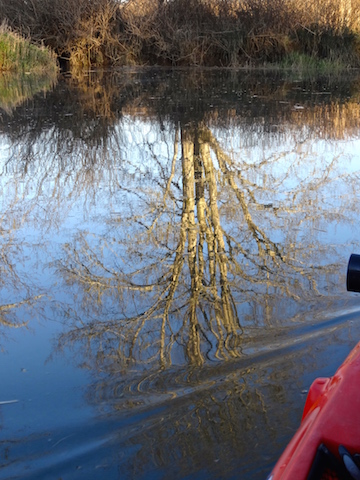
A fallen tree had blocked three-quarters of the river. I think it used to be an island that is now being washed away.


Before this boat, my usual experience was that I had to fold up the sail to get home. Tacking back and forth trying to work back upwind with my dad’s boat would usually just take me back and forth but no upwind progress until I got the oars out. Small sailboats usually don’t come with oarlocks but I find them handy.


Now the wind was at my back. The river isn’t straight, nor does the wind keep coming from the same direction as the terrain changes. This makes the sail sometimes flip from hanging off one side to hanging off the other side. The boom running along the bottom of the sail will whack the inattentive sailor as it flips to the other side giving notice that the boat will be instantly leaning the other way. This boat has no boom however the sail is more efficient downwind with a boom to hold it out.
The internet suggested I could make a temporary boom if I cut a notch in the paddle.
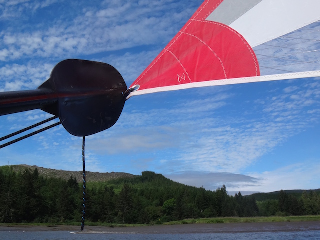

It was an easy 6 mph glide back up to the woodsy part of the river. That beats 3.5 average paddling speed. That made the extra time setting up a sail worth it.


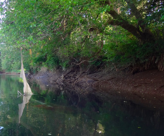
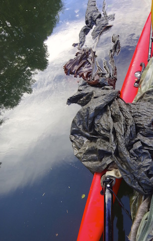
It’s got tent poles. Here’s another use for a waterproof camera…use it under water.

Now to do the responsible thing because creatures could drown in it. It won’t decompose.

So, two hours after spotting the tent, I was heading home to clean off the mud and to cook up a late dinner.
15 December 2015: Almost Paddling down the Naselle River
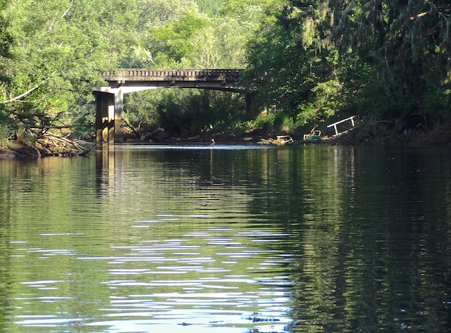
Today’s goal was to float down from Naselle to the 101 bridge at Teal Slough and back, only about 16 miles. The tide was incoming and up to + 9 ft. by 4 pm. The weather was supposed to be cloudy with no wind…a potentially excellent boating day. I had previously gone upstream from here and had also previously entered the mouth of the Naselle river after launching from the Willapa National Wildlife Refuge on the bay.


Slippery clay and a current a bit too fast did not appeal, so at noon I headed south to Cullaby Lake instead.
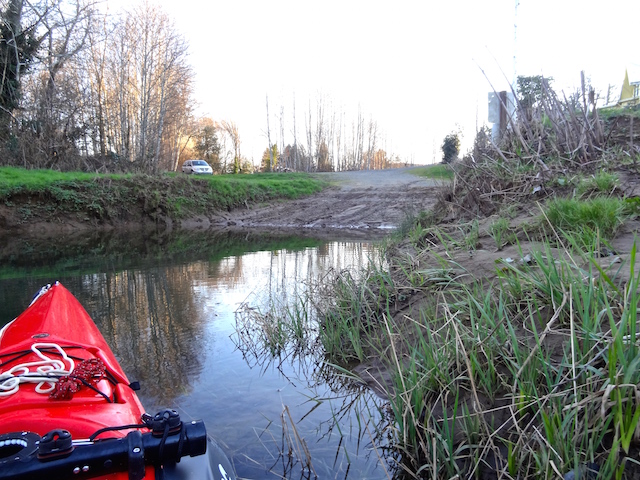
23 February 2015: Paddling up the Naselle River
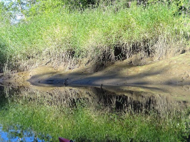
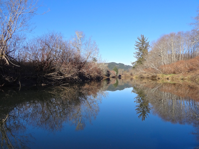
Today I thought I would paddle the upper Naselle River. I had looked at it and its current several times. I wondered if I could successfully paddle back to the town of Naselle’s launch or whether I would be walking back from downstream. Because we’ve haven’t had a day off for a while, I had a bunch of chores but finally arrived at the launch about 3:30 with two hours before sunset. The tide was still rising from 6 to 7 feet and would drop to 5 before I left.

Last time I boated the Naselle River, I started at the Willapa Wildlife Refuge, went around Stanley Peninsula and had to turn around a little past the 101 bridge.

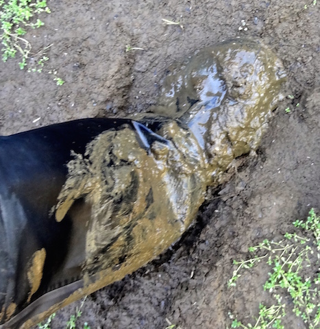
Fortunately, I didn’t need to back in with a boat trailer. This stuff was sticky. Trying to keep mud out of the boat, I discovered that the water near that bank was indeed deeper than my 15-inch boots. After tying the muddy wheels on the boat in case they were needed, I headed upstream. If I couldn’t make headway I planned to go ashore at the bridge and walk back. The GPS later said the current was 1.4 mph which fortunately is slower than the 3-5 mph I can paddle.


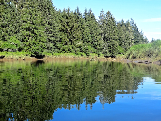
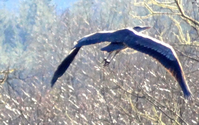
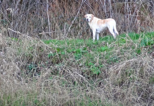
I heard lots of little birds but very little other noise. Only the occasional car as there was a small road paralleling the river for part of the way.

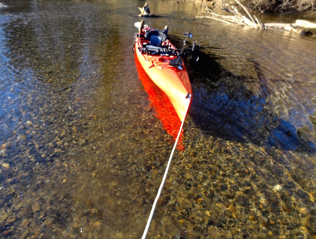
After a little over a mile, there was shallow gravel all the way across. After a tow, I found deeper water upstream.
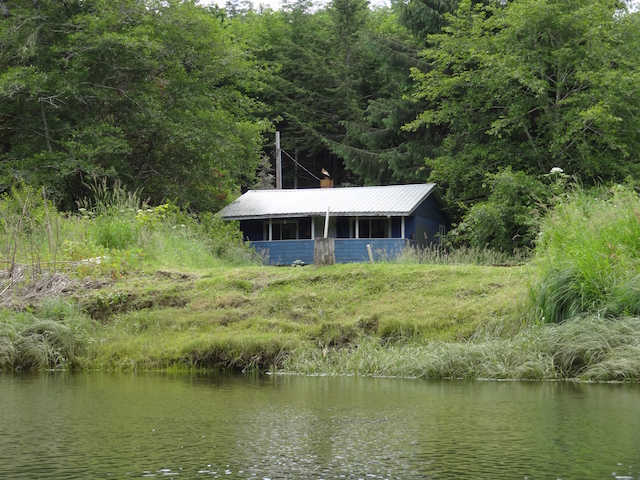
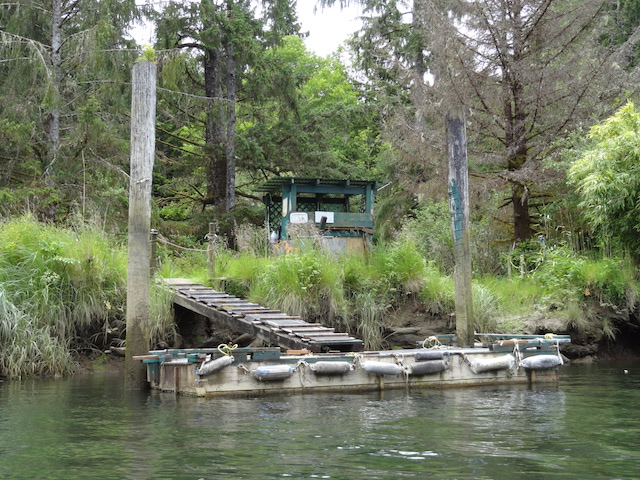
Our gardening and blogger friend, Ann, had shared pictures of her father’s place on the river up here somewhere. I remember it had a monkey puzzle tree near the river and it was also near a fish counting station with a cable & basket over the water. At this point. the current seemed to get faster and I would need to get out and tow again. Cars were visible ahead on Highway 4 but I wasn’t getting to any of these goals today. I turned around.


Back to the launch. I remembered the van getting stuck in soft grass on a job last week and knew I would not have been able to pull out a boat trailer through the mud today. Fortunately, my boat is light enough to not need a trailer.
The GPS told me I had gone 1.5 miles upstream and that the boat had reached a speed of 5.6 mph going downstream. With an hour of sunlight to go, I was able to go one more mile downstream.


The water was over 15″ deep here too.


Reminds me that my dad once boated down the Cedar River through Kent, which is south of Seattle, into Lake Washington. He mentioned that the parking lots, stores and malls are hardly visible at all from the river and the car noises are much quieter. The deep trench of this river didn’t allow me to find Ann’s monkey puzzle tree that I mentioned earlier or to see much of this pasture.
It’s still a plus 7.0 tide on the falling side now so I thought I’d stay cleaner and tow the boat in from the grassy bank.


